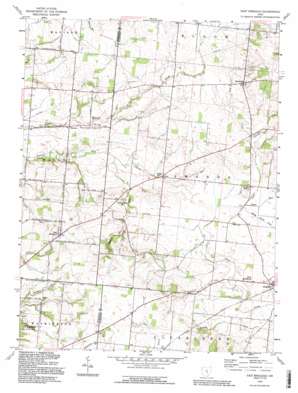
East Ringgold Topo Map Ohio
To zoom in, hover over the map of East Ringgold
USGS Topo Quad 39082f7 - 1:24,000 scale
| Topo Map Name: | East Ringgold |
| USGS Topo Quad ID: | 39082f7 |
| Print Size: | ca. 21 1/4" wide x 27" high |
| Southeast Coordinates: | 39.625° N latitude / 82.75° W longitude |
| Map Center Coordinates: | 39.6875° N latitude / 82.8125° W longitude |
| U.S. State: | OH |
| Filename: | o39082f7.jpg |
| Download Map JPG Image: | East Ringgold topo map 1:24,000 scale |
| Map Type: | Topographic |
| Topo Series: | 7.5´ |
| Map Scale: | 1:24,000 |
| Source of Map Images: | United States Geological Survey (USGS) |
| Alternate Map Versions: |
East Ringgold OH 1958, updated 1959 Download PDF Buy paper map East Ringgold OH 1958, updated 1972 Download PDF Buy paper map East Ringgold OH 1958, updated 1985 Download PDF Buy paper map East Ringgold OH 1992, updated 1995 Download PDF Buy paper map East Ringgold OH 2010 Download PDF Buy paper map East Ringgold OH 2013 Download PDF Buy paper map East Ringgold OH 2016 Download PDF Buy paper map |
1:24,000 Topo Quads surrounding East Ringgold
> Back to 39082e1 at 1:100,000 scale
> Back to 39082a1 at 1:250,000 scale
> Back to U.S. Topo Maps home
East Ringgold topo map: Gazetteer
East Ringgold: Populated Places
Cedar Hill elevation 266m 872′East Ringgold elevation 299m 980′
Highlander Trailer Park elevation 323m 1059′
New Strasburg elevation 282m 925′
Royalton elevation 308m 1010′
Walnut elevation 247m 810′
Wyandotte (historical) elevation 308m 1010′
East Ringgold: Post Offices
Cedarhill Post Office (historical) elevation 268m 879′East Ringgold Post Office (historical) elevation 294m 964′
Royalton Post Office (historical) elevation 308m 1010′
Walnut Post Office (historical) elevation 247m 810′
East Ringgold: Streams
Cherry Run elevation 255m 836′Muddy Prairie Creek elevation 277m 908′
Sand Run elevation 277m 908′
Toby Creek elevation 286m 938′
East Ringgold: Valleys
Dutch Hollow elevation 271m 889′East Ringgold digital topo map on disk
Buy this East Ringgold topo map showing relief, roads, GPS coordinates and other geographical features, as a high-resolution digital map file on DVD:


