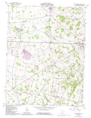
New Market Topo Map Ohio
To zoom in, hover over the map of New Market
USGS Topo Quad 39083b6 - 1:24,000 scale
| Topo Map Name: | New Market |
| USGS Topo Quad ID: | 39083b6 |
| Print Size: | ca. 21 1/4" wide x 27" high |
| Southeast Coordinates: | 39.125° N latitude / 83.625° W longitude |
| Map Center Coordinates: | 39.1875° N latitude / 83.6875° W longitude |
| U.S. State: | OH |
| Filename: | o39083b6.jpg |
| Download Map JPG Image: | New Market topo map 1:24,000 scale |
| Map Type: | Topographic |
| Topo Series: | 7.5´ |
| Map Scale: | 1:24,000 |
| Source of Map Images: | United States Geological Survey (USGS) |
| Alternate Map Versions: |
New Market OH 1960, updated 1962 Download PDF Buy paper map New Market OH 1960, updated 1976 Download PDF Buy paper map New Market OH 1960, updated 1987 Download PDF Buy paper map New Market OH 2010 Download PDF Buy paper map New Market OH 2013 Download PDF Buy paper map New Market OH 2016 Download PDF Buy paper map |
1:24,000 Topo Quads surrounding New Market
> Back to 39083a1 at 1:100,000 scale
> Back to 39082a1 at 1:250,000 scale
> Back to U.S. Topo Maps home
New Market topo map: Gazetteer
New Market: Parks
Oldaker State Wildlife Area elevation 321m 1053′New Market: Populated Places
Danville elevation 326m 1069′Fairview elevation 314m 1030′
Hoagland elevation 323m 1059′
New Market elevation 344m 1128′
Russell elevation 320m 1049′
Shackleton elevation 332m 1089′
New Market: Post Offices
Newmarket Post Office (historical) elevation 341m 1118′Russell Post Office (historical) elevation 316m 1036′
Shakeltown Post Office (historical) elevation 329m 1079′
New Market: Ridges
Pea Ridge elevation 324m 1062′New Market: Streams
Hussey Run elevation 291m 954′South Fork Dodson Creek elevation 306m 1003′
New Market: Summits
Calebs Hill elevation 354m 1161′Horner Hill elevation 344m 1128′
New Market digital topo map on disk
Buy this New Market topo map showing relief, roads, GPS coordinates and other geographical features, as a high-resolution digital map file on DVD:


