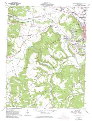
Chillicothe West Topo Map Ohio
To zoom in, hover over the map of Chillicothe West
USGS Topo Quad 39083c1 - 1:24,000 scale
| Topo Map Name: | Chillicothe West |
| USGS Topo Quad ID: | 39083c1 |
| Print Size: | ca. 21 1/4" wide x 27" high |
| Southeast Coordinates: | 39.25° N latitude / 83° W longitude |
| Map Center Coordinates: | 39.3125° N latitude / 83.0625° W longitude |
| U.S. State: | OH |
| Filename: | o39083c1.jpg |
| Download Map JPG Image: | Chillicothe West topo map 1:24,000 scale |
| Map Type: | Topographic |
| Topo Series: | 7.5´ |
| Map Scale: | 1:24,000 |
| Source of Map Images: | United States Geological Survey (USGS) |
| Alternate Map Versions: |
Chillicothe West OH 1961, updated 1962 Download PDF Buy paper map Chillicothe West OH 1961, updated 1972 Download PDF Buy paper map Chillicothe West OH 1961, updated 1977 Download PDF Buy paper map Chillicothe West OH 1961, updated 1982 Download PDF Buy paper map Chillicothe West OH 2010 Download PDF Buy paper map Chillicothe West OH 2013 Download PDF Buy paper map Chillicothe West OH 2016 Download PDF Buy paper map |
1:24,000 Topo Quads surrounding Chillicothe West
> Back to 39083a1 at 1:100,000 scale
> Back to 39082a1 at 1:250,000 scale
> Back to U.S. Topo Maps home
Chillicothe West topo map: Gazetteer
Chillicothe West: Bridges
Shotts Bridge elevation 201m 659′Chillicothe West: Cliffs
Alum Cliffs elevation 245m 803′Chillicothe West: Lakes
Lake Ellensmere elevation 193m 633′Chillicothe West: Parks
Adena State Memorial elevation 270m 885′Chillicothe West: Populated Places
Anderson elevation 208m 682′Belleview Heights elevation 258m 846′
Brewer Heights elevation 266m 872′
Brownsville elevation 227m 744′
Ebush (historical) elevation 214m 702′
Knockemstiff elevation 211m 692′
Maple Grove elevation 282m 925′
Newingburg (historical) elevation 344m 1128′
North Fork Village elevation 201m 659′
Pleasant Valley elevation 228m 748′
Randall Terrace elevation 207m 679′
Slate Mills elevation 201m 659′
Sulphur Lick elevation 213m 698′
Chillicothe West: Post Offices
Anderson Post Office (historical) elevation 208m 682′Ebush Post Office (historical) elevation 210m 688′
Newingburg Post Office (historical) elevation 340m 1115′
Slate Mills Post Office (historical) elevation 211m 692′
Sulphur Lick Post Office (historical) elevation 212m 695′
Chillicothe West: Streams
Anderson Run elevation 212m 695′Biers Run elevation 201m 659′
Cattail Run elevation 195m 639′
North Fork Paint Creek elevation 189m 620′
Owl Creek elevation 201m 659′
Ralston Run elevation 191m 626′
Sulphur Lick elevation 213m 698′
Chillicothe West: Valleys
Paint Valley elevation 196m 643′Chillicothe West digital topo map on disk
Buy this Chillicothe West topo map showing relief, roads, GPS coordinates and other geographical features, as a high-resolution digital map file on DVD:


