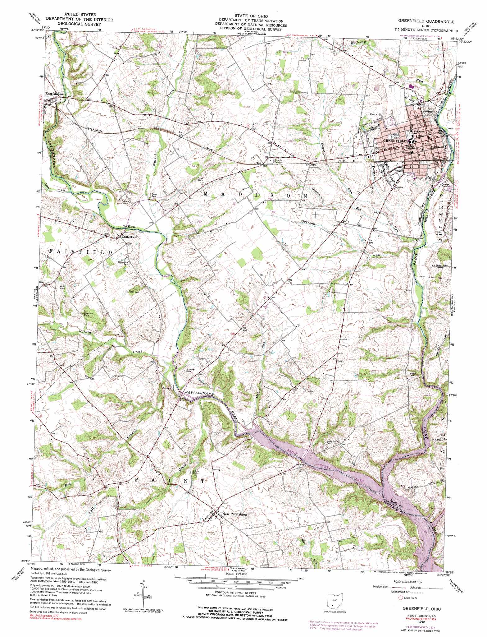
Greenfield Topo Map Ohio
To zoom in, hover over the map of Greenfield
USGS Topo Quad 39083c4 - 1:24,000 scale
| Topo Map Name: | Greenfield |
| USGS Topo Quad ID: | 39083c4 |
| Print Size: | ca. 21 1/4" wide x 27" high |
| Southeast Coordinates: | 39.25° N latitude / 83.375° W longitude |
| Map Center Coordinates: | 39.3125° N latitude / 83.4375° W longitude |
| U.S. State: | OH |
| Filename: | o39083c4.jpg |
| Download Map JPG Image: | Greenfield topo map 1:24,000 scale |
| Map Type: | Topographic |
| Topo Series: | 7.5´ |
| Map Scale: | 1:24,000 |
| Source of Map Images: | United States Geological Survey (USGS) |
| Alternate Map Versions: |
Greenfield OH 1960, updated 1962 Download PDF Buy paper map Greenfield OH 1960, updated 1976 Download PDF Buy paper map Greenfield OH 1960, updated 1990 Download PDF Buy paper map Greenfield OH 2010 Download PDF Buy paper map Greenfield OH 2013 Download PDF Buy paper map Greenfield OH 2016 Download PDF Buy paper map |
1:24,000 Topo Quads surrounding Greenfield
Bowersville |
Milledgeville |
Washington Court House |
New Holland |
Clarksburg |
Sabina |
Memphis |
New Martinsburg |
Good Hope |
Frankfort |
New Vienna |
Leesburg |
Greenfield |
South Salem |
Bourneville |
New Market |
Hillsboro |
Rainsboro |
Bainbridge |
Morgantown |
Sugar Tree Ridge |
Belfast |
Sinking Spring |
Byington |
Latham |
> Back to 39083a1 at 1:100,000 scale
> Back to 39082a1 at 1:250,000 scale
> Back to U.S. Topo Maps home
Greenfield topo map: Gazetteer
Greenfield: Airports
Unger Field elevation 289m 948′Greenfield: Parks
Paint Creek State Park elevation 260m 853′Greenfield: Populated Places
East Monroe elevation 293m 961′Greenfield elevation 278m 912′
New Petersburg elevation 298m 977′
Greenfield: Post Offices
East Monroe Post Office elevation 293m 961′Greenfield Post Office elevation 277m 908′
New Petersburg Post Office (historical) elevation 296m 971′
Greenfield: Streams
Big Branch elevation 243m 797′Cedar Run elevation 242m 793′
Duncan Run elevation 258m 846′
Fall Creek elevation 244m 800′
Farmers Run elevation 249m 816′
Hardin Creek elevation 246m 807′
Holliday Run elevation 256m 839′
Lees Creek elevation 258m 846′
Opossum Run elevation 249m 816′
Rattlesnake Creek elevation 236m 774′
Sugar Run elevation 258m 846′
Walnut Creek elevation 252m 826′
Greenfield digital topo map on disk
Buy this Greenfield topo map showing relief, roads, GPS coordinates and other geographical features, as a high-resolution digital map file on DVD:
 map DVD")