Martinsville Topo Map Ohio
To zoom in, hover over the map of Martinsville
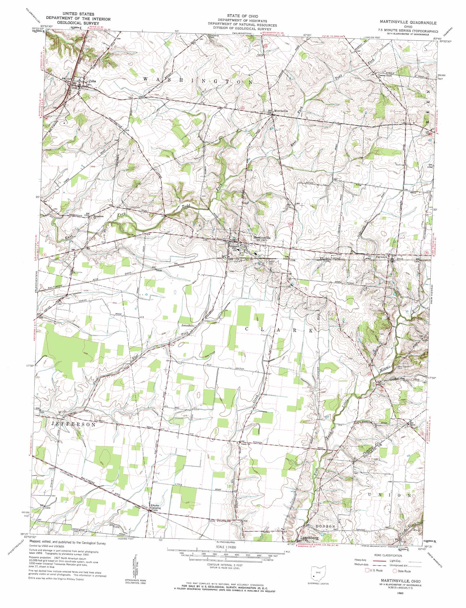
USGS Topo Quad 39083c7 - 1:24,000 scale
| Topo Map Name: | Martinsville |
| USGS Topo Quad ID: | 39083c7 |
| Print Size: | ca. 21 1/4" wide x 27" high |
| Southeast Coordinates: | 39.25° N latitude / 83.75° W longitude |
| Map Center Coordinates: | 39.3125° N latitude / 83.8125° W longitude |
| U.S. State: | OH |
| Filename: | o39083c7.jpg |
| Download Map JPG Image: | Martinsville topo map 1:24,000 scale |
| Map Type: | Topographic |
| Topo Series: | 7.5´ |
| Map Scale: | 1:24,000 |
| Source of Map Images: | United States Geological Survey (USGS) |
| Alternate Map Versions: |
Martinsville OH 1960, updated 1962 Download PDF Buy paper map Martinsville OH 2010 Download PDF Buy paper map Martinsville OH 2013 Download PDF Buy paper map Martinsville OH 2016 Download PDF Buy paper map |
1:24,000 Topo Quads surrounding Martinsville
Waynesville |
New Burlington |
Port William |
Bowersville |
Milledgeville |
Oregonia |
Clarksville |
Wilmington |
Sabina |
Memphis |
Pleasant Plain |
Blanchester |
Martinsville |
New Vienna |
Leesburg |
Newtonsville |
Fayetteville |
Lynchburg |
New Market |
Hillsboro |
Williamsburg |
Mount Orab |
Sardinia |
Sugar Tree Ridge |
Belfast |
> Back to 39083a1 at 1:100,000 scale
> Back to 39082a1 at 1:250,000 scale
> Back to U.S. Topo Maps home
Martinsville topo map: Gazetteer
Martinsville: Airports
Barnett Airpark elevation 308m 1010′Martinsville: Bridges
Martinsville Road Bridge elevation 306m 1003′Martinsville: Populated Places
Cuba elevation 313m 1026′Farmers elevation 324m 1062′
Jonesboro elevation 311m 1020′
Klocks Crossing elevation 308m 1010′
Martinsville elevation 331m 1085′
Morrisville elevation 324m 1062′
Wallopsburg elevation 341m 1118′
Martinsville: Post Offices
Cuba Post Office elevation 313m 1026′Farmers Station Post Office (historical) elevation 324m 1062′
Martinsville Post Office elevation 330m 1082′
Martinsville digital topo map on disk
Buy this Martinsville topo map showing relief, roads, GPS coordinates and other geographical features, as a high-resolution digital map file on DVD:
 map DVD")