Midway Topo Map Ohio
To zoom in, hover over the map of Midway
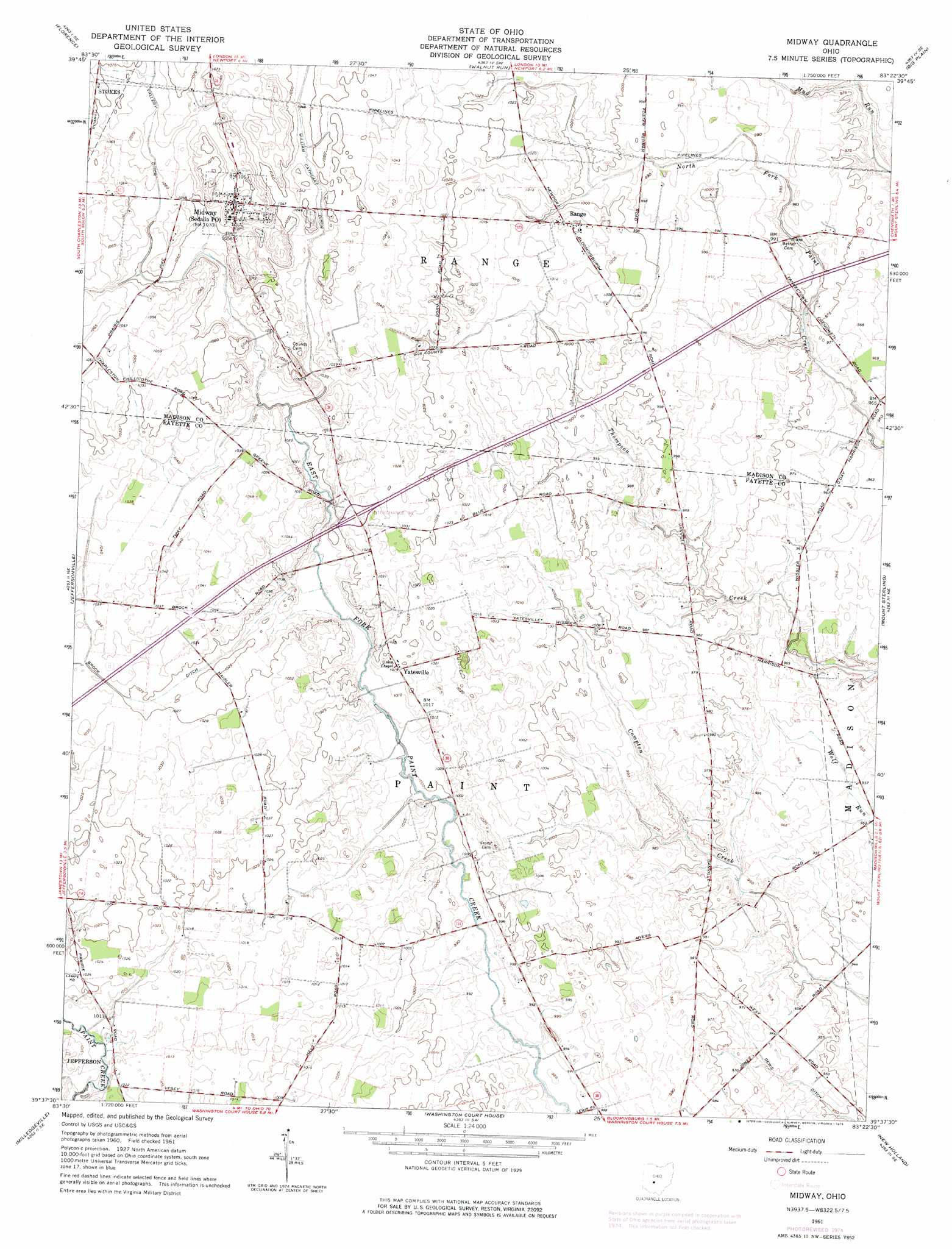
USGS Topo Quad 39083f4 - 1:24,000 scale
| Topo Map Name: | Midway |
| USGS Topo Quad ID: | 39083f4 |
| Print Size: | ca. 21 1/4" wide x 27" high |
| Southeast Coordinates: | 39.625° N latitude / 83.375° W longitude |
| Map Center Coordinates: | 39.6875° N latitude / 83.4375° W longitude |
| U.S. State: | OH |
| Filename: | o39083f4.jpg |
| Download Map JPG Image: | Midway topo map 1:24,000 scale |
| Map Type: | Topographic |
| Topo Series: | 7.5´ |
| Map Scale: | 1:24,000 |
| Source of Map Images: | United States Geological Survey (USGS) |
| Alternate Map Versions: |
Midway OH 1961, updated 1963 Download PDF Buy paper map Midway OH 1961, updated 1975 Download PDF Buy paper map Midway OH 2010 Download PDF Buy paper map Midway OH 2013 Download PDF Buy paper map Midway OH 2016 Download PDF Buy paper map |
1:24,000 Topo Quads surrounding Midway
New Moorefield |
South Vienna |
London |
West Jefferson |
Galloway |
South Charleston |
Florence |
Walnut Run |
Big Plain |
Harrisburg |
Jamestown |
Jeffersonville |
Midway |
Mount Sterling |
Five Points |
Bowersville |
Milledgeville |
Washington Court House |
New Holland |
Clarksburg |
Sabina |
Memphis |
New Martinsburg |
Good Hope |
Frankfort |
> Back to 39083e1 at 1:100,000 scale
> Back to 39082a1 at 1:250,000 scale
> Back to U.S. Topo Maps home
Midway topo map: Gazetteer
Midway: Canals
Brock Ditch elevation 312m 1023′Dews Ditch elevation 290m 951′
Vallery Ditch elevation 324m 1062′
William Cathcart Ditch elevation 318m 1043′
Midway: Crossings
Interchange 75 elevation 314m 1030′Midway: Populated Places
Bethel elevation 302m 990′Midway elevation 324m 1062′
Range elevation 309m 1013′
Yatesville elevation 310m 1017′
Midway: Post Offices
Range Post Office (historical) elevation 309m 1013′Yatesville Post Office (historical) elevation 310m 1017′
Midway digital topo map on disk
Buy this Midway topo map showing relief, roads, GPS coordinates and other geographical features, as a high-resolution digital map file on DVD:
 map DVD")