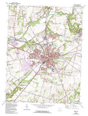
Xenia Topo Map Ohio
To zoom in, hover over the map of Xenia
USGS Topo Quad 39083f8 - 1:24,000 scale
| Topo Map Name: | Xenia |
| USGS Topo Quad ID: | 39083f8 |
| Print Size: | ca. 21 1/4" wide x 27" high |
| Southeast Coordinates: | 39.625° N latitude / 83.875° W longitude |
| Map Center Coordinates: | 39.6875° N latitude / 83.9375° W longitude |
| U.S. State: | OH |
| Filename: | o39083f8.jpg |
| Download Map JPG Image: | Xenia topo map 1:24,000 scale |
| Map Type: | Topographic |
| Topo Series: | 7.5´ |
| Map Scale: | 1:24,000 |
| Source of Map Images: | United States Geological Survey (USGS) |
| Alternate Map Versions: |
Xenia OH 1955, updated 1956 Download PDF Buy paper map Xenia OH 1965, updated 1967 Download PDF Buy paper map Xenia OH 1965, updated 1975 Download PDF Buy paper map Xenia OH 1965, updated 1988 Download PDF Buy paper map Xenia OH 1965, updated 1995 Download PDF Buy paper map Xenia OH 2010 Download PDF Buy paper map Xenia OH 2013 Download PDF Buy paper map Xenia OH 2016 Download PDF Buy paper map |
1:24,000 Topo Quads surrounding Xenia
> Back to 39083e1 at 1:100,000 scale
> Back to 39082a1 at 1:250,000 scale
> Back to U.S. Topo Maps home
Xenia topo map: Gazetteer
Xenia: Airports
Greene County Airport elevation 283m 928′Xenia: Bridges
Stevenson Road Bridge elevation 258m 846′Xenia: Parks
East Second Street Historic District elevation 283m 928′Franklin Park elevation 281m 921′
Glen Thompson State Reserve elevation 240m 787′
Lexington Avenue Park elevation 305m 1000′
Parnell Park elevation 280m 918′
Pierce County Park elevation 273m 895′
Ridgebury Park elevation 283m 928′
Sel Arnovitz Park elevation 270m 885′
Shawnee Park elevation 279m 915′
Spring Hill Park elevation 295m 967′
Waterstreet Historic District elevation 283m 928′
Xenia: Populated Places
Bryson (historical) elevation 265m 869′Oldtown elevation 251m 823′
Pinewood Village elevation 277m 908′
Trebein elevation 244m 800′
Waynetta Mobile Home Park elevation 247m 810′
Wilberforce elevation 307m 1007′
Xenia elevation 284m 931′
Xenia: Post Offices
Old Town Post Office (historical) elevation 250m 820′Trebeins Post Office (historical) elevation 244m 800′
Wilberforce Post Office elevation 308m 1010′
Xenia Post Office elevation 286m 938′
Xenia: Reservoirs
Greene Company Fish and Game Association Reservoir elevation 285m 935′Xenia: Streams
Clark Run elevation 257m 843′Ludlow Creek elevation 246m 807′
Massies Creek elevation 246m 807′
Oldtown Creek elevation 252m 826′
Shawnee Creek elevation 243m 797′
Shawnee Run elevation 277m 908′
Twist Run elevation 280m 918′
Xenia digital topo map on disk
Buy this Xenia topo map showing relief, roads, GPS coordinates and other geographical features, as a high-resolution digital map file on DVD:


