Whitcomb Topo Map Indiana
To zoom in, hover over the map of Whitcomb
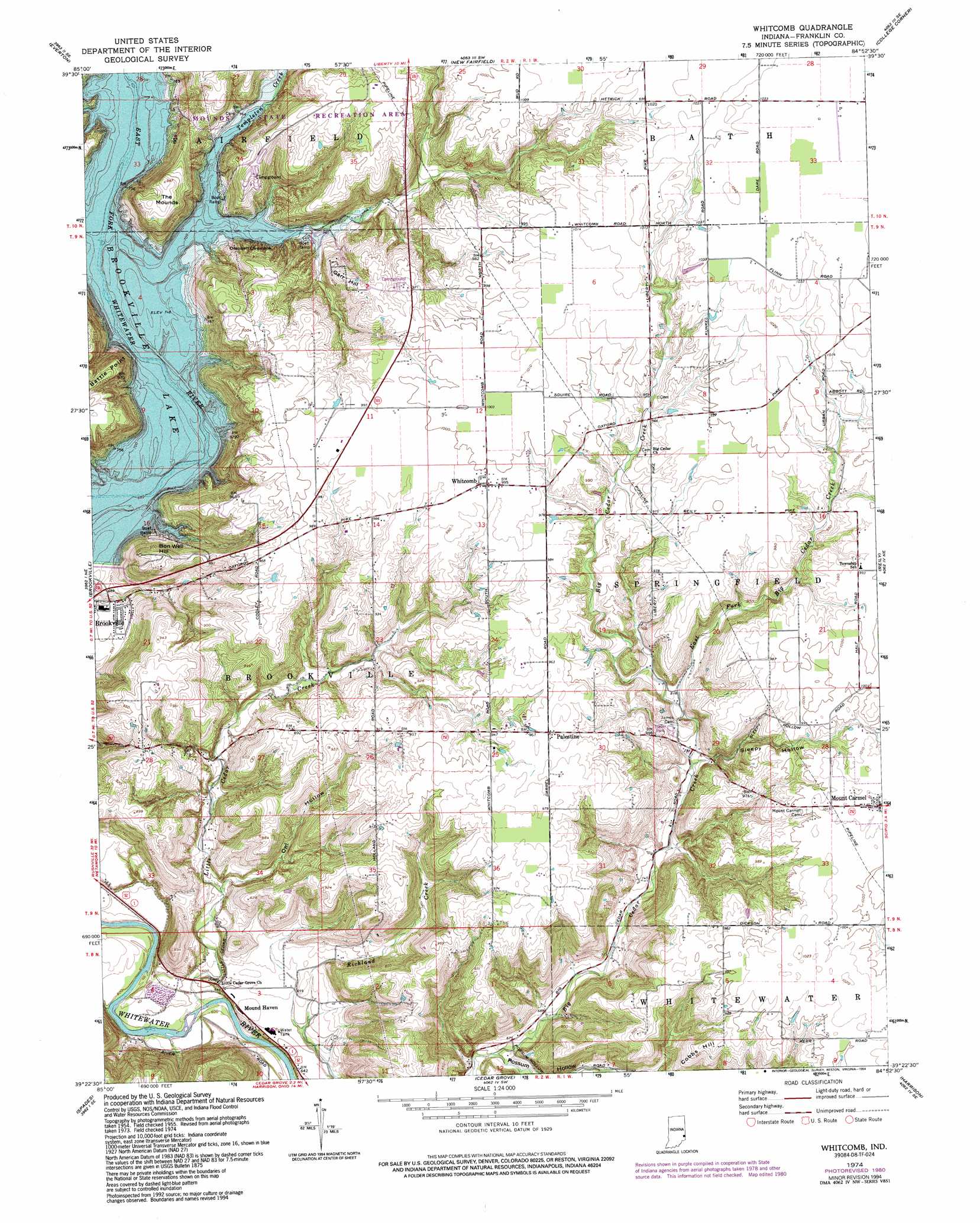
USGS Topo Quad 39084d8 - 1:24,000 scale
| Topo Map Name: | Whitcomb |
| USGS Topo Quad ID: | 39084d8 |
| Print Size: | ca. 21 1/4" wide x 27" high |
| Southeast Coordinates: | 39.375° N latitude / 84.875° W longitude |
| Map Center Coordinates: | 39.4375° N latitude / 84.9375° W longitude |
| U.S. State: | IN |
| Filename: | o39084d8.jpg |
| Download Map JPG Image: | Whitcomb topo map 1:24,000 scale |
| Map Type: | Topographic |
| Topo Series: | 7.5´ |
| Map Scale: | 1:24,000 |
| Source of Map Images: | United States Geological Survey (USGS) |
| Alternate Map Versions: |
Mount Carmel IN 1955, updated 1956 Download PDF Buy paper map Mount Carmel IN 1955, updated 1967 Download PDF Buy paper map Whitcomb IN 1974, updated 1975 Download PDF Buy paper map Whitcomb IN 1974, updated 1981 Download PDF Buy paper map Whitcomb IN 1974, updated 1994 Download PDF Buy paper map Whitcomb IN 2010 Download PDF Buy paper map Whitcomb IN 2013 Download PDF Buy paper map Whitcomb IN 2016 Download PDF Buy paper map |
1:24,000 Topo Quads surrounding Whitcomb
Connersville |
Brownsville |
Liberty |
Fairhaven |
Eaton South |
Alpine |
Everton |
New Fairfield |
College Corner |
Oxford |
Metamora |
Brookville |
Whitcomb |
Reily |
Millville |
Batesville |
Spades |
Cedar Grove |
Harrison |
Shandon |
Pierceville |
Sunman |
Guilford |
Hooven |
Addyston |
> Back to 39084a1 at 1:100,000 scale
> Back to 39084a1 at 1:250,000 scale
> Back to U.S. Topo Maps home
Whitcomb topo map: Gazetteer
Whitcomb: Dams
Brookville Lake Dam elevation 228m 748′Whitcomb: Parks
Mounds State Recreation Area elevation 291m 954′Whitcomb: Populated Places
Mound Haven elevation 201m 659′Palestine elevation 295m 967′
Whitcomb elevation 304m 997′
Whitcomb: Reservoirs
Brookville Lake elevation 228m 748′Whitcomb: Streams
East Fork Big Cedar Creek elevation 250m 820′Little Cedar Creek elevation 177m 580′
Templeton Creek elevation 228m 748′
Whitcomb: Summits
Battle Point elevation 298m 977′Bon Well Hill elevation 296m 971′
Cobbs Hill elevation 299m 980′
Garr Hill elevation 288m 944′
The Mounds elevation 301m 987′
Whitcomb: Valleys
Owl Hollow elevation 212m 695′Possum Hollow elevation 198m 649′
Sleepy Hollow elevation 247m 810′
Whitcomb digital topo map on disk
Buy this Whitcomb topo map showing relief, roads, GPS coordinates and other geographical features, as a high-resolution digital map file on DVD:
Northern Illinois, Northern Indiana & Southwestern Michigan
Buy digital topo maps: Northern Illinois, Northern Indiana & Southwestern Michigan