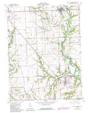
West Alexandria Topo Map Ohio
To zoom in, hover over the map of West Alexandria
USGS Topo Quad 39084f5 - 1:24,000 scale
| Topo Map Name: | West Alexandria |
| USGS Topo Quad ID: | 39084f5 |
| Print Size: | ca. 21 1/4" wide x 27" high |
| Southeast Coordinates: | 39.625° N latitude / 84.5° W longitude |
| Map Center Coordinates: | 39.6875° N latitude / 84.5625° W longitude |
| U.S. State: | OH |
| Filename: | o39084f5.jpg |
| Download Map JPG Image: | West Alexandria topo map 1:24,000 scale |
| Map Type: | Topographic |
| Topo Series: | 7.5´ |
| Map Scale: | 1:24,000 |
| Source of Map Images: | United States Geological Survey (USGS) |
| Alternate Map Versions: |
West Alexandria OH 1961, updated 1962 Download PDF Buy paper map West Alexandria OH 1961, updated 1977 Download PDF Buy paper map West Alexandria OH 1961, updated 1988 Download PDF Buy paper map West Alexandria OH 2010 Download PDF Buy paper map West Alexandria OH 2013 Download PDF Buy paper map West Alexandria OH 2016 Download PDF Buy paper map |
1:24,000 Topo Quads surrounding West Alexandria
> Back to 39084e1 at 1:100,000 scale
> Back to 39084a1 at 1:250,000 scale
> Back to U.S. Topo Maps home
West Alexandria topo map: Gazetteer
West Alexandria: Airports
Morningstar North Airport elevation 299m 980′West Alexandria: Bridges
Brubaker Bridge elevation 253m 830′Roberts Covered Bridge elevation 289m 948′
West Alexandria: Crossings
Bowers Ford elevation 259m 849′Guggs Ford elevation 244m 800′
Moore Ford elevation 255m 836′
Shallow Ford elevation 281m 921′
Wolfs Ford elevation 265m 869′
West Alexandria: Populated Places
Dadsville elevation 287m 941′Enterprise elevation 284m 931′
Gratis elevation 268m 879′
Ransom elevation 301m 987′
Sampleville elevation 299m 980′
West Alexandria elevation 271m 889′
Wheatville elevation 290m 951′
West Alexandria: Post Offices
Enterprise Post Office (historical) elevation 284m 931′Gratis Post Office elevation 269m 882′
Ingomar Post Office (historical) elevation 283m 928′
West Alexandria Post Office elevation 271m 889′
Wheatville Post Office (historical) elevation 288m 944′
West Alexandria: Streams
Aukerman Creek elevation 240m 787′Bantas Fork elevation 253m 830′
Lesley Run elevation 253m 830′
Rocky Run elevation 289m 948′
Sandy Run elevation 249m 816′
West Alexandria digital topo map on disk
Buy this West Alexandria topo map showing relief, roads, GPS coordinates and other geographical features, as a high-resolution digital map file on DVD:
Northern Illinois, Northern Indiana & Southwestern Michigan
Buy digital topo maps: Northern Illinois, Northern Indiana & Southwestern Michigan


