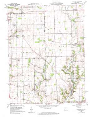
Fairhaven Topo Map Ohio
To zoom in, hover over the map of Fairhaven
USGS Topo Quad 39084f7 - 1:24,000 scale
| Topo Map Name: | Fairhaven |
| USGS Topo Quad ID: | 39084f7 |
| Print Size: | ca. 21 1/4" wide x 27" high |
| Southeast Coordinates: | 39.625° N latitude / 84.75° W longitude |
| Map Center Coordinates: | 39.6875° N latitude / 84.8125° W longitude |
| U.S. States: | OH, IN |
| Filename: | o39084f7.jpg |
| Download Map JPG Image: | Fairhaven topo map 1:24,000 scale |
| Map Type: | Topographic |
| Topo Series: | 7.5´ |
| Map Scale: | 1:24,000 |
| Source of Map Images: | United States Geological Survey (USGS) |
| Alternate Map Versions: |
Fairhaven OH 1960, updated 1961 Download PDF Buy paper map Fairhaven OH 1960, updated 1969 Download PDF Buy paper map Fairhaven OH 2010 Download PDF Buy paper map Fairhaven OH 2013 Download PDF Buy paper map Fairhaven OH 2016 Download PDF Buy paper map |
1:24,000 Topo Quads surrounding Fairhaven
> Back to 39084e1 at 1:100,000 scale
> Back to 39084a1 at 1:250,000 scale
> Back to U.S. Topo Maps home
Fairhaven topo map: Gazetteer
Fairhaven: Airports
E-Z Acres Airport elevation 329m 1079′Fairhaven: Bridges
Harshman Bridge elevation 325m 1066′Fairhaven: Canals
Statler Ditch elevation 338m 1108′Fairhaven: Populated Places
Boston elevation 345m 1131′Claysburg (historical) elevation 313m 1026′
Fairhaven elevation 295m 967′
Five Points elevation 344m 1128′
Goodwins Corner elevation 324m 1062′
Kitchel elevation 337m 1105′
West Florence elevation 349m 1145′
Witts Station elevation 341m 1118′
Fairhaven: Post Offices
Beechy Mire Post Office (historical) elevation 338m 1108′Fairhaven Post Office (historical) elevation 295m 967′
West Florence Post Office (historical) elevation 350m 1148′
Fairhaven: Streams
Church Creek elevation 326m 1069′Dixon Branch elevation 322m 1056′
Fleisch Run elevation 317m 1040′
Fleisch Run elevation 317m 1040′
Goodwins Creek elevation 312m 1023′
Kitchel Creek elevation 322m 1056′
Nut Run elevation 316m 1036′
Radar Creek elevation 321m 1053′
Railsback Creek elevation 319m 1046′
Silver Station Brook elevation 328m 1076′
Square Run elevation 341m 1118′
Toney Run elevation 323m 1059′
Toney Run elevation 323m 1059′
Witts Run elevation 328m 1076′
Fairhaven digital topo map on disk
Buy this Fairhaven topo map showing relief, roads, GPS coordinates and other geographical features, as a high-resolution digital map file on DVD:
Northern Illinois, Northern Indiana & Southwestern Michigan
Buy digital topo maps: Northern Illinois, Northern Indiana & Southwestern Michigan


