Brookville Topo Map Ohio
To zoom in, hover over the map of Brookville
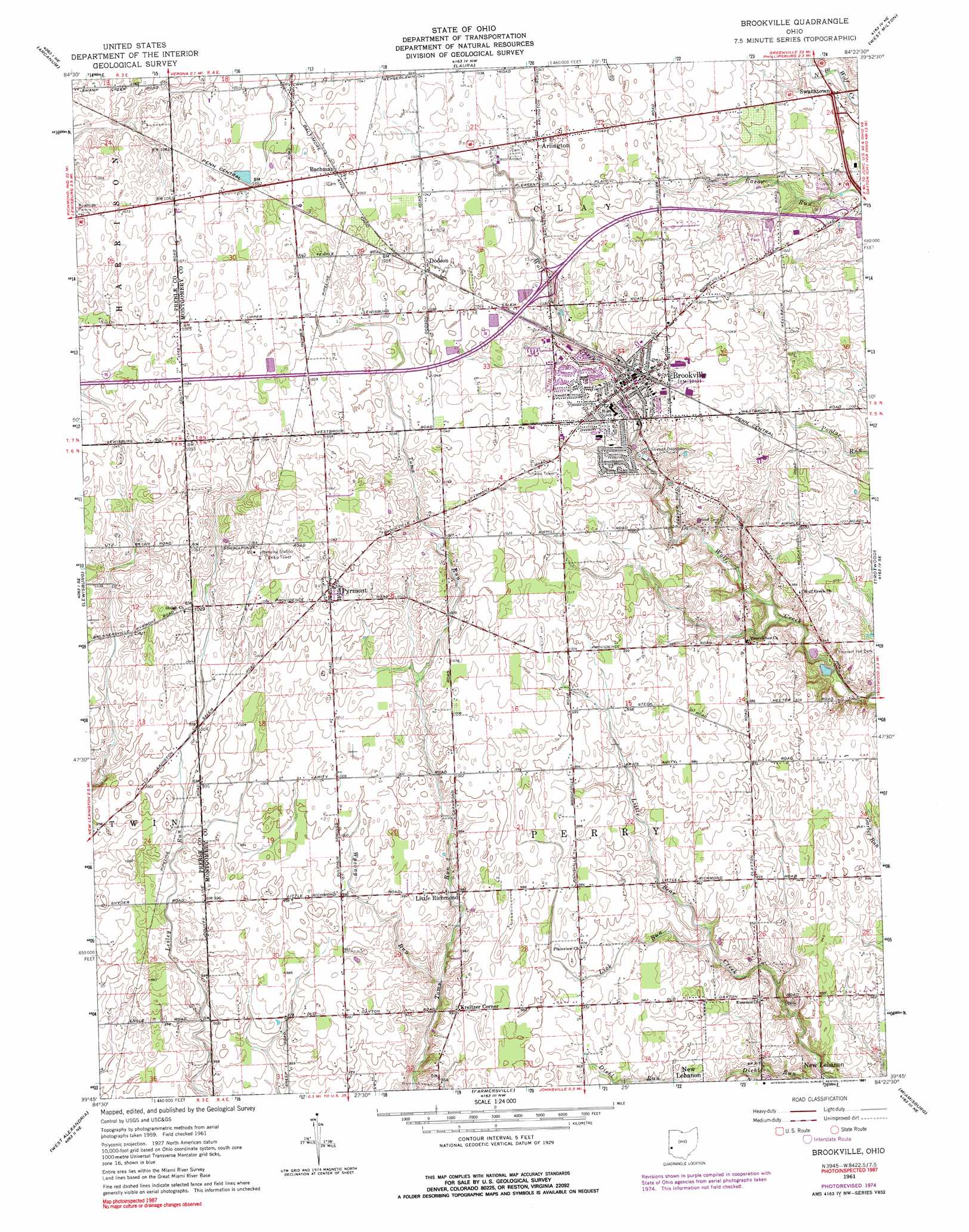
USGS Topo Quad 39084g4 - 1:24,000 scale
| Topo Map Name: | Brookville |
| USGS Topo Quad ID: | 39084g4 |
| Print Size: | ca. 21 1/4" wide x 27" high |
| Southeast Coordinates: | 39.75° N latitude / 84.375° W longitude |
| Map Center Coordinates: | 39.8125° N latitude / 84.4375° W longitude |
| U.S. State: | OH |
| Filename: | o39084g4.jpg |
| Download Map JPG Image: | Brookville topo map 1:24,000 scale |
| Map Type: | Topographic |
| Topo Series: | 7.5´ |
| Map Scale: | 1:24,000 |
| Source of Map Images: | United States Geological Survey (USGS) |
| Alternate Map Versions: |
Brookville OH 1961, updated 1962 Download PDF Buy paper map Brookville OH 1961, updated 1975 Download PDF Buy paper map Brookville OH 1961, updated 1991 Download PDF Buy paper map Brookville OH 2010 Download PDF Buy paper map Brookville OH 2013 Download PDF Buy paper map Brookville OH 2016 Download PDF Buy paper map |
1:24,000 Topo Quads surrounding Brookville
Greenville West |
Greenville East |
Gettysburg |
Pleasant Hill |
Troy |
New Madison |
Arcanum |
Laura |
West Milton |
Tipp City |
Eaton North |
Lewisburg |
Brookville |
Trotwood |
Dayton North |
Eaton South |
West Alexandria |
Farmersville |
Miamisburg |
Dayton South |
Oxford |
West Elkton |
Middletown |
Franklin |
Springboro |
> Back to 39084e1 at 1:100,000 scale
> Back to 39084a1 at 1:250,000 scale
> Back to U.S. Topo Maps home
Brookville topo map: Gazetteer
Brookville: Airports
Brookville Airpark elevation 315m 1033′Halbeisen Airport elevation 297m 974′
Stone Airport elevation 297m 974′
Brookville: Crossings
Interchange 21 elevation 315m 1033′Brookville: Populated Places
Arlington elevation 319m 1046′Bachman elevation 320m 1049′
Brookville elevation 314m 1030′
Dodson elevation 319m 1046′
Kreitzer Corner elevation 302m 990′
Little Richmond elevation 300m 984′
Pyrmont elevation 320m 1049′
Swanktown elevation 305m 1000′
Wengerlawn elevation 319m 1046′
Brookville: Post Offices
Bachman Post Office (historical) elevation 320m 1049′Brookville Post Office elevation 313m 1026′
Dodson Post Office (historical) elevation 320m 1049′
Pyrmont Post Office (historical) elevation 320m 1049′
Wengerlawn Post Office (historical) elevation 319m 1046′
Brookville: Streams
Lick Run elevation 285m 935′Wysong Run elevation 289m 948′
Brookville digital topo map on disk
Buy this Brookville topo map showing relief, roads, GPS coordinates and other geographical features, as a high-resolution digital map file on DVD:
Northern Illinois, Northern Indiana & Southwestern Michigan
Buy digital topo maps: Northern Illinois, Northern Indiana & Southwestern Michigan