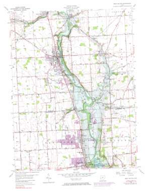
West Milton Topo Map Ohio
To zoom in, hover over the map of West Milton
USGS Topo Quad 39084h3 - 1:24,000 scale
| Topo Map Name: | West Milton |
| USGS Topo Quad ID: | 39084h3 |
| Print Size: | ca. 21 1/4" wide x 27" high |
| Southeast Coordinates: | 39.875° N latitude / 84.25° W longitude |
| Map Center Coordinates: | 39.9375° N latitude / 84.3125° W longitude |
| U.S. State: | OH |
| Filename: | o39084h3.jpg |
| Download Map JPG Image: | West Milton topo map 1:24,000 scale |
| Map Type: | Topographic |
| Topo Series: | 7.5´ |
| Map Scale: | 1:24,000 |
| Source of Map Images: | United States Geological Survey (USGS) |
| Alternate Map Versions: |
West Milton OH 1955, updated 1956 Download PDF Buy paper map West Milton OH 1955, updated 1967 Download PDF Buy paper map West Milton OH 1955, updated 1971 Download PDF Buy paper map West Milton OH 1955, updated 1974 Download PDF Buy paper map West Milton OH 1955, updated 1984 Download PDF Buy paper map West Milton OH 2010 Download PDF Buy paper map West Milton OH 2013 Download PDF Buy paper map West Milton OH 2016 Download PDF Buy paper map |
1:24,000 Topo Quads surrounding West Milton
> Back to 39084e1 at 1:100,000 scale
> Back to 39084a1 at 1:250,000 scale
> Back to U.S. Topo Maps home
West Milton topo map: Gazetteer
West Milton: Airports
Kleptz Airport elevation 296m 971′Millers Grove Heliport elevation 275m 902′
Troy Skypark elevation 282m 925′
Wagner International Airport elevation 284m 931′
West Milton: Dams
West Milton Low Head Dam elevation 246m 807′West Milton: Parks
Government Park elevation 286m 938′Union Community Park elevation 287m 941′
West Milton: Populated Places
County Line (historical) elevation 273m 895′Englewood elevation 279m 915′
Frederick elevation 278m 912′
Garland elevation 313m 1026′
Kessler elevation 280m 918′
Ludlow Falls elevation 275m 902′
Nashville elevation 271m 889′
Pigeye elevation 260m 853′
Pinebrook Estates elevation 290m 951′
Union elevation 281m 921′
West Milton elevation 276m 905′
West Milton: Post Offices
Garland Post Office (historical) elevation 313m 1026′Kessler Post Office (historical) elevation 280m 918′
Ludlow Falls Post Office elevation 275m 902′
Union Post Office (historical) elevation 281m 921′
West Milton Post Office elevation 275m 902′
West Milton: Reservoirs
West Milton Low Head Reservoir elevation 246m 807′West Milton: Streams
Brush Creek elevation 243m 797′Brush Creek elevation 274m 898′
Jones Run elevation 246m 807′
Mill Creek elevation 243m 797′
Pigeye Creek elevation 243m 797′
West Milton digital topo map on disk
Buy this West Milton topo map showing relief, roads, GPS coordinates and other geographical features, as a high-resolution digital map file on DVD:
Northern Illinois, Northern Indiana & Southwestern Michigan
Buy digital topo maps: Northern Illinois, Northern Indiana & Southwestern Michigan


