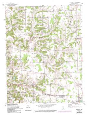
Pierceville Topo Map Indiana
To zoom in, hover over the map of Pierceville
USGS Topo Quad 39085b2 - 1:24,000 scale
| Topo Map Name: | Pierceville |
| USGS Topo Quad ID: | 39085b2 |
| Print Size: | ca. 21 1/4" wide x 27" high |
| Southeast Coordinates: | 39.125° N latitude / 85.125° W longitude |
| Map Center Coordinates: | 39.1875° N latitude / 85.1875° W longitude |
| U.S. State: | IN |
| Filename: | o39085b2.jpg |
| Download Map JPG Image: | Pierceville topo map 1:24,000 scale |
| Map Type: | Topographic |
| Topo Series: | 7.5´ |
| Map Scale: | 1:24,000 |
| Source of Map Images: | United States Geological Survey (USGS) |
| Alternate Map Versions: |
Pierceville IN 1946 Download PDF Buy paper map Pierceville IN 1961, updated 1963 Download PDF Buy paper map Pierceville IN 1961, updated 1981 Download PDF Buy paper map Pierceville IN 1961, updated 1993 Download PDF Buy paper map Pierceville IN 2010 Download PDF Buy paper map Pierceville IN 2013 Download PDF Buy paper map Pierceville IN 2016 Download PDF Buy paper map |
1:24,000 Topo Quads surrounding Pierceville
> Back to 39085a1 at 1:100,000 scale
> Back to 39084a1 at 1:250,000 scale
> Back to U.S. Topo Maps home
Pierceville topo map: Gazetteer
Pierceville: Dams
Broughton Lake Dam elevation 282m 925′La Sarre Lake Dam elevation 280m 918′
Pierceville: Populated Places
Behlmer Corner elevation 302m 990′Clinton elevation 302m 990′
Delaware elevation 281m 921′
Laughery Switch elevation 266m 872′
Lookout elevation 297m 974′
Old Milan elevation 297m 974′
Pierceville elevation 309m 1013′
Prattsburg elevation 296m 971′
Stumpke Corner elevation 302m 990′
Pierceville: Reservoirs
Broughton Lake elevation 282m 925′Paradise Lake elevation 280m 918′
Pierceville: Streams
Castators Creek elevation 253m 830′Little Laughery Creek elevation 268m 879′
North Branch Ripley Creek elevation 270m 885′
Pierceville digital topo map on disk
Buy this Pierceville topo map showing relief, roads, GPS coordinates and other geographical features, as a high-resolution digital map file on DVD:
Northern Illinois, Northern Indiana & Southwestern Michigan
Buy digital topo maps: Northern Illinois, Northern Indiana & Southwestern Michigan


