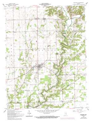
Westport Topo Map Indiana
To zoom in, hover over the map of Westport
USGS Topo Quad 39085b5 - 1:24,000 scale
| Topo Map Name: | Westport |
| USGS Topo Quad ID: | 39085b5 |
| Print Size: | ca. 21 1/4" wide x 27" high |
| Southeast Coordinates: | 39.125° N latitude / 85.5° W longitude |
| Map Center Coordinates: | 39.1875° N latitude / 85.5625° W longitude |
| U.S. State: | IN |
| Filename: | o39085b5.jpg |
| Download Map JPG Image: | Westport topo map 1:24,000 scale |
| Map Type: | Topographic |
| Topo Series: | 7.5´ |
| Map Scale: | 1:24,000 |
| Source of Map Images: | United States Geological Survey (USGS) |
| Alternate Map Versions: |
Westport IN 1958, updated 1959 Download PDF Buy paper map Westport IN 1958, updated 1981 Download PDF Buy paper map Westport IN 1958, updated 1983 Download PDF Buy paper map Westport IN 1958, updated 1994 Download PDF Buy paper map Westport IN 2010 Download PDF Buy paper map Westport IN 2013 Download PDF Buy paper map Westport IN 2016 Download PDF Buy paper map |
1:24,000 Topo Quads surrounding Westport
> Back to 39085a1 at 1:100,000 scale
> Back to 39084a1 at 1:250,000 scale
> Back to U.S. Topo Maps home
Westport topo map: Gazetteer
Westport: Populated Places
Gaynorsville elevation 267m 875′Harper elevation 238m 780′
Letts elevation 273m 895′
Letts Corner elevation 273m 895′
Mapleton Corner elevation 253m 830′
Neff Corner elevation 253m 830′
Pinhook elevation 261m 856′
Westport elevation 248m 813′
Westport: Streams
Cobbs Fork elevation 234m 767′Ice Creek elevation 213m 698′
Millstone Creek elevation 212m 695′
Panther Creek elevation 219m 718′
Poplar Root Creek elevation 211m 692′
Rock Creek elevation 213m 698′
Rodney Branch elevation 228m 748′
Turnover Creek elevation 214m 702′
Westport digital topo map on disk
Buy this Westport topo map showing relief, roads, GPS coordinates and other geographical features, as a high-resolution digital map file on DVD:
Northern Illinois, Northern Indiana & Southwestern Michigan
Buy digital topo maps: Northern Illinois, Northern Indiana & Southwestern Michigan


