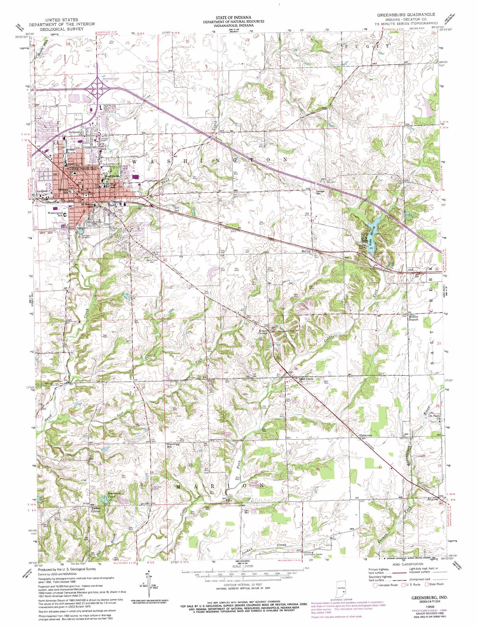
Greensburg Topo Map Indiana
To zoom in, hover over the map of Greensburg
USGS Topo Quad 39085c4 - 1:24,000 scale
| Topo Map Name: | Greensburg |
| USGS Topo Quad ID: | 39085c4 |
| Print Size: | ca. 21 1/4" wide x 27" high |
| Southeast Coordinates: | 39.25° N latitude / 85.375° W longitude |
| Map Center Coordinates: | 39.3125° N latitude / 85.4375° W longitude |
| U.S. State: | IN |
| Filename: | o39085c4.jpg |
| Download Map JPG Image: | Greensburg topo map 1:24,000 scale |
| Map Type: | Topographic |
| Topo Series: | 7.5´ |
| Map Scale: | 1:24,000 |
| Source of Map Images: | United States Geological Survey (USGS) |
| Alternate Map Versions: |
Greensburg IN 1958, updated 1959 Download PDF Buy paper map Greensburg IN 1958, updated 1981 Download PDF Buy paper map Greensburg IN 1958, updated 1988 Download PDF Buy paper map Greensburg IN 1958, updated 1993 Download PDF Buy paper map Greensburg IN 2010 Download PDF Buy paper map Greensburg IN 2013 Download PDF Buy paper map Greensburg IN 2016 Download PDF Buy paper map |
1:24,000 Topo Quads surrounding Greensburg
Rays Crossing |
Manilla |
Rushville |
New Salem |
Alpine |
Waldron |
Adams |
Milroy |
Clarksburg |
Metamora |
Hartsville |
Forest Hill |
Greensburg |
New Point |
Batesville |
Grammer |
Westport |
Millhousen |
Osgood |
Pierceville |
North Vernon |
Butlerville |
Holton |
Versailles |
Milan |
> Back to 39085a1 at 1:100,000 scale
> Back to 39084a1 at 1:250,000 scale
> Back to U.S. Topo Maps home
Greensburg topo map: Gazetteer
Greensburg: Dams
Cresswood Lake Dam elevation 296m 971′Morrison Pond Dam elevation 280m 918′
Reed Dam elevation 317m 1040′
Greensburg: Populated Places
Greensburg elevation 292m 958′Knarr Corner elevation 304m 997′
McCoy elevation 308m 1010′
Middle Branch elevation 302m 990′
Slabtown elevation 298m 977′
Smyrna elevation 294m 964′
Tarkeo Corner elevation 291m 954′
Greensburg: Reservoirs
Lake McCoy elevation 301m 987′Morrison Pond elevation 280m 918′
Reed Reservoir elevation 317m 1040′
Greensburg: Streams
Lost Fork elevation 252m 826′Greensburg digital topo map on disk
Buy this Greensburg topo map showing relief, roads, GPS coordinates and other geographical features, as a high-resolution digital map file on DVD:
Northern Illinois, Northern Indiana & Southwestern Michigan
Buy digital topo maps: Northern Illinois, Northern Indiana & Southwestern Michigan