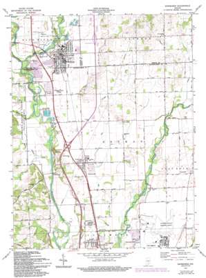
Edinburgh Topo Map Indiana
To zoom in, hover over the map of Edinburgh
USGS Topo Quad 39085c8 - 1:24,000 scale
| Topo Map Name: | Edinburgh |
| USGS Topo Quad ID: | 39085c8 |
| Print Size: | ca. 21 1/4" wide x 27" high |
| Southeast Coordinates: | 39.25° N latitude / 85.875° W longitude |
| Map Center Coordinates: | 39.3125° N latitude / 85.9375° W longitude |
| U.S. State: | IN |
| Filename: | o39085c8.jpg |
| Download Map JPG Image: | Edinburgh topo map 1:24,000 scale |
| Map Type: | Topographic |
| Topo Series: | 7.5´ |
| Map Scale: | 1:24,000 |
| Source of Map Images: | United States Geological Survey (USGS) |
| Alternate Map Versions: |
Edinburg IN 1948 Download PDF Buy paper map Edinburg IN 1961, updated 1964 Download PDF Buy paper map Edinburg IN 1961, updated 1968 Download PDF Buy paper map Edinburgh IN 1961, updated 1993 Download PDF Buy paper map Edinburgh IN 1961, updated 1993 Download PDF Buy paper map Edinburgh IN 2010 Download PDF Buy paper map Edinburgh IN 2013 Download PDF Buy paper map Edinburgh IN 2016 Download PDF Buy paper map |
1:24,000 Topo Quads surrounding Edinburgh
> Back to 39085a1 at 1:100,000 scale
> Back to 39084a1 at 1:250,000 scale
> Back to U.S. Topo Maps home
Edinburgh topo map: Gazetteer
Edinburgh: Airports
Columbus Bakalar Municipal Airport elevation 199m 652′Edinburgh: Bridges
Tannehill Covered Bridge elevation 192m 629′Edinburgh: Crossings
Interchange 76 elevation 205m 672′Interchange 80 elevation 231m 757′
Interchange 80 elevation 207m 679′
Edinburgh: Lakes
Dailey Lake elevation 200m 656′Edinburgh: Parks
Irwin Park elevation 200m 656′Edinburgh: Populated Places
Cuba elevation 203m 666′Edinburgh elevation 205m 672′
Flat Rock Park elevation 195m 639′
Lowell elevation 195m 639′
North Gate elevation 199m 652′
North Park elevation 199m 652′
Northcliff elevation 204m 669′
Pleasant View Village elevation 202m 662′
Taylorsville elevation 199m 652′
Edinburgh: Streams
Big Blue River elevation 198m 649′Big Slough elevation 192m 629′
Lick Creek elevation 193m 633′
Muddy Branch Creek elevation 195m 639′
Nineveh Creek elevation 192m 629′
Sugar Creek elevation 198m 649′
Edinburgh digital topo map on disk
Buy this Edinburgh topo map showing relief, roads, GPS coordinates and other geographical features, as a high-resolution digital map file on DVD:
Northern Illinois, Northern Indiana & Southwestern Michigan
Buy digital topo maps: Northern Illinois, Northern Indiana & Southwestern Michigan


