New Salem Topo Map Indiana
To zoom in, hover over the map of New Salem
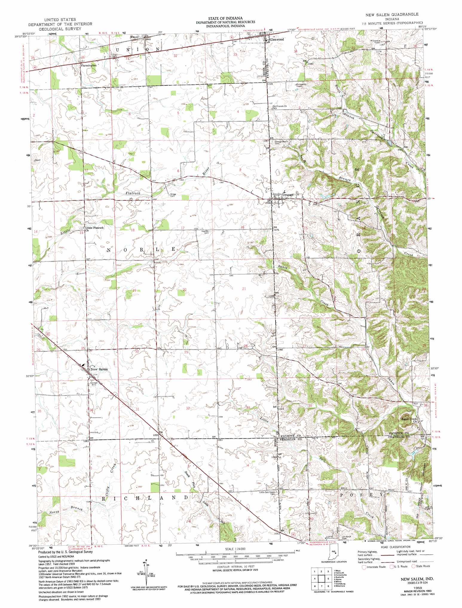
USGS Topo Quad 39085e3 - 1:24,000 scale
| Topo Map Name: | New Salem |
| USGS Topo Quad ID: | 39085e3 |
| Print Size: | ca. 21 1/4" wide x 27" high |
| Southeast Coordinates: | 39.5° N latitude / 85.25° W longitude |
| Map Center Coordinates: | 39.5625° N latitude / 85.3125° W longitude |
| U.S. State: | IN |
| Filename: | o39085e3.jpg |
| Download Map JPG Image: | New Salem topo map 1:24,000 scale |
| Map Type: | Topographic |
| Topo Series: | 7.5´ |
| Map Scale: | 1:24,000 |
| Source of Map Images: | United States Geological Survey (USGS) |
| Alternate Map Versions: |
New Salem IN 1959, updated 1960 Download PDF Buy paper map New Salem IN 1959, updated 1973 Download PDF Buy paper map New Salem IN 1959, updated 1994 Download PDF Buy paper map New Salem IN 2010 Download PDF Buy paper map New Salem IN 2013 Download PDF Buy paper map New Salem IN 2016 Download PDF Buy paper map |
1:24,000 Topo Quads surrounding New Salem
Knightstown |
Dunreith |
Lewisville |
Cambridge City |
Jacksonburg |
Carthage |
Mays |
Falmouth |
Connersville |
Brownsville |
Manilla |
Rushville |
New Salem |
Alpine |
Everton |
Adams |
Milroy |
Clarksburg |
Metamora |
Brookville |
Forest Hill |
Greensburg |
New Point |
Batesville |
Spades |
> Back to 39085e1 at 1:100,000 scale
> Back to 39084a1 at 1:250,000 scale
> Back to U.S. Topo Maps home
New Salem topo map: Gazetteer
New Salem: Dams
Woodland Retreat Dam elevation 290m 951′New Salem: Populated Places
Farmington elevation 319m 1046′Mauzy elevation 319m 1046′
New Salem elevation 314m 1030′
Orange elevation 335m 1099′
New Salem: Reservoirs
Woodland Retreat Lake elevation 290m 951′New Salem digital topo map on disk
Buy this New Salem topo map showing relief, roads, GPS coordinates and other geographical features, as a high-resolution digital map file on DVD:
Northern Illinois, Northern Indiana & Southwestern Michigan
Buy digital topo maps: Northern Illinois, Northern Indiana & Southwestern Michigan