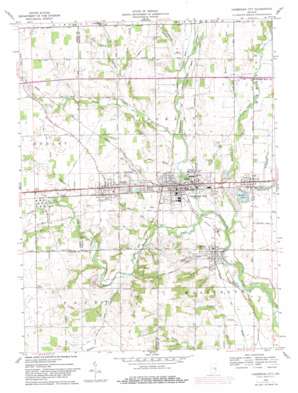
Cambridge City Topo Map Indiana
To zoom in, hover over the map of Cambridge City
USGS Topo Quad 39085g2 - 1:24,000 scale
| Topo Map Name: | Cambridge City |
| USGS Topo Quad ID: | 39085g2 |
| Print Size: | ca. 21 1/4" wide x 27" high |
| Southeast Coordinates: | 39.75° N latitude / 85.125° W longitude |
| Map Center Coordinates: | 39.8125° N latitude / 85.1875° W longitude |
| U.S. State: | IN |
| Filename: | o39085g2.jpg |
| Download Map JPG Image: | Cambridge City topo map 1:24,000 scale |
| Map Type: | Topographic |
| Topo Series: | 7.5´ |
| Map Scale: | 1:24,000 |
| Source of Map Images: | United States Geological Survey (USGS) |
| Alternate Map Versions: |
Cambridge City IN 1960, updated 1961 Download PDF Buy paper map Cambridge City IN 1960, updated 1982 Download PDF Buy paper map Cambridge City IN 2010 Download PDF Buy paper map Cambridge City IN 2013 Download PDF Buy paper map Cambridge City IN 2016 Download PDF Buy paper map |
1:24,000 Topo Quads surrounding Cambridge City
> Back to 39085e1 at 1:100,000 scale
> Back to 39084a1 at 1:250,000 scale
> Back to U.S. Topo Maps home
Cambridge City topo map: Gazetteer
Cambridge City: Canals
Davis Rich Ditch elevation 317m 1040′Gilbert Ditch elevation 315m 1033′
Cambridge City: Lakes
Hi-Way Springs elevation 302m 990′Cambridge City: Parks
Criotz Park elevation 283m 928′Wilson Park elevation 317m 1040′
Cambridge City: Populated Places
Cambridge City elevation 285m 935′Dublin elevation 321m 1053′
East Germantown elevation 290m 951′
Milton elevation 284m 931′
Mount Auburn elevation 302m 990′
Cambridge City: Reservoirs
We-Hi Lake elevation 282m 925′Cambridge City: Streams
Auburn Brook elevation 282m 925′Beard Run elevation 291m 954′
City Run elevation 275m 902′
Coon Creek elevation 307m 1007′
Crietz Creek elevation 282m 925′
Dry Branch elevation 277m 908′
Glue Run elevation 306m 1003′
Horn Creek elevation 301m 987′
Lick Branch elevation 295m 967′
Martindale Creek elevation 276m 905′
Milton Drain elevation 276m 905′
Pronghorn Run elevation 291m 954′
Roy Run elevation 308m 1010′
Simple Branch elevation 293m 961′
Springs Run elevation 292m 958′
Symonds Creek elevation 284m 931′
Symons Creek elevation 277m 908′
Wilson Run elevation 286m 938′
Cambridge City digital topo map on disk
Buy this Cambridge City topo map showing relief, roads, GPS coordinates and other geographical features, as a high-resolution digital map file on DVD:
Northern Illinois, Northern Indiana & Southwestern Michigan
Buy digital topo maps: Northern Illinois, Northern Indiana & Southwestern Michigan


