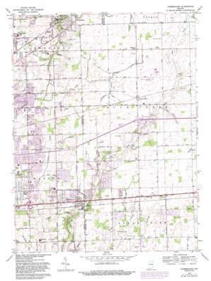
Cumberland Topo Map Indiana
To zoom in, hover over the map of Cumberland
USGS Topo Quad 39085g8 - 1:24,000 scale
| Topo Map Name: | Cumberland |
| USGS Topo Quad ID: | 39085g8 |
| Print Size: | ca. 21 1/4" wide x 27" high |
| Southeast Coordinates: | 39.75° N latitude / 85.875° W longitude |
| Map Center Coordinates: | 39.8125° N latitude / 85.9375° W longitude |
| U.S. State: | IN |
| Filename: | o39085g8.jpg |
| Download Map JPG Image: | Cumberland topo map 1:24,000 scale |
| Map Type: | Topographic |
| Topo Series: | 7.5´ |
| Map Scale: | 1:24,000 |
| Source of Map Images: | United States Geological Survey (USGS) |
| Alternate Map Versions: |
Cumberland IN 1952, updated 1953 Download PDF Buy paper map Cumberland IN 1962, updated 1964 Download PDF Buy paper map Cumberland IN 1962, updated 1976 Download PDF Buy paper map Cumberland IN 1962, updated 1982 Download PDF Buy paper map Cumberland IN 1962, updated 1988 Download PDF Buy paper map Cumberland IN 1962, updated 1988 Download PDF Buy paper map Cumberland IN 2010 Download PDF Buy paper map Cumberland IN 2013 Download PDF Buy paper map Cumberland IN 2016 Download PDF Buy paper map |
1:24,000 Topo Quads surrounding Cumberland
> Back to 39085e1 at 1:100,000 scale
> Back to 39084a1 at 1:250,000 scale
> Back to U.S. Topo Maps home
Cumberland topo map: Gazetteer
Cumberland: Airports
Mount Comfort Airfield elevation 261m 856′Cumberland: Canals
Breier Arm elevation 256m 839′Burris Ditch elevation 260m 853′
Dunn Ditch elevation 260m 853′
Heinrich Ditch elevation 259m 849′
Hunter Mitthoefer Ditch elevation 256m 839′
Morris Ditch elevation 254m 833′
O'Brian Ditch elevation 256m 839′
Osborn Ditch elevation 253m 830′
Parker Eastes Ditch elevation 258m 846′
Prange Ditch elevation 251m 823′
Rothe Ditch elevation 257m 843′
Rouark Ditch elevation 255m 836′
Steele Ditch elevation 256m 839′
Young Ditch elevation 255m 836′
Cumberland: Parks
Bel East Park elevation 255m 836′German Church And East 30th Street Park elevation 253m 830′
Grassy Creek Park elevation 255m 836′
Lee Road Park elevation 258m 846′
Paul Ruster Park elevation 251m 823′
Veterans Memorial Park elevation 262m 859′
Cumberland: Populated Places
Cumberland elevation 260m 853′Gem elevation 261m 856′
Mount Comfort elevation 262m 859′
Oaklandon elevation 261m 856′
Pleasant Acres elevation 261m 856′
Warren Hills elevation 262m 859′
Cumberland: Streams
Amity Branch elevation 253m 830′Bells Run elevation 251m 823′
Billings Creek elevation 250m 820′
Brave Creek elevation 250m 820′
Chime Run elevation 254m 833′
Cumberland Creek elevation 250m 820′
Field Creek elevation 255m 836′
Hay Run elevation 254m 833′
Hoss Creek elevation 247m 810′
Lead Creek elevation 253m 830′
Mock Creek elevation 246m 807′
Papoose Creek elevation 250m 820′
Snider Branch elevation 253m 830′
Squaw Run elevation 248m 813′
Straw Branch elevation 251m 823′
Washington Creek elevation 250m 820′
Wead Run elevation 251m 823′
Wesley Creek elevation 251m 823′
Cumberland digital topo map on disk
Buy this Cumberland topo map showing relief, roads, GPS coordinates and other geographical features, as a high-resolution digital map file on DVD:
Northern Illinois, Northern Indiana & Southwestern Michigan
Buy digital topo maps: Northern Illinois, Northern Indiana & Southwestern Michigan


