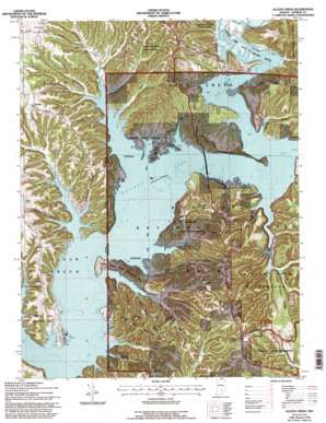
Allens Creek Topo Map Indiana
To zoom in, hover over the map of Allens Creek
USGS Topo Quad 39086a4 - 1:24,000 scale
| Topo Map Name: | Allens Creek |
| USGS Topo Quad ID: | 39086a4 |
| Print Size: | ca. 21 1/4" wide x 27" high |
| Southeast Coordinates: | 39° N latitude / 86.375° W longitude |
| Map Center Coordinates: | 39.0625° N latitude / 86.4375° W longitude |
| U.S. State: | IN |
| Filename: | o39086a4.jpg |
| Download Map JPG Image: | Allens Creek topo map 1:24,000 scale |
| Map Type: | Topographic |
| Topo Series: | 7.5´ |
| Map Scale: | 1:24,000 |
| Source of Map Images: | United States Geological Survey (USGS) |
| Alternate Map Versions: |
Allens Creek IN 1947 Download PDF Buy paper map Allens Creek IN 1947 Download PDF Buy paper map Allens Creek IN 1947, updated 1953 Download PDF Buy paper map Allens Creek IN 1957, updated 1959 Download PDF Buy paper map Allens Creek IN 1957, updated 1959 Download PDF Buy paper map Allens Creek IN 1957, updated 1959 Download PDF Buy paper map Allens Creek IN 1966, updated 1968 Download PDF Buy paper map Allens Creek IN 1966, updated 1968 Download PDF Buy paper map Allens Creek IN 1966, updated 1971 Download PDF Buy paper map Allens Creek IN 1966, updated 1981 Download PDF Buy paper map Allens Creek IN 1966, updated 1996 Download PDF Buy paper map Allens Creek IN 1966, updated 1996 Download PDF Buy paper map Allens Creek IN 2011 Download PDF Buy paper map Allens Creek IN 2013 Download PDF Buy paper map Allens Creek IN 2016 Download PDF Buy paper map |
| FStopo: | US Forest Service topo Allens Creek is available: Download FStopo PDF Download FStopo TIF |
1:24,000 Topo Quads surrounding Allens Creek
> Back to 39086a1 at 1:100,000 scale
> Back to 39086a1 at 1:250,000 scale
> Back to U.S. Topo Maps home
Allens Creek topo map: Gazetteer
Allens Creek: Airports
Lake Monroe Airport elevation 164m 538′Allens Creek: Parks
Allens Creek State Recreation Area elevation 204m 669′Fairfax State Recreation Area elevation 191m 626′
Hardin Ridge Recreation Area elevation 232m 761′
North Fork State Wildlife Refuge elevation 164m 538′
Paynetown State Recreation Area elevation 171m 561′
Allens Creek: Populated Places
Fairfax elevation 164m 538′Handy elevation 234m 767′
Allens Creek: Post Offices
Allens Creek Post Office (historical) elevation 181m 593′South Granger Post Office (historical) elevation 168m 551′
Allens Creek: Reservoirs
Blackwell Lake elevation 235m 770′Tower Blackwell Lake elevation 248m 813′
Allens Creek: Ridges
Dutch Ridge elevation 253m 830′Frog Pond Ridge elevation 232m 761′
Hardin Ridge elevation 233m 764′
Holland Ridge elevation 234m 767′
Pine Ridge elevation 230m 754′
Rush Ridge elevation 216m 708′
Allens Creek: Streams
Allens Creek elevation 164m 538′Baxter Branch elevation 164m 538′
Butcher Branch elevation 167m 547′
Middle Fork Salt Creek elevation 164m 538′
Moore Creek elevation 164m 538′
North Fork Salt Creek elevation 164m 538′
Ramp Creek elevation 164m 538′
Saddle Creek elevation 164m 538′
Siscoe Branch elevation 164m 538′
Allens Creek: Valleys
Butcher Hollow elevation 164m 538′Eads Hollow elevation 167m 547′
Hayes Hollow elevation 165m 541′
Jacobs Hollow elevation 164m 538′
Jarrell Hollow elevation 164m 538′
Johnson Hollow elevation 169m 554′
Martin Hollow elevation 164m 538′
Miller Hollow elevation 164m 538′
Pate Hollow elevation 169m 554′
Phillipe Hollow elevation 164m 538′
Sherril Hollow elevation 171m 561′
Sugarcamp Hollow elevation 164m 538′
Allens Creek digital topo map on disk
Buy this Allens Creek topo map showing relief, roads, GPS coordinates and other geographical features, as a high-resolution digital map file on DVD:
Northern Illinois, Northern Indiana & Southwestern Michigan
Buy digital topo maps: Northern Illinois, Northern Indiana & Southwestern Michigan


