Whitehall Topo Map Indiana
To zoom in, hover over the map of Whitehall
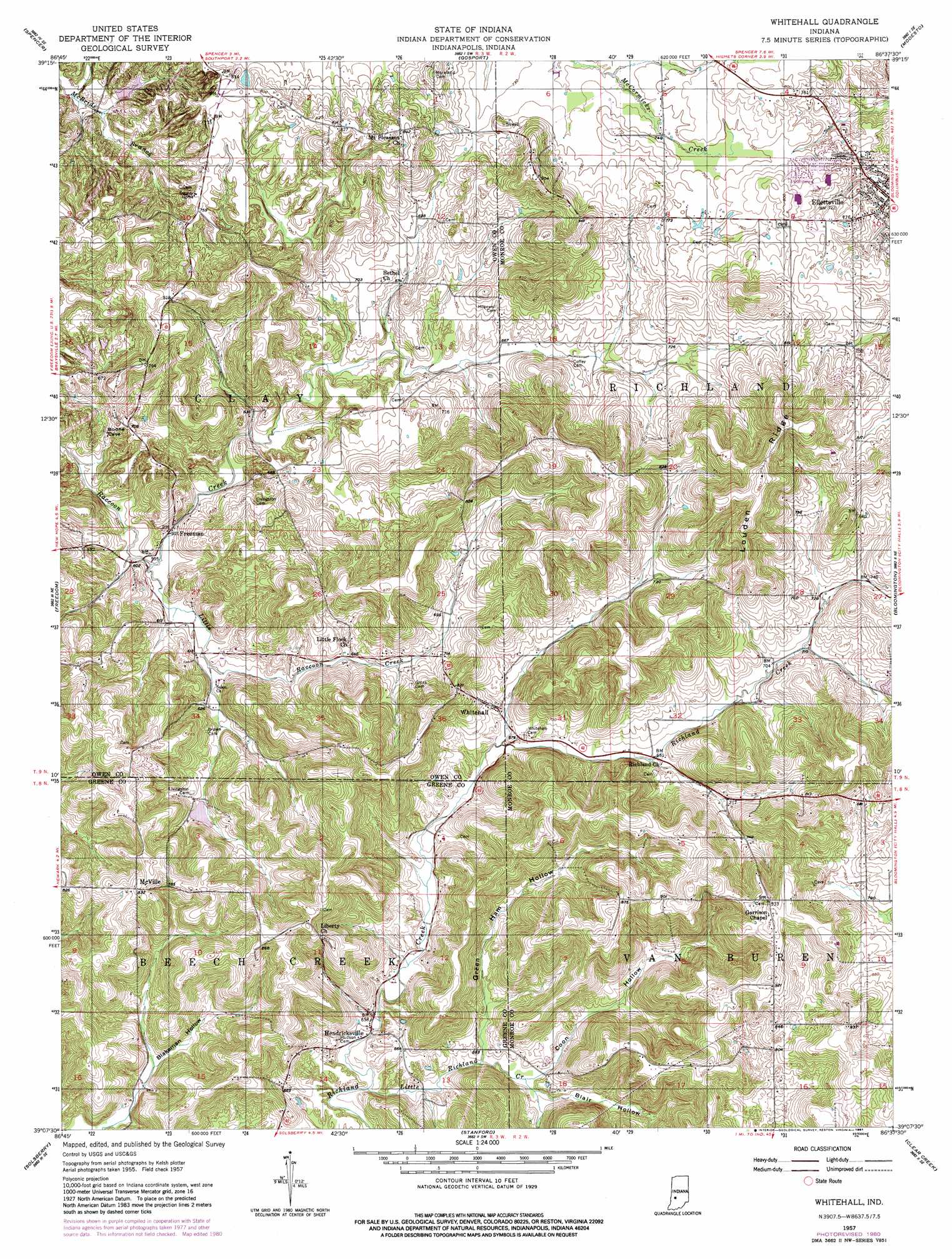
USGS Topo Quad 39086b6 - 1:24,000 scale
| Topo Map Name: | Whitehall |
| USGS Topo Quad ID: | 39086b6 |
| Print Size: | ca. 21 1/4" wide x 27" high |
| Southeast Coordinates: | 39.125° N latitude / 86.625° W longitude |
| Map Center Coordinates: | 39.1875° N latitude / 86.6875° W longitude |
| U.S. State: | IN |
| Filename: | o39086b6.jpg |
| Download Map JPG Image: | Whitehall topo map 1:24,000 scale |
| Map Type: | Topographic |
| Topo Series: | 7.5´ |
| Map Scale: | 1:24,000 |
| Source of Map Images: | United States Geological Survey (USGS) |
| Alternate Map Versions: |
Whitehall IN 1957, updated 1958 Download PDF Buy paper map Whitehall IN 1957, updated 1966 Download PDF Buy paper map Whitehall IN 1957, updated 1981 Download PDF Buy paper map Whitehall IN 1957, updated 1981 Download PDF Buy paper map Whitehall IN 1998, updated 2002 Download PDF Buy paper map Whitehall IN 2010 Download PDF Buy paper map Whitehall IN 2013 Download PDF Buy paper map Whitehall IN 2016 Download PDF Buy paper map |
1:24,000 Topo Quads surrounding Whitehall
Poland |
Cataract |
Quincy |
Paragon |
Martinsville |
Patricksburg |
Spencer |
Gosport |
Modesto |
Hindustan |
Arney |
Freedom |
Whitehall |
Bloomington |
Unionville |
Bloomfield |
Solsberry |
Stanford |
Clear Creek |
Allens Creek |
Scotland |
Koleen |
Owensburg |
Oolitic |
Bartlettsville |
> Back to 39086a1 at 1:100,000 scale
> Back to 39086a1 at 1:250,000 scale
> Back to U.S. Topo Maps home
Whitehall topo map: Gazetteer
Whitehall: Dams
Timber Ridge Lake Dam elevation 198m 649′Whitehall: Populated Places
Ellettsville elevation 212m 695′Freeman elevation 186m 610′
Hendricksville elevation 193m 633′
McVille elevation 255m 836′
Whitehall elevation 210m 688′
Whitehall: Reservoirs
Timber Ridge Lake elevation 198m 649′Whitehall: Ridges
Louden Ridge elevation 299m 980′Whitehall: Streams
Little Raccoon Creek elevation 180m 590′Little Richland Creek elevation 192m 629′
Whitehall: Valleys
Blair Hollow elevation 195m 639′Blakeman Hollow elevation 187m 613′
Coon Hollow elevation 194m 636′
Green Ham Hollow elevation 196m 643′
Whitehall digital topo map on disk
Buy this Whitehall topo map showing relief, roads, GPS coordinates and other geographical features, as a high-resolution digital map file on DVD:
Northern Illinois, Northern Indiana & Southwestern Michigan
Buy digital topo maps: Northern Illinois, Northern Indiana & Southwestern Michigan