Trafalgar Topo Map Indiana
To zoom in, hover over the map of Trafalgar
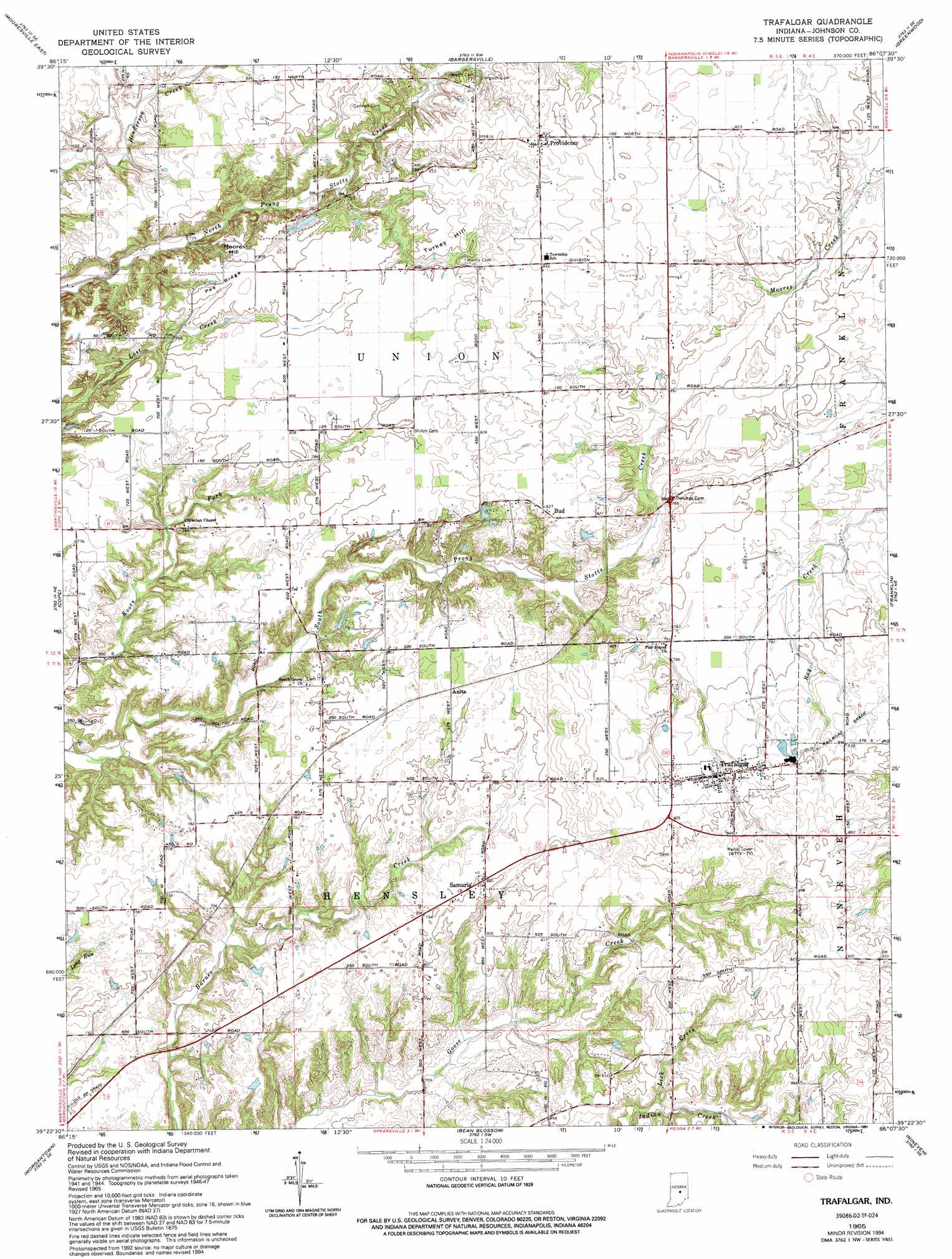
USGS Topo Quad 39086d2 - 1:24,000 scale
| Topo Map Name: | Trafalgar |
| USGS Topo Quad ID: | 39086d2 |
| Print Size: | ca. 21 1/4" wide x 27" high |
| Southeast Coordinates: | 39.375° N latitude / 86.125° W longitude |
| Map Center Coordinates: | 39.4375° N latitude / 86.1875° W longitude |
| U.S. State: | IN |
| Filename: | o39086d2.jpg |
| Download Map JPG Image: | Trafalgar topo map 1:24,000 scale |
| Map Type: | Topographic |
| Topo Series: | 7.5´ |
| Map Scale: | 1:24,000 |
| Source of Map Images: | United States Geological Survey (USGS) |
| Alternate Map Versions: |
Trafalgar IN 1948 Download PDF Buy paper map Trafalgar IN 1965, updated 1966 Download PDF Buy paper map Trafalgar IN 1965, updated 1976 Download PDF Buy paper map Trafalgar IN 1965, updated 1991 Download PDF Buy paper map Trafalgar IN 1965, updated 1994 Download PDF Buy paper map Trafalgar IN 2010 Download PDF Buy paper map Trafalgar IN 2013 Download PDF Buy paper map Trafalgar IN 2016 Download PDF Buy paper map |
1:24,000 Topo Quads surrounding Trafalgar
Plainfield |
Bridgeport |
Maywood |
Beech Grove |
Acton |
Mooresville West |
Mooresville East |
Bargersville |
Greenwood |
Boggstown |
Martinsville |
Cope |
Trafalgar |
Franklin |
Marietta |
Hindustan |
Morgantown |
Beanblossom |
Nineveh |
Edinburgh |
Unionville |
Belmont |
Nashville |
New Bellsville |
Columbus |
> Back to 39086a1 at 1:100,000 scale
> Back to 39086a1 at 1:250,000 scale
> Back to U.S. Topo Maps home
Trafalgar topo map: Gazetteer
Trafalgar: Dams
Murray Lake Dam elevation 261m 856′Teeters Lake Dam elevation 255m 836′
Trafalgar: Populated Places
Anita elevation 247m 810′Bud elevation 251m 823′
Providence elevation 256m 839′
Samaria elevation 244m 800′
Trafalgar elevation 252m 826′
Trafalgar: Reservoirs
Murray Lake elevation 261m 856′Teeters Lake elevation 255m 836′
Trafalgar: Ridges
Pea Ridge elevation 244m 800′Trafalgar: Streams
Lick Creek elevation 243m 797′Trafalgar: Summits
Moore Hill elevation 247m 810′Turkey Hill elevation 253m 830′
Trafalgar digital topo map on disk
Buy this Trafalgar topo map showing relief, roads, GPS coordinates and other geographical features, as a high-resolution digital map file on DVD:
Northern Illinois, Northern Indiana & Southwestern Michigan
Buy digital topo maps: Northern Illinois, Northern Indiana & Southwestern Michigan