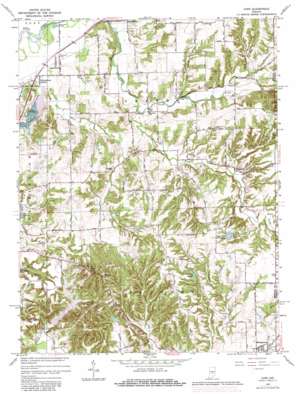
Cope Topo Map Indiana
To zoom in, hover over the map of Cope
USGS Topo Quad 39086d3 - 1:24,000 scale
| Topo Map Name: | Cope |
| USGS Topo Quad ID: | 39086d3 |
| Print Size: | ca. 21 1/4" wide x 27" high |
| Southeast Coordinates: | 39.375° N latitude / 86.25° W longitude |
| Map Center Coordinates: | 39.4375° N latitude / 86.3125° W longitude |
| U.S. State: | IN |
| Filename: | o39086d3.jpg |
| Download Map JPG Image: | Cope topo map 1:24,000 scale |
| Map Type: | Topographic |
| Topo Series: | 7.5´ |
| Map Scale: | 1:24,000 |
| Source of Map Images: | United States Geological Survey (USGS) |
| Alternate Map Versions: |
Cope IN 1955, updated 1957 Download PDF Buy paper map Cope IN 1965, updated 1966 Download PDF Buy paper map Cope IN 1965, updated 1981 Download PDF Buy paper map Cope IN 1965, updated 1981 Download PDF Buy paper map Cope IN 2010 Download PDF Buy paper map Cope IN 2013 Download PDF Buy paper map Cope IN 2016 Download PDF Buy paper map |
1:24,000 Topo Quads surrounding Cope
> Back to 39086a1 at 1:100,000 scale
> Back to 39086a1 at 1:250,000 scale
> Back to U.S. Topo Maps home
Cope topo map: Gazetteer
Cope: Airports
Jungclause Airport elevation 230m 754′Cope: Bridges
Henderson Bridge elevation 183m 600′Cope: Canals
Sedwick Ditch elevation 196m 643′Cope: Dams
Nebo Lake Dam elevation 227m 744′Painted Hills Lake Dam elevation 199m 652′
Parker Lake Dam elevation 210m 688′
Twin Oaks Lake Dam elevation 232m 761′
Whitley Lake Dam elevation 236m 774′
Cope: Populated Places
Adams elevation 198m 649′Chetwynd elevation 209m 685′
Cope elevation 226m 741′
Maple Grove Village Mobile Home Park elevation 204m 669′
Stines Mill Corner elevation 189m 620′
Willowbrook Estates elevation 190m 623′
Cope: Reservoirs
Little Nebo Lake elevation 227m 744′Painted Hills Lake elevation 199m 652′
Parker Lake elevation 210m 688′
Twin Oaks Lake elevation 232m 761′
Whitley Lake elevation 236m 774′
Cope: Streams
Buck Creek elevation 201m 659′East Fork Clear Creek elevation 189m 620′
Henderson Creek elevation 211m 692′
Koots Fork elevation 209m 685′
Lazy Run elevation 207m 679′
Lost Creek elevation 204m 669′
North Prong Stotts Creek elevation 194m 636′
South Prong Stotts Creek elevation 195m 639′
Cope: Summits
Mount Nebo elevation 291m 954′Cope: Valleys
Skunk Hollow elevation 201m 659′Cope digital topo map on disk
Buy this Cope topo map showing relief, roads, GPS coordinates and other geographical features, as a high-resolution digital map file on DVD:
Northern Illinois, Northern Indiana & Southwestern Michigan
Buy digital topo maps: Northern Illinois, Northern Indiana & Southwestern Michigan


