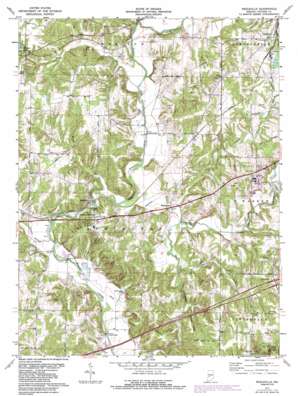
Reelsville Topo Map Indiana
To zoom in, hover over the map of Reelsville
USGS Topo Quad 39086e8 - 1:24,000 scale
| Topo Map Name: | Reelsville |
| USGS Topo Quad ID: | 39086e8 |
| Print Size: | ca. 21 1/4" wide x 27" high |
| Southeast Coordinates: | 39.5° N latitude / 86.875° W longitude |
| Map Center Coordinates: | 39.5625° N latitude / 86.9375° W longitude |
| U.S. State: | IN |
| Filename: | o39086e8.jpg |
| Download Map JPG Image: | Reelsville topo map 1:24,000 scale |
| Map Type: | Topographic |
| Topo Series: | 7.5´ |
| Map Scale: | 1:24,000 |
| Source of Map Images: | United States Geological Survey (USGS) |
| Alternate Map Versions: |
Reelsville IN 1952, updated 1954 Download PDF Buy paper map Reelsville IN 1971, updated 1972 Download PDF Buy paper map Reelsville IN 1971, updated 1985 Download PDF Buy paper map Reelsville IN 1971, updated 1987 Download PDF Buy paper map Reelsville IN 1971, updated 1987 Download PDF Buy paper map Reelsville IN 2010 Download PDF Buy paper map Reelsville IN 2013 Download PDF Buy paper map Reelsville IN 2016 Download PDF Buy paper map |
1:24,000 Topo Quads surrounding Reelsville
> Back to 39086e1 at 1:100,000 scale
> Back to 39086a1 at 1:250,000 scale
> Back to U.S. Topo Maps home
Reelsville topo map: Gazetteer
Reelsville: Bridges
Houck Covered Bridge elevation 193m 633′Huffman Covered Bridge elevation 181m 593′
Manhatten Covered Bridge elevation 187m 613′
Reelsville: Cliffs
Fern Cliff elevation 206m 675′Reelsville: Mines
Putnamville Quarry elevation 204m 669′Reelsville: Populated Places
Jenkinsville elevation 219m 718′Limedale elevation 239m 784′
Manhattan elevation 196m 643′
Pleasant Gardens elevation 215m 705′
Reelsville elevation 214m 702′
Reelsville: Post Offices
Hamricks Station Post Office (historical) elevation 217m 711′Reelsville: Reservoirs
Thomas Lake elevation 234m 767′Reelsville: Ridges
Indian Ridge elevation 252m 826′Reelsville: Streams
Beacon Run elevation 187m 613′Canaan Run elevation 187m 613′
Deer Creek elevation 178m 583′
Deweese Branch elevation 188m 616′
Johnson Branch elevation 186m 610′
Leatherwood Creek elevation 185m 606′
Little Walnut Creek elevation 209m 685′
Maiden Run elevation 185m 606′
Mosquito Creek elevation 192m 629′
Rocky Fork elevation 186m 610′
Snake Creek elevation 193m 633′
Reelsville digital topo map on disk
Buy this Reelsville topo map showing relief, roads, GPS coordinates and other geographical features, as a high-resolution digital map file on DVD:
Northern Illinois, Northern Indiana & Southwestern Michigan
Buy digital topo maps: Northern Illinois, Northern Indiana & Southwestern Michigan


