Danville Topo Map Indiana
To zoom in, hover over the map of Danville
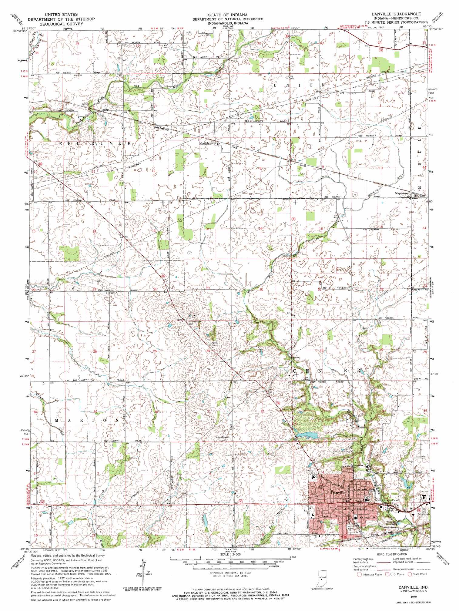
USGS Topo Quad 39086g5 - 1:24,000 scale
| Topo Map Name: | Danville |
| USGS Topo Quad ID: | 39086g5 |
| Print Size: | ca. 21 1/4" wide x 27" high |
| Southeast Coordinates: | 39.75° N latitude / 86.5° W longitude |
| Map Center Coordinates: | 39.8125° N latitude / 86.5625° W longitude |
| U.S. State: | IN |
| Filename: | o39086g5.jpg |
| Download Map JPG Image: | Danville topo map 1:24,000 scale |
| Map Type: | Topographic |
| Topo Series: | 7.5´ |
| Map Scale: | 1:24,000 |
| Source of Map Images: | United States Geological Survey (USGS) |
| Alternate Map Versions: |
Danville IN 1953, updated 1955 Download PDF Buy paper map Danville IN 1970, updated 1972 Download PDF Buy paper map Danville IN 2010 Download PDF Buy paper map Danville IN 2013 Download PDF Buy paper map Danville IN 2016 Download PDF Buy paper map |
1:24,000 Topo Quads surrounding Danville
Darlington |
Shannondale |
Hazelrigg |
Lebanon |
Rosston |
Ladoga |
New Ross |
Lizton |
Fayette |
Zionsville |
Roachdale |
North Salem |
Danville |
Brownsburg |
Clermont |
Greencastle |
Coatesville |
Clayton |
Plainfield |
Bridgeport |
Cloverdale |
Eminence |
Hall |
Mooresville West |
Mooresville East |
> Back to 39086e1 at 1:100,000 scale
> Back to 39086a1 at 1:250,000 scale
> Back to U.S. Topo Maps home
Danville topo map: Gazetteer
Danville: Airports
Reynolds Landing Strip elevation 289m 948′Temple Airport elevation 287m 941′
Danville: Canals
Barnette Ditch elevation 286m 938′Eads Ditch elevation 286m 938′
Danville: Dams
Danville Conservation Club Lake Dam elevation 262m 859′Stout Lake Dam elevation 280m 918′
Danville: Parks
Ellis Park elevation 258m 846′Danville: Populated Places
Danville elevation 291m 954′Maplewood elevation 288m 944′
Montclair elevation 293m 961′
Danville: Reservoirs
Danville Conservation Club Lake elevation 262m 859′Stout Lake elevation 280m 918′
Danville: Streams
Thompson Creek elevation 261m 856′Danville digital topo map on disk
Buy this Danville topo map showing relief, roads, GPS coordinates and other geographical features, as a high-resolution digital map file on DVD:
Northern Illinois, Northern Indiana & Southwestern Michigan
Buy digital topo maps: Northern Illinois, Northern Indiana & Southwestern Michigan