Linton Topo Map Indiana
To zoom in, hover over the map of Linton
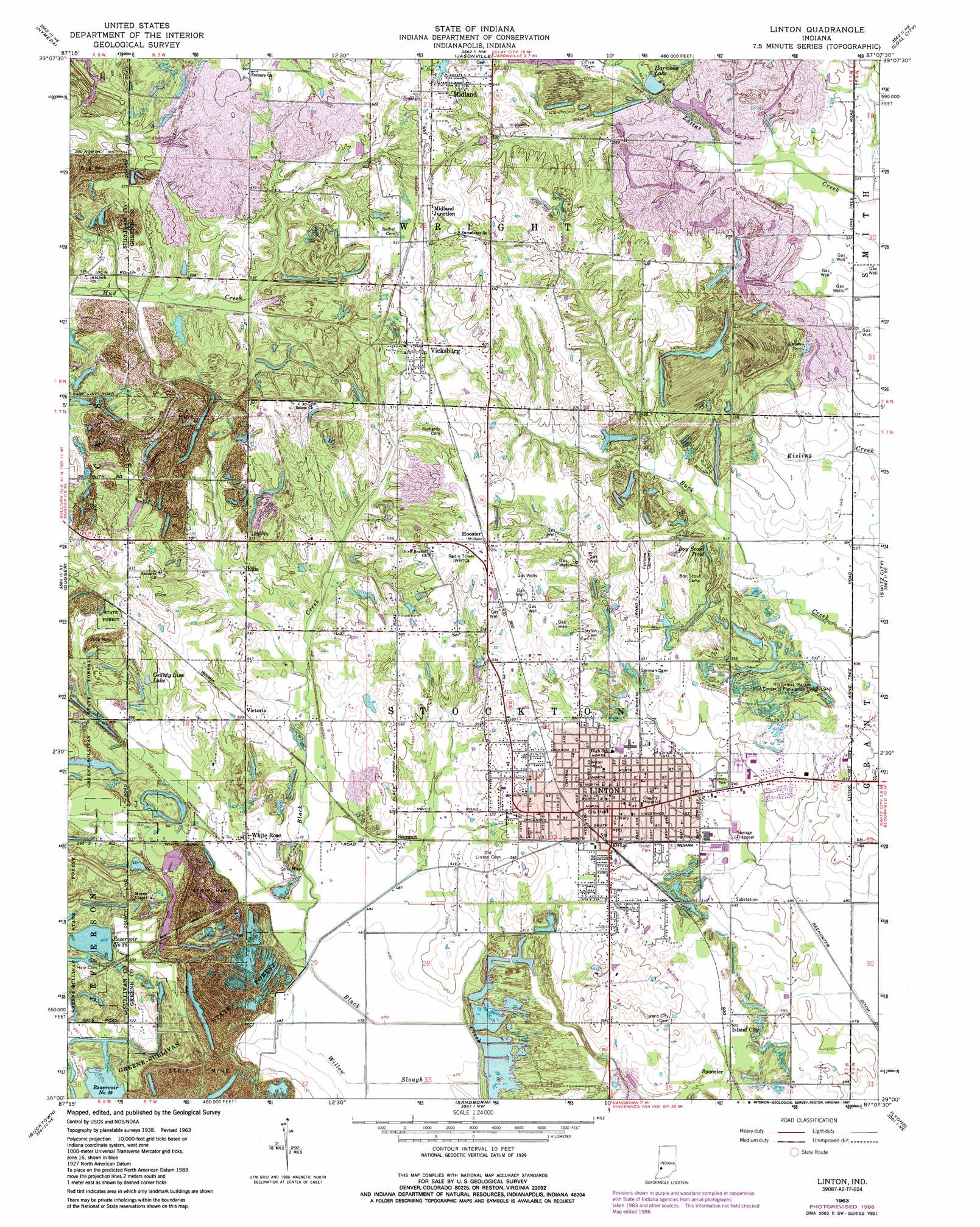
USGS Topo Quad 39087a2 - 1:24,000 scale
| Topo Map Name: | Linton |
| USGS Topo Quad ID: | 39087a2 |
| Print Size: | ca. 21 1/4" wide x 27" high |
| Southeast Coordinates: | 39° N latitude / 87.125° W longitude |
| Map Center Coordinates: | 39.0625° N latitude / 87.1875° W longitude |
| U.S. State: | IN |
| Filename: | o39087a2.jpg |
| Download Map JPG Image: | Linton topo map 1:24,000 scale |
| Map Type: | Topographic |
| Topo Series: | 7.5´ |
| Map Scale: | 1:24,000 |
| Source of Map Images: | United States Geological Survey (USGS) |
| Alternate Map Versions: |
Linton IN 1940 Download PDF Buy paper map Linton IN 1947 Download PDF Buy paper map Linton IN 1947, updated 1951 Download PDF Buy paper map Linton IN 1963, updated 1964 Download PDF Buy paper map Linton IN 1963, updated 1973 Download PDF Buy paper map Linton IN 1963, updated 1981 Download PDF Buy paper map Linton IN 1963, updated 1987 Download PDF Buy paper map Linton IN 2010 Download PDF Buy paper map Linton IN 2013 Download PDF Buy paper map Linton IN 2016 Download PDF Buy paper map |
1:24,000 Topo Quads surrounding Linton
Pimento |
Lewis |
Saline City |
Clay City |
Patricksburg |
Shelburn |
Hymera |
Jasonville |
Coal City |
Arney |
Sullivan |
Dugger |
Linton |
Switz City |
Bloomfield |
Carlisle |
Bucktown |
Sandborn |
Lyons |
Scotland |
Oaktown |
Bicknell |
Plainville |
Epsom |
Odon |
> Back to 39087a1 at 1:100,000 scale
> Back to 39086a1 at 1:250,000 scale
> Back to U.S. Topo Maps home
Linton topo map: Gazetteer
Linton: Lakes
Boy Scout Pond elevation 160m 524′Linton: Parks
Historical Marker USA Center of Population elevation 162m 531′Humphrey Park elevation 150m 492′
Linton: Populated Places
Antioch elevation 162m 531′Ellis elevation 166m 544′
Hoosier elevation 190m 623′
Island City elevation 162m 531′
Linton elevation 162m 531′
Midland elevation 200m 656′
Midland Junction elevation 198m 649′
Sponsler elevation 160m 524′
Summit elevation 155m 508′
Vicksburg elevation 186m 610′
Victoria elevation 164m 538′
White Rose elevation 152m 498′
Linton: Reservoirs
County Line Lake elevation 160m 524′Harmons Lake elevation 167m 547′
Reservoir Number Twenty-nine elevation 157m 515′
Reservoir Number Twenty-six elevation 154m 505′
Sunflower Pond elevation 186m 610′
Linton: Streams
Willow Slough elevation 143m 469′Linton digital topo map on disk
Buy this Linton topo map showing relief, roads, GPS coordinates and other geographical features, as a high-resolution digital map file on DVD:
Northern Illinois, Northern Indiana & Southwestern Michigan
Buy digital topo maps: Northern Illinois, Northern Indiana & Southwestern Michigan