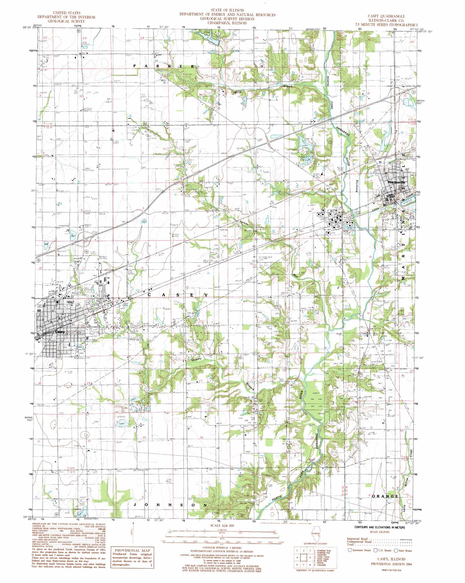
Casey Topo Map Illinois
To zoom in, hover over the map of Casey
USGS Topo Quad 39087c8 - 1:24,000 scale
| Topo Map Name: | Casey |
| USGS Topo Quad ID: | 39087c8 |
| Print Size: | ca. 21 1/4" wide x 27" high |
| Southeast Coordinates: | 39.25° N latitude / 87.875° W longitude |
| Map Center Coordinates: | 39.3125° N latitude / 87.9375° W longitude |
| U.S. State: | IL |
| Filename: | o39087c8.jpg |
| Download Map JPG Image: | Casey topo map 1:24,000 scale |
| Map Type: | Topographic |
| Topo Series: | 7.5´ |
| Map Scale: | 1:24,000 |
| Source of Map Images: | United States Geological Survey (USGS) |
| Alternate Map Versions: |
Casey IL 1984, updated 1985 Download PDF Buy paper map Casey IL 1998, updated 2002 Download PDF Buy paper map Casey IL 2012 Download PDF Buy paper map Casey IL 2015 Download PDF Buy paper map |
1:24,000 Topo Quads surrounding Casey
Charleston North |
Ashmore |
Kansas |
Grandview |
Paris South |
Charleston South |
Westfield West |
Westfield East |
Clarksville |
Marshall |
Toledo |
Union Center |
Casey |
Clark Center |
Snyder |
Greenup |
Hazel Dell |
Moriah |
Annapolis |
West Union |
Rose Hill |
Yale |
Oblong North |
Eaton |
Hutsonville |
> Back to 39087a1 at 1:100,000 scale
> Back to 39086a1 at 1:250,000 scale
> Back to U.S. Topo Maps home
Casey topo map: Gazetteer
Casey: Crossings
Connelly Ford elevation 162m 531′Interchange 129 elevation 201m 659′
Interchange 136 elevation 191m 626′
Casey: Dams
Round Grove Sportsman Lake Dam elevation 189m 620′Sherwood Forest Lake Dam elevation 178m 583′
Snake Trail Campground Lake Dam elevation 187m 613′
Casey: Mines
North Quarry Number 305 elevation 186m 610′Casey: Parks
Fairview Park elevation 194m 636′Casey: Populated Places
Casey elevation 197m 646′Cumberland elevation 193m 633′
Martinsville elevation 186m 610′
Casey: Post Offices
Martinsville Post Office elevation 184m 603′Casey: Reservoirs
Round Grove Sportsman Lake elevation 189m 620′Sherwood Forest Lake elevation 178m 583′
Snake Trail Campground Lake elevation 187m 613′
Casey: Streams
Ketterina Branch elevation 175m 574′Little Creek elevation 170m 557′
Quarry Branch elevation 166m 544′
Turkey Run elevation 168m 551′
Willis Branch elevation 174m 570′
Casey: Woods
Round Grove (historical) elevation 204m 669′Casey digital topo map on disk
Buy this Casey topo map showing relief, roads, GPS coordinates and other geographical features, as a high-resolution digital map file on DVD:
Northern Illinois, Northern Indiana & Southwestern Michigan
Buy digital topo maps: Northern Illinois, Northern Indiana & Southwestern Michigan