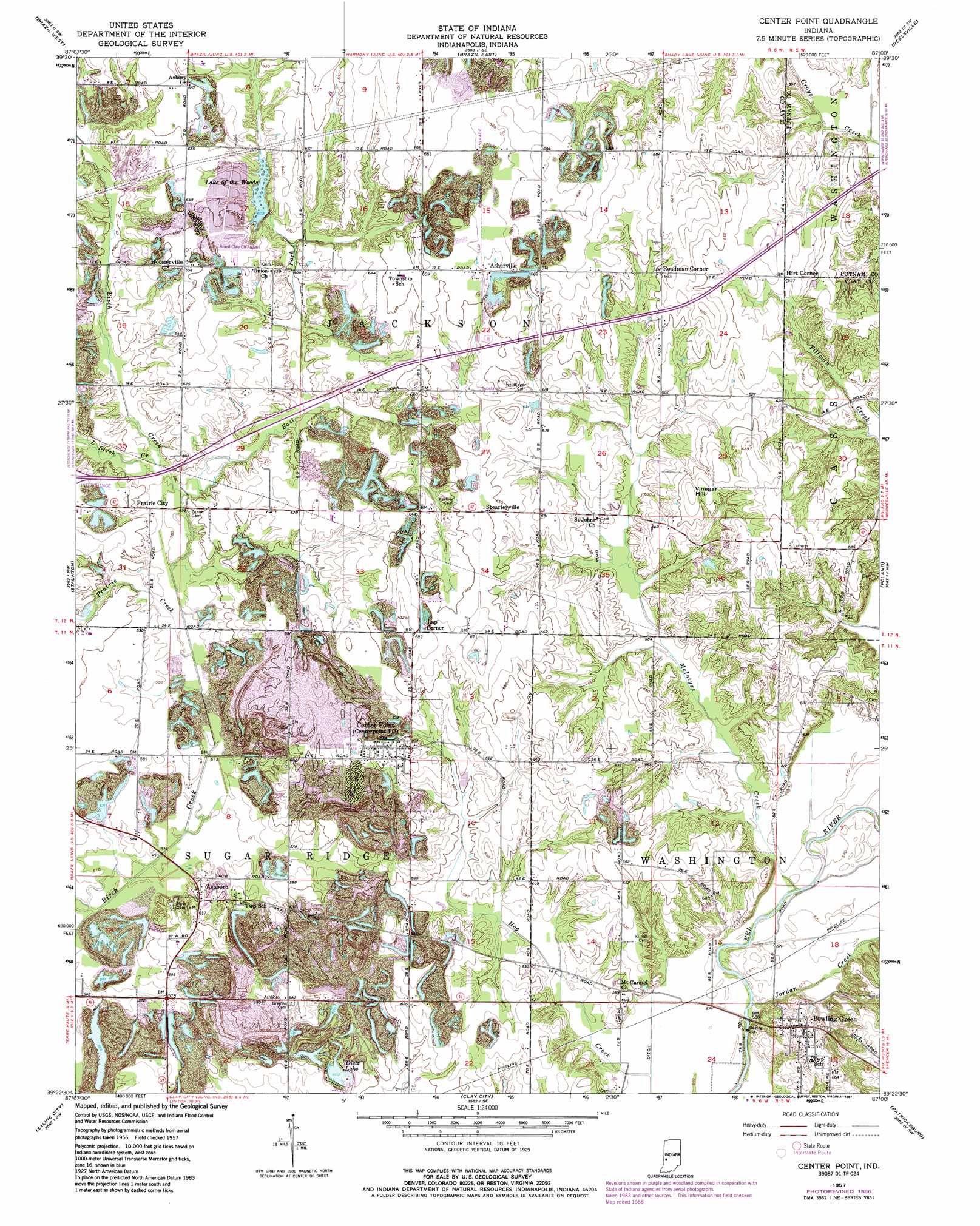
Center Point Topo Map Indiana
To zoom in, hover over the map of Center Point
USGS Topo Quad 39087d1 - 1:24,000 scale
| Topo Map Name: | Center Point |
| USGS Topo Quad ID: | 39087d1 |
| Print Size: | ca. 21 1/4" wide x 27" high |
| Southeast Coordinates: | 39.375° N latitude / 87° W longitude |
| Map Center Coordinates: | 39.4375° N latitude / 87.0625° W longitude |
| U.S. State: | IN |
| Filename: | o39087d1.jpg |
| Download Map JPG Image: | Center Point topo map 1:24,000 scale |
| Map Type: | Topographic |
| Topo Series: | 7.5´ |
| Map Scale: | 1:24,000 |
| Source of Map Images: | United States Geological Survey (USGS) |
| Alternate Map Versions: |
Center Point IN 1957, updated 1958 Download PDF Buy paper map Center Point IN 1957, updated 1973 Download PDF Buy paper map Center Point IN 1957, updated 1987 Download PDF Buy paper map Center Point IN 2010 Download PDF Buy paper map Center Point IN 2013 Download PDF Buy paper map Center Point IN 2016 Download PDF Buy paper map |
1:24,000 Topo Quads surrounding Center Point
Mecca |
Catlin |
Mansfield |
Clinton Falls |
Greencastle |
Rosedale |
Brazil West |
Brazil East |
Reelsville |
Cloverdale |
Seelyville |
Staunton |
Center Point |
Poland |
Cataract |
Lewis |
Saline City |
Clay City |
Patricksburg |
Spencer |
Hymera |
Jasonville |
Coal City |
Arney |
Freedom |
> Back to 39087a1 at 1:100,000 scale
> Back to 39086a1 at 1:250,000 scale
> Back to U.S. Topo Maps home
Center Point topo map: Gazetteer
Center Point: Airports
Arthur Municipal Airport elevation 196m 643′Center Point: Lakes
Dietz Lake elevation 183m 600′Center Point: Populated Places
Ashboro elevation 186m 610′Asherville elevation 201m 659′
Bowling Green elevation 199m 652′
Center Point elevation 200m 656′
Hirt Corner elevation 191m 626′
Hoosierville elevation 199m 652′
Lap Corner elevation 205m 672′
Prairie City elevation 179m 587′
Roadman Corner elevation 202m 662′
Stearleyville elevation 198m 649′
Center Point: Reservoirs
Lake in the Woods elevation 186m 610′Lake of the Woods elevation 185m 606′
Center Point: Streams
Church Creek elevation 180m 590′East Fork Birch Creek elevation 176m 577′
Jordan Creek elevation 171m 561′
Little Birch Creek elevation 177m 580′
McIntyre Creek elevation 171m 561′
Miller Creek elevation 204m 669′
Prairie Creek elevation 174m 570′
Son Run elevation 176m 577′
Center Point: Summits
Vinegar Hill elevation 205m 672′Center Point digital topo map on disk
Buy this Center Point topo map showing relief, roads, GPS coordinates and other geographical features, as a high-resolution digital map file on DVD:
Northern Illinois, Northern Indiana & Southwestern Michigan
Buy digital topo maps: Northern Illinois, Northern Indiana & Southwestern Michigan