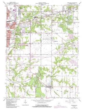
Seelyville Topo Map Indiana
To zoom in, hover over the map of Seelyville
USGS Topo Quad 39087d3 - 1:24,000 scale
| Topo Map Name: | Seelyville |
| USGS Topo Quad ID: | 39087d3 |
| Print Size: | ca. 21 1/4" wide x 27" high |
| Southeast Coordinates: | 39.375° N latitude / 87.25° W longitude |
| Map Center Coordinates: | 39.4375° N latitude / 87.3125° W longitude |
| U.S. State: | IN |
| Filename: | o39087d3.jpg |
| Download Map JPG Image: | Seelyville topo map 1:24,000 scale |
| Map Type: | Topographic |
| Topo Series: | 7.5´ |
| Map Scale: | 1:24,000 |
| Source of Map Images: | United States Geological Survey (USGS) |
| Alternate Map Versions: |
Seelyville IN 1941 Download PDF Buy paper map Seelyville IN 1941 Download PDF Buy paper map Seelyville IN 1952, updated 1953 Download PDF Buy paper map Seelyville IN 1963, updated 1965 Download PDF Buy paper map Seelyville IN 1963, updated 1973 Download PDF Buy paper map Seelyville IN 1963, updated 1981 Download PDF Buy paper map Seelyville IN 1963, updated 1987 Download PDF Buy paper map Seelyville IN 2010 Download PDF Buy paper map Seelyville IN 2013 Download PDF Buy paper map Seelyville IN 2016 Download PDF Buy paper map |
1:24,000 Topo Quads surrounding Seelyville
> Back to 39087a1 at 1:100,000 scale
> Back to 39086a1 at 1:250,000 scale
> Back to U.S. Topo Maps home
Seelyville topo map: Gazetteer
Seelyville: Airports
Hulman Field elevation 175m 574′Seelyville: Dams
Felstein Lake Dam elevation 168m 551′Hulman Lodge Dam elevation 162m 531′
Hulman Street Dam elevation 166m 544′
Lakewood Subdivision Dam elevation 169m 554′
Maple Avenue Lake Dam elevation 166m 544′
Patton Lake Dam elevation 165m 541′
Seelyville: Lakes
Malone Pond elevation 161m 528′Seelyville: Mines
Mount Pleasant Mine elevation 164m 538′Seelyville: Parks
Wildwood Camp elevation 161m 528′Seelyville: Populated Places
Deming Park elevation 166m 544′Deming Woods elevation 165m 541′
East Glenn elevation 173m 567′
Glen Ayre elevation 174m 570′
Glenn Ayr elevation 176m 577′
Gospel Grove elevation 174m 570′
Grange Corner elevation 177m 580′
Riley elevation 172m 564′
Seelyville elevation 178m 583′
Swalls elevation 181m 593′
Tabertown elevation 180m 590′
Seelyville: Reservoirs
Hulman Lodge Lake elevation 162m 531′Hulman Street Reservoir elevation 166m 544′
Lakewood Subdivision Lake elevation 169m 554′
Llewellyn Lake elevation 171m 561′
Maple Avenue Lake elevation 166m 544′
Patton Lake elevation 165m 541′
Thompson Lake elevation 171m 561′
Seelyville: Streams
Little Honey Creek elevation 152m 498′Little Lost Creek elevation 156m 511′
Stone Quarry Branch elevation 161m 528′
Seelyville digital topo map on disk
Buy this Seelyville topo map showing relief, roads, GPS coordinates and other geographical features, as a high-resolution digital map file on DVD:
Northern Illinois, Northern Indiana & Southwestern Michigan
Buy digital topo maps: Northern Illinois, Northern Indiana & Southwestern Michigan


