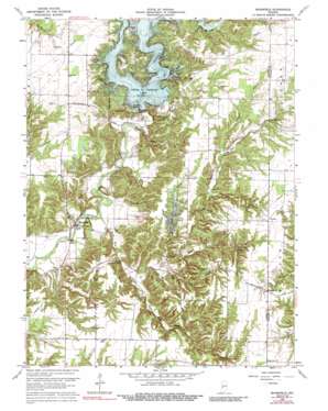
Mansfield Topo Map Indiana
To zoom in, hover over the map of Mansfield
USGS Topo Quad 39087f1 - 1:24,000 scale
| Topo Map Name: | Mansfield |
| USGS Topo Quad ID: | 39087f1 |
| Print Size: | ca. 21 1/4" wide x 27" high |
| Southeast Coordinates: | 39.625° N latitude / 87° W longitude |
| Map Center Coordinates: | 39.6875° N latitude / 87.0625° W longitude |
| U.S. State: | IN |
| Filename: | o39087f1.jpg |
| Download Map JPG Image: | Mansfield topo map 1:24,000 scale |
| Map Type: | Topographic |
| Topo Series: | 7.5´ |
| Map Scale: | 1:24,000 |
| Source of Map Images: | United States Geological Survey (USGS) |
| Alternate Map Versions: |
Mansfield IN 1963, updated 1964 Download PDF Buy paper map Mansfield IN 1963, updated 1973 Download PDF Buy paper map Mansfield IN 1963, updated 1977 Download PDF Buy paper map Mansfield IN 1963, updated 1991 Download PDF Buy paper map Mansfield IN 2010 Download PDF Buy paper map Mansfield IN 2013 Download PDF Buy paper map Mansfield IN 2016 Download PDF Buy paper map |
1:24,000 Topo Quads surrounding Mansfield
> Back to 39087e1 at 1:100,000 scale
> Back to 39086a1 at 1:250,000 scale
> Back to U.S. Topo Maps home
Mansfield topo map: Gazetteer
Mansfield: Bridges
Mansfield Bridge elevation 174m 570′Rocky Fork Covered Bridge elevation 180m 590′
Mansfield: Dams
Cecil M Harden Lake Dam elevation 205m 672′Rocky Fork Lake Dam elevation 203m 666′
Mansfield: Falls
Groundhog Falls elevation 218m 715′Mansfield: Parks
Raccoon Lake State Recreation Area elevation 214m 702′Mansfield: Populated Places
Ferndale elevation 188m 616′Keytsville elevation 245m 803′
Madalline elevation 224m 734′
Mansfield elevation 180m 590′
Vivalia elevation 244m 800′
Mansfield: Reservoirs
Cecil M Harden Lake elevation 205m 672′Rocky Fork Lake elevation 203m 666′
Mansfield: Streams
Crooked Branch elevation 205m 672′Groundhog Branch elevation 197m 646′
Indian Branch elevation 189m 620′
Limestone Branch elevation 183m 600′
Little Rocky Fork Creek elevation 184m 603′
Readys Creek elevation 174m 570′
Rocky Fork Creek elevation 177m 580′
Straight Branch elevation 196m 643′
Sutherlin Branch elevation 214m 702′
Troutman Branch elevation 202m 662′
Mansfield digital topo map on disk
Buy this Mansfield topo map showing relief, roads, GPS coordinates and other geographical features, as a high-resolution digital map file on DVD:
Northern Illinois, Northern Indiana & Southwestern Michigan
Buy digital topo maps: Northern Illinois, Northern Indiana & Southwestern Michigan


