Kingman Topo Map Indiana
To zoom in, hover over the map of Kingman
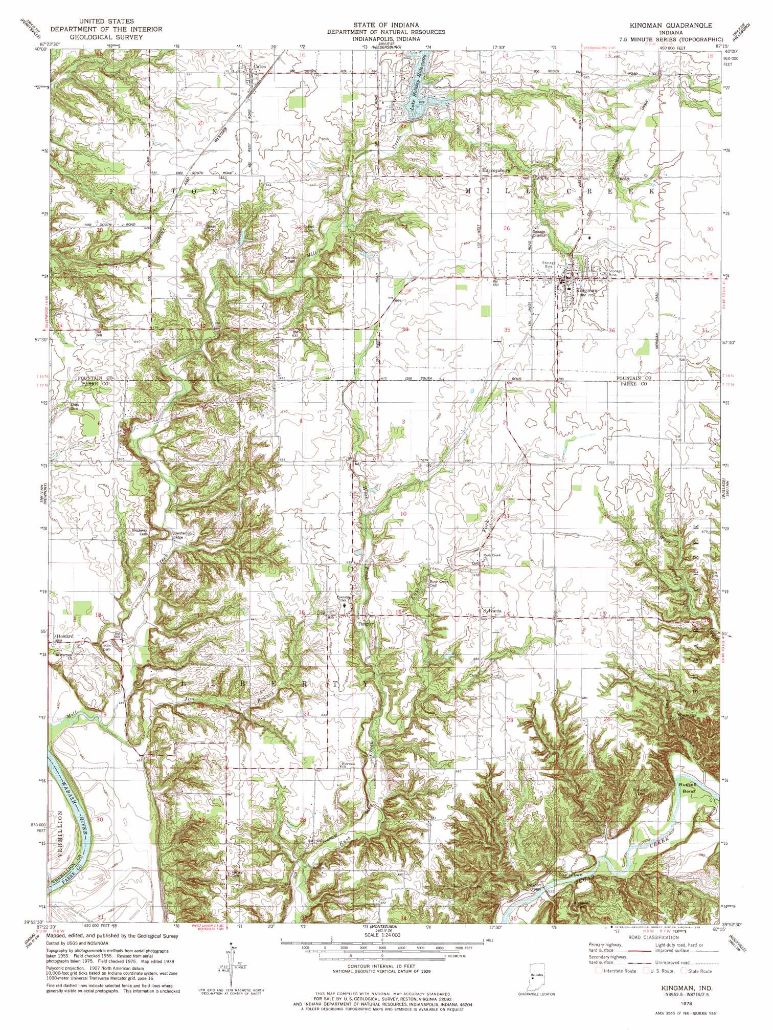
USGS Topo Quad 39087h3 - 1:24,000 scale
| Topo Map Name: | Kingman |
| USGS Topo Quad ID: | 39087h3 |
| Print Size: | ca. 21 1/4" wide x 27" high |
| Southeast Coordinates: | 39.875° N latitude / 87.25° W longitude |
| Map Center Coordinates: | 39.9375° N latitude / 87.3125° W longitude |
| U.S. State: | IN |
| Filename: | o39087h3.jpg |
| Download Map JPG Image: | Kingman topo map 1:24,000 scale |
| Map Type: | Topographic |
| Topo Series: | 7.5´ |
| Map Scale: | 1:24,000 |
| Source of Map Images: | United States Geological Survey (USGS) |
| Alternate Map Versions: |
Kingman IN 1955, updated 1956 Download PDF Buy paper map Kingman IN 1955, updated 1956 Download PDF Buy paper map Kingman IN 1978, updated 1978 Download PDF Buy paper map Kingman IN 2010 Download PDF Buy paper map Kingman IN 2013 Download PDF Buy paper map Kingman IN 2016 Download PDF Buy paper map |
1:24,000 Topo Quads surrounding Kingman
Danville Ne |
Covington |
Stone Bluff |
Mellott |
Wingate |
Danville Se |
Perrysville |
Veedersburg |
Hillsboro |
Waynetown |
Humrick |
Newport |
Kingman |
Wallace |
Alamo |
Scottland |
Dana |
Montezuma |
Rockville |
Bellmore |
Saint Bernice |
Clinton |
Mecca |
Catlin |
Mansfield |
> Back to 39087e1 at 1:100,000 scale
> Back to 39086a1 at 1:250,000 scale
> Back to U.S. Topo Maps home
Kingman topo map: Gazetteer
Kingman: Bends
Russell Bend elevation 156m 511′Kingman: Bridges
Bowsher Ford Bridge elevation 156m 511′Jackson Bridge elevation 149m 488′
Marshall Covered Bridge elevation 164m 538′
Mill Creek Bridge elevation 150m 492′
Rush Creek Bridge elevation 174m 570′
Kingman: Dams
Lake Holiday Hide-Away Dam elevation 190m 623′Kingman: Populated Places
Cates elevation 197m 646′Harveysburg elevation 207m 679′
Kingman elevation 214m 702′
Rockport elevation 150m 492′
Sylvania elevation 203m 666′
Tangier elevation 192m 629′
Kingman: Reservoirs
Lake Holiday Hide-away elevation 190m 623′Kingman: Slopes
Devils Den elevation 158m 518′Kingman: Streams
East Fork Rush Creek elevation 175m 574′Jim Branch elevation 148m 485′
Roaring Creek elevation 155m 508′
West Fork Rush Creek elevation 175m 574′
Kingman: Valleys
Pot Rock Hollow elevation 155m 508′Kingman digital topo map on disk
Buy this Kingman topo map showing relief, roads, GPS coordinates and other geographical features, as a high-resolution digital map file on DVD:
Northern Illinois, Northern Indiana & Southwestern Michigan
Buy digital topo maps: Northern Illinois, Northern Indiana & Southwestern Michigan