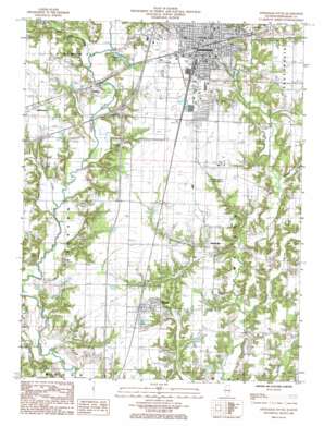
Effingham South Topo Map Illinois
To zoom in, hover over the map of Effingham South
USGS Topo Quad 39088a5 - 1:24,000 scale
| Topo Map Name: | Effingham South |
| USGS Topo Quad ID: | 39088a5 |
| Print Size: | ca. 21 1/4" wide x 27" high |
| Southeast Coordinates: | 39° N latitude / 88.5° W longitude |
| Map Center Coordinates: | 39.0625° N latitude / 88.5625° W longitude |
| U.S. State: | IL |
| Filename: | o39088a5.jpg |
| Download Map JPG Image: | Effingham South topo map 1:24,000 scale |
| Map Type: | Topographic |
| Topo Series: | 7.5´ |
| Map Scale: | 1:24,000 |
| Source of Map Images: | United States Geological Survey (USGS) |
| Alternate Map Versions: |
Effingham South IL 1998, updated 2002 Download PDF Buy paper map Effingham South IL 2012 Download PDF Buy paper map Effingham South IL 2015 Download PDF Buy paper map |
1:24,000 Topo Quads surrounding Effingham South
> Back to 39088a1 at 1:100,000 scale
> Back to 39088a1 at 1:250,000 scale
> Back to U.S. Topo Maps home
Effingham South topo map: Gazetteer
Effingham South: Airports
Effingham County Memorial Airport elevation 175m 574′Percival Airport elevation 168m 551′
Saint Anthony Memorial Hospital Heliport elevation 180m 590′
Effingham South: Crossings
Interchange 157 elevation 172m 564′Interchange 159 elevation 181m 593′
Interchange 160 elevation 180m 590′
Effingham South: Dams
Central Illinois Public Service Dam elevation 161m 528′Little Wabash River Dam elevation 158m 518′
Effingham South: Parks
Bliss Park elevation 179m 587′Effingham South: Populated Places
Effingham elevation 182m 597′Ewington elevation 177m 580′
Funkhouser elevation 177m 580′
Heartville elevation 171m 561′
Watson elevation 171m 561′
Effingham South: Post Offices
Effingham Post Office elevation 183m 600′Watson Post Office elevation 172m 564′
Effingham South: Reservoirs
Central Illinois Public Service Reservoir elevation 161m 528′Cips Lake elevation 168m 551′
Little Wabash River Reservoir elevation 158m 518′
Effingham South: Streams
Big Creek elevation 149m 488′Blue Point Creek elevation 155m 508′
Brush Creek elevation 155m 508′
Lily Creek elevation 150m 492′
Little Salt Creek elevation 149m 488′
Effingham South digital topo map on disk
Buy this Effingham South topo map showing relief, roads, GPS coordinates and other geographical features, as a high-resolution digital map file on DVD:
Northern Illinois, Northern Indiana & Southwestern Michigan
Buy digital topo maps: Northern Illinois, Northern Indiana & Southwestern Michigan


