Beecher City Topo Map Illinois
To zoom in, hover over the map of Beecher City
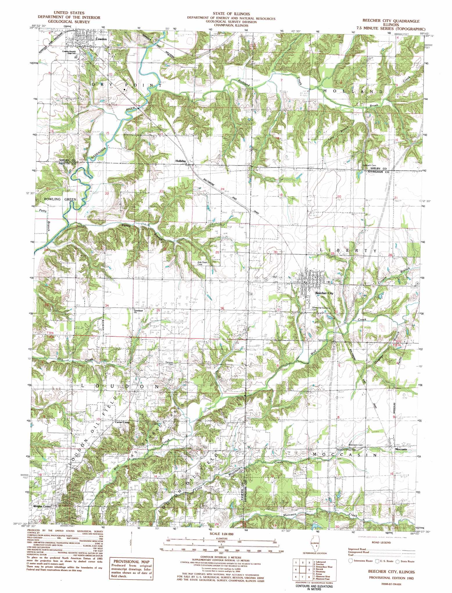
USGS Topo Quad 39088b7 - 1:24,000 scale
| Topo Map Name: | Beecher City |
| USGS Topo Quad ID: | 39088b7 |
| Print Size: | ca. 21 1/4" wide x 27" high |
| Southeast Coordinates: | 39.125° N latitude / 88.75° W longitude |
| Map Center Coordinates: | 39.1875° N latitude / 88.8125° W longitude |
| U.S. State: | IL |
| Filename: | o39088b7.jpg |
| Download Map JPG Image: | Beecher City topo map 1:24,000 scale |
| Map Type: | Topographic |
| Topo Series: | 7.5´ |
| Map Scale: | 1:24,000 |
| Source of Map Images: | United States Geological Survey (USGS) |
| Alternate Map Versions: |
Beecher City IL 1983, updated 1983 Download PDF Buy paper map Beecher City IL 2012 Download PDF Buy paper map Beecher City IL 2015 Download PDF Buy paper map |
1:24,000 Topo Quads surrounding Beecher City
Pana |
Tower Hill |
Shelbyville |
Middlesworth |
Windsor |
Oconee |
Lakewood |
Fancher |
Stewardson West |
Stewardson East |
Ramsey |
Herrick |
Beecher City |
Shumway |
Effingham North |
Vera |
Avena |
Altamont West |
Altamont East |
Effingham South |
Vandalia |
Brownstown |
Loogootee |
Edgewood |
Hord |
> Back to 39088a1 at 1:100,000 scale
> Back to 39088a1 at 1:250,000 scale
> Back to U.S. Topo Maps home
Beecher City topo map: Gazetteer
Beecher City: Bridges
Cowden Bridge (historical) elevation 152m 498′Beecher City: Oilfields
Loudon Oil Field elevation 177m 580′Beecher City: Populated Places
Beecher City elevation 187m 613′Cowden elevation 182m 597′
Greenland (historical) elevation 188m 616′
Holliday elevation 183m 600′
Moccasin elevation 186m 610′
Wrights Corner elevation 201m 659′
Beecher City: Streams
Brush Creek elevation 159m 521′Cary Branch elevation 161m 528′
Corwin Branch elevation 170m 557′
Fanny Branch elevation 152m 498′
Gossage Branch elevation 170m 557′
Petty Branch elevation 152m 498′
Richland Creek elevation 155m 508′
Beecher City digital topo map on disk
Buy this Beecher City topo map showing relief, roads, GPS coordinates and other geographical features, as a high-resolution digital map file on DVD:
Northern Illinois, Northern Indiana & Southwestern Michigan
Buy digital topo maps: Northern Illinois, Northern Indiana & Southwestern Michigan