Mattoon East Topo Map Illinois
To zoom in, hover over the map of Mattoon East
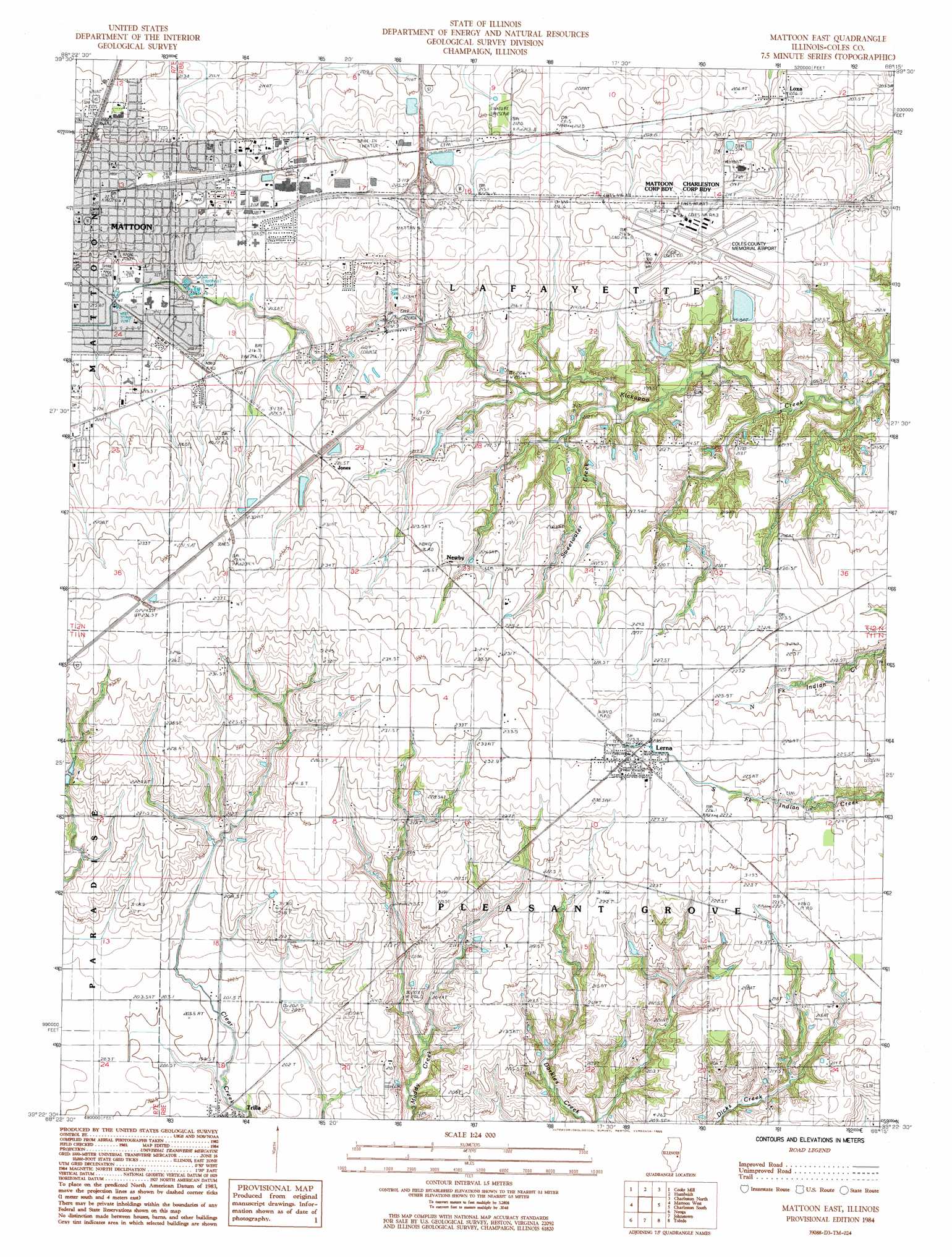
USGS Topo Quad 39088d3 - 1:24,000 scale
| Topo Map Name: | Mattoon East |
| USGS Topo Quad ID: | 39088d3 |
| Print Size: | ca. 21 1/4" wide x 27" high |
| Southeast Coordinates: | 39.375° N latitude / 88.25° W longitude |
| Map Center Coordinates: | 39.4375° N latitude / 88.3125° W longitude |
| U.S. State: | IL |
| Filename: | o39088d3.jpg |
| Download Map JPG Image: | Mattoon East topo map 1:24,000 scale |
| Map Type: | Topographic |
| Topo Series: | 7.5´ |
| Map Scale: | 1:24,000 |
| Source of Map Images: | United States Geological Survey (USGS) |
| Alternate Map Versions: |
Mattoon East IL 1984, updated 1985 Download PDF Buy paper map Mattoon East IL 1998, updated 2002 Download PDF Buy paper map Mattoon East IL 2012 Download PDF Buy paper map Mattoon East IL 2015 Download PDF Buy paper map |
1:24,000 Topo Quads surrounding Mattoon East
Cadwell |
Arthur |
Arcola |
Hindsburg |
Oakland |
Sullivan |
Cooksmill |
Humboldt |
Charleston North |
Ashmore |
Windsor |
Mattoon West |
Mattoon East |
Charleston South |
Westfield West |
Stewardson East |
Neoga |
Johnstown |
Toledo |
Union Center |
Effingham North |
Teutopolis |
Woodbury |
Greenup |
Hazel Dell |
> Back to 39088a1 at 1:100,000 scale
> Back to 39088a1 at 1:250,000 scale
> Back to U.S. Topo Maps home
Mattoon East topo map: Gazetteer
Mattoon East: Airports
Coles County Memorial Airport elevation 217m 711′Mattoon East: Crossings
Interchange 190 elevation 223m 731′Mattoon East: Dams
Lake Windermere Dam elevation 206m 675′Mattoon East: Parks
Cunningham Park elevation 222m 728′Lawson Park elevation 215m 705′
Peterson Park elevation 219m 718′
Mattoon East: Populated Places
Country Club Estates elevation 212m 695′Jones elevation 225m 738′
Lerna elevation 230m 754′
Loxa elevation 205m 672′
Mattoon elevation 224m 734′
Newby elevation 225m 738′
Old State Mobile Home Village elevation 225m 738′
Rolling Green elevation 216m 708′
Trilla elevation 199m 652′
Mattoon East: Post Offices
Lerna Post Office elevation 229m 751′Mattoon Post Office elevation 224m 734′
Mattoon East: Reservoirs
Lake Windermere elevation 206m 675′Mattoon East: Streams
Sweetwater Creek elevation 199m 652′Mattoon East digital topo map on disk
Buy this Mattoon East topo map showing relief, roads, GPS coordinates and other geographical features, as a high-resolution digital map file on DVD:
Northern Illinois, Northern Indiana & Southwestern Michigan
Buy digital topo maps: Northern Illinois, Northern Indiana & Southwestern Michigan