Mattoon West Topo Map Illinois
To zoom in, hover over the map of Mattoon West
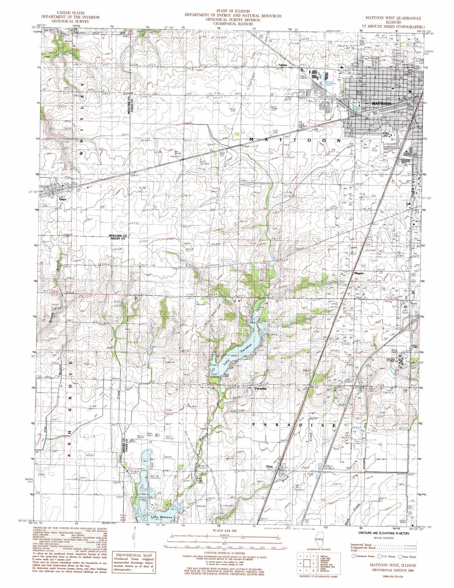
USGS Topo Quad 39088d4 - 1:24,000 scale
| Topo Map Name: | Mattoon West |
| USGS Topo Quad ID: | 39088d4 |
| Print Size: | ca. 21 1/4" wide x 27" high |
| Southeast Coordinates: | 39.375° N latitude / 88.375° W longitude |
| Map Center Coordinates: | 39.4375° N latitude / 88.4375° W longitude |
| U.S. State: | IL |
| Filename: | o39088d4.jpg |
| Download Map JPG Image: | Mattoon West topo map 1:24,000 scale |
| Map Type: | Topographic |
| Topo Series: | 7.5´ |
| Map Scale: | 1:24,000 |
| Source of Map Images: | United States Geological Survey (USGS) |
| Alternate Map Versions: |
Mattoon West IL 1984, updated 1985 Download PDF Buy paper map Mattoon West IL 1998, updated 2002 Download PDF Buy paper map Mattoon West IL 2012 Download PDF Buy paper map Mattoon West IL 2015 Download PDF Buy paper map |
1:24,000 Topo Quads surrounding Mattoon West
Lovington |
Cadwell |
Arthur |
Arcola |
Hindsburg |
Kirksville |
Sullivan |
Cooksmill |
Humboldt |
Charleston North |
Middlesworth |
Windsor |
Mattoon West |
Mattoon East |
Charleston South |
Stewardson West |
Stewardson East |
Neoga |
Johnstown |
Toledo |
Shumway |
Effingham North |
Teutopolis |
Woodbury |
Greenup |
> Back to 39088a1 at 1:100,000 scale
> Back to 39088a1 at 1:250,000 scale
> Back to U.S. Topo Maps home
Mattoon West topo map: Gazetteer
Mattoon West: Canals
Buttermilk Ditch elevation 204m 669′Mattoon West: Crossings
Interchange 184 elevation 235m 770′Mattoon West: Dams
Daily Pond Dam elevation 233m 764′Mattoon West: Parks
Kinzel Field elevation 219m 718′Kinzel Park elevation 219m 718′
Lytle Park elevation 220m 721′
Vanlaningham Park elevation 219m 718′
Mattoon West: Populated Places
Etna elevation 201m 659′Gays elevation 230m 754′
Lane Acres elevation 220m 721′
Lipsey elevation 218m 715′
Magnet elevation 230m 754′
Paradise elevation 206m 675′
Wabash Point elevation 215m 705′
Mattoon West: Post Offices
Gays Post Office elevation 230m 754′Mattoon West: Reservoirs
Daily Pond elevation 233m 764′Lake Paradise elevation 201m 659′
Mattoon West digital topo map on disk
Buy this Mattoon West topo map showing relief, roads, GPS coordinates and other geographical features, as a high-resolution digital map file on DVD:
Northern Illinois, Northern Indiana & Southwestern Michigan
Buy digital topo maps: Northern Illinois, Northern Indiana & Southwestern Michigan