Cooksmill Topo Map Illinois
To zoom in, hover over the map of Cooksmill
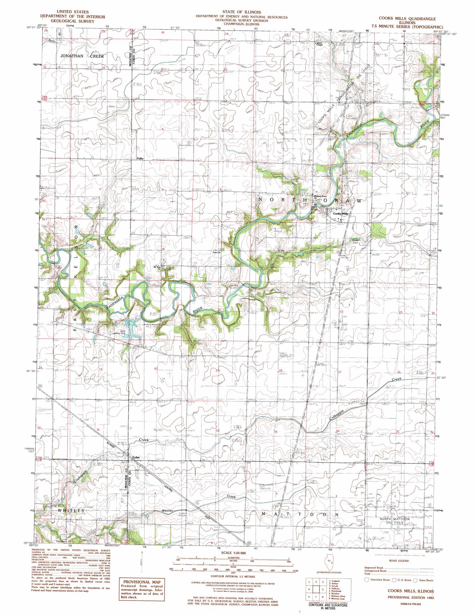
USGS Topo Quad 39088e4 - 1:24,000 scale
| Topo Map Name: | Cooksmill |
| USGS Topo Quad ID: | 39088e4 |
| Print Size: | ca. 21 1/4" wide x 27" high |
| Southeast Coordinates: | 39.5° N latitude / 88.375° W longitude |
| Map Center Coordinates: | 39.5625° N latitude / 88.4375° W longitude |
| U.S. State: | IL |
| Filename: | o39088e4.jpg |
| Download Map JPG Image: | Cooksmill topo map 1:24,000 scale |
| Map Type: | Topographic |
| Topo Series: | 7.5´ |
| Map Scale: | 1:24,000 |
| Source of Map Images: | United States Geological Survey (USGS) |
| Alternate Map Versions: |
Cooks Mills IL 1983, updated 1983 Download PDF Buy paper map Cooks Mills IL 1998, updated 2003 Download PDF Buy paper map Cooks Mills IL 2012 Download PDF Buy paper map Cooks Mills IL 2015 Download PDF Buy paper map |
1:24,000 Topo Quads surrounding Cooksmill
La Place |
Hammond |
Atwood |
Tuscola |
Villa Grove |
Lovington |
Cadwell |
Arthur |
Arcola |
Hindsburg |
Kirksville |
Sullivan |
Cooksmill |
Humboldt |
Charleston North |
Middlesworth |
Windsor |
Mattoon West |
Mattoon East |
Charleston South |
Stewardson West |
Stewardson East |
Neoga |
Johnstown |
Toledo |
> Back to 39088e1 at 1:100,000 scale
> Back to 39088a1 at 1:250,000 scale
> Back to U.S. Topo Maps home
Cooksmill topo map: Gazetteer
Cooksmill: Airports
Daily RLA Airport elevation 196m 643′Cooksmill: Oilfields
North Mattoon Oil Field elevation 211m 692′Cooksmill: Populated Places
Coles elevation 201m 659′Cooks Mills elevation 200m 656′
Fuller elevation 204m 669′
Cooksmill: Streams
Flat Branch elevation 191m 626′Cooksmill digital topo map on disk
Buy this Cooksmill topo map showing relief, roads, GPS coordinates and other geographical features, as a high-resolution digital map file on DVD:
Northern Illinois, Northern Indiana & Southwestern Michigan
Buy digital topo maps: Northern Illinois, Northern Indiana & Southwestern Michigan