Bingham Topo Map Illinois
To zoom in, hover over the map of Bingham
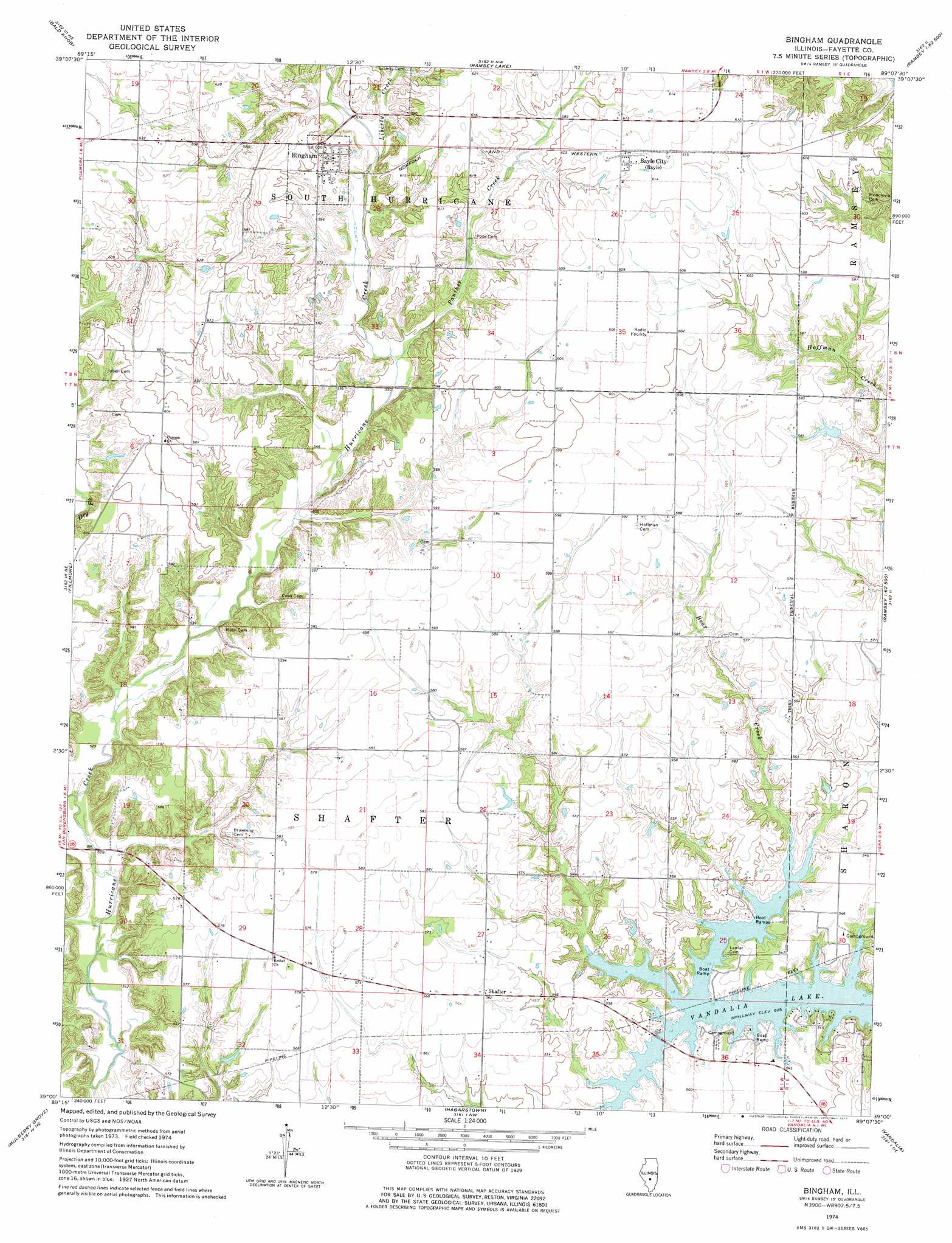
USGS Topo Quad 39089a2 - 1:24,000 scale
| Topo Map Name: | Bingham |
| USGS Topo Quad ID: | 39089a2 |
| Print Size: | ca. 21 1/4" wide x 27" high |
| Southeast Coordinates: | 39° N latitude / 89.125° W longitude |
| Map Center Coordinates: | 39.0625° N latitude / 89.1875° W longitude |
| U.S. State: | IL |
| Filename: | o39089a2.jpg |
| Download Map JPG Image: | Bingham topo map 1:24,000 scale |
| Map Type: | Topographic |
| Topo Series: | 7.5´ |
| Map Scale: | 1:24,000 |
| Source of Map Images: | United States Geological Survey (USGS) |
| Alternate Map Versions: |
Bingham IL 1974, updated 1977 Download PDF Buy paper map Bingham IL 1998, updated 2002 Download PDF Buy paper map Bingham IL 2012 Download PDF Buy paper map Bingham IL 2015 Download PDF Buy paper map |
1:24,000 Topo Quads surrounding Bingham
Nokomis Sw |
Nokomis |
Ohlman |
Oconee |
Lakewood |
Hillsboro |
Bald Knob |
Ramsey Lake |
Ramsey |
Herrick |
Coffeen |
Fillmore |
Bingham |
Vera |
Avena |
Greenville |
Mulberry Grove |
Hagarstown |
Vandalia |
Brownstown |
Beaver Creek |
Pleasant Mound |
Wildcat Lake |
Patoka |
Saint Paul |
> Back to 39089a1 at 1:100,000 scale
> Back to 39088a1 at 1:250,000 scale
> Back to U.S. Topo Maps home
Bingham topo map: Gazetteer
Bingham: Populated Places
Bayle City elevation 187m 613′Bingham elevation 183m 600′
Shafter elevation 171m 561′
Bingham: Streams
Dry Fork elevation 158m 518′Liberty Creek elevation 170m 557′
Panther Creek elevation 167m 547′
Bingham digital topo map on disk
Buy this Bingham topo map showing relief, roads, GPS coordinates and other geographical features, as a high-resolution digital map file on DVD:
Northern Illinois, Northern Indiana & Southwestern Michigan
Buy digital topo maps: Northern Illinois, Northern Indiana & Southwestern Michigan