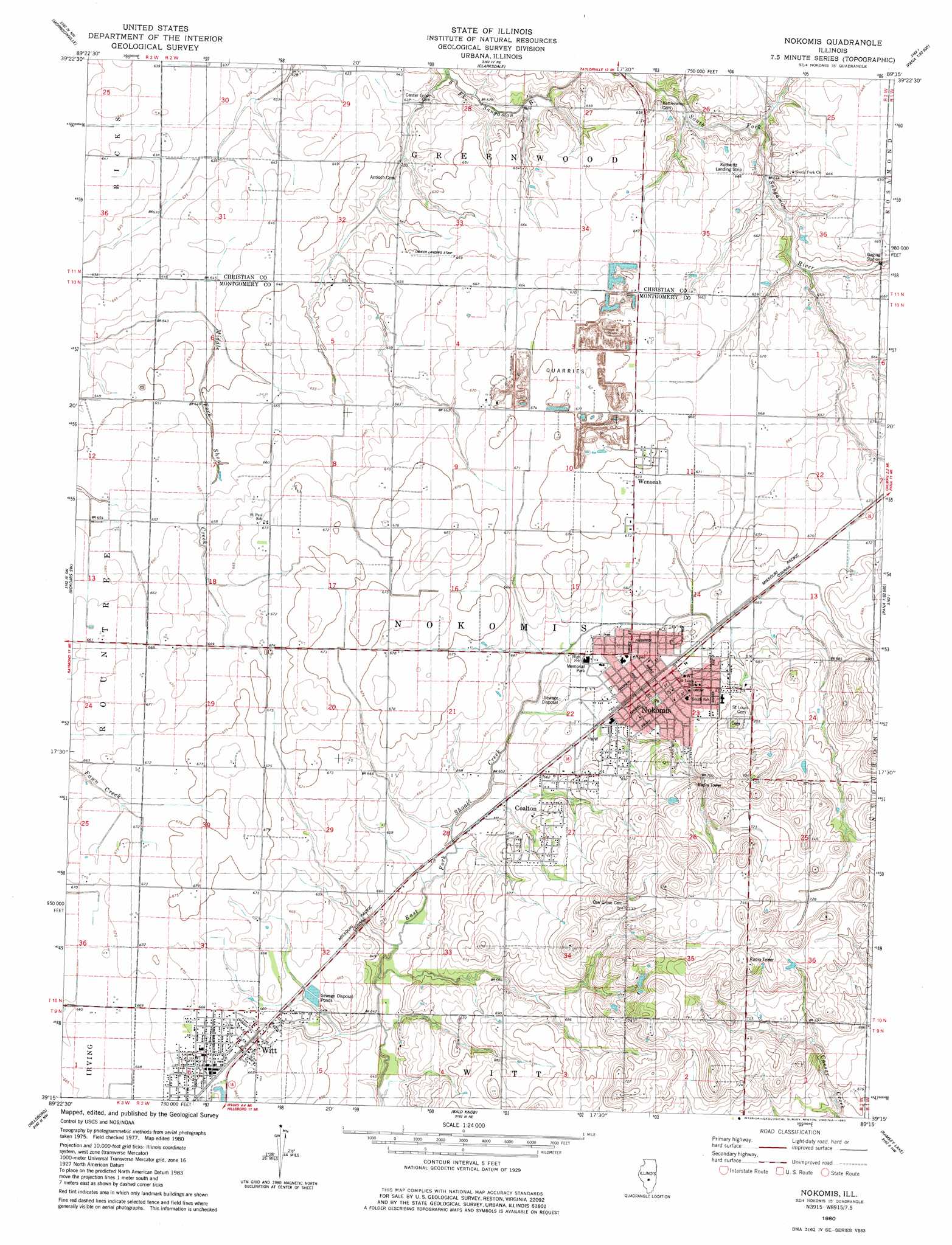
Nokomis Topo Map Illinois
To zoom in, hover over the map of Nokomis
USGS Topo Quad 39089c3 - 1:24,000 scale
| Topo Map Name: | Nokomis |
| USGS Topo Quad ID: | 39089c3 |
| Print Size: | ca. 21 1/4" wide x 27" high |
| Southeast Coordinates: | 39.25° N latitude / 89.25° W longitude |
| Map Center Coordinates: | 39.3125° N latitude / 89.3125° W longitude |
| U.S. State: | IL |
| Filename: | o39089c3.jpg |
| Download Map JPG Image: | Nokomis topo map 1:24,000 scale |
| Map Type: | Topographic |
| Topo Series: | 7.5´ |
| Map Scale: | 1:24,000 |
| Source of Map Images: | United States Geological Survey (USGS) |
| Alternate Map Versions: |
Nokomis IL 1980, updated 1980 Download PDF Buy paper map Nokomis IL 1998, updated 2002 Download PDF Buy paper map Nokomis IL 2012 Download PDF Buy paper map Nokomis IL 2015 Download PDF Buy paper map |
1:24,000 Topo Quads surrounding Nokomis
Pawnee |
Kincaid |
Taylorville |
Willeys |
Assumption |
Raymond Ne |
Morrisonville |
Clarksdale |
Owaneco |
Pana |
Raymond |
Nokomis Sw |
Nokomis |
Ohlman |
Oconee |
Butler |
Hillsboro |
Bald Knob |
Ramsey Lake |
Ramsey |
Sorento North |
Coffeen |
Fillmore |
Bingham |
Vera |
> Back to 39089a1 at 1:100,000 scale
> Back to 39088a1 at 1:250,000 scale
> Back to U.S. Topo Maps home
Nokomis topo map: Gazetteer
Nokomis: Airports
Dahler Airport elevation 202m 662′Dooley Field elevation 202m 662′
J and J Farms Airport elevation 197m 646′
Kottwitz Landing Strip elevation 203m 666′
Nokomis: Mines
Nokomis Quarry elevation 196m 643′Reliance Mine Number 9 elevation 206m 675′
Nokomis: Parks
Memorial Park elevation 201m 659′Nokomis: Populated Places
Coalton elevation 206m 675′Nokomis elevation 205m 672′
Wenonah elevation 205m 672′
Witt elevation 202m 662′
Nokomis: Post Offices
Nokomis Post Office elevation 206m 675′Nokomis digital topo map on disk
Buy this Nokomis topo map showing relief, roads, GPS coordinates and other geographical features, as a high-resolution digital map file on DVD:
Northern Illinois, Northern Indiana & Southwestern Michigan
Buy digital topo maps: Northern Illinois, Northern Indiana & Southwestern Michigan