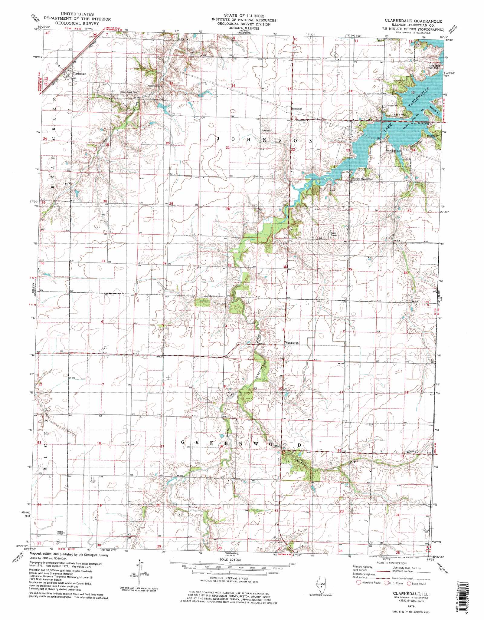
Clarksdale Topo Map Illinois
To zoom in, hover over the map of Clarksdale
USGS Topo Quad 39089d3 - 1:24,000 scale
| Topo Map Name: | Clarksdale |
| USGS Topo Quad ID: | 39089d3 |
| Print Size: | ca. 21 1/4" wide x 27" high |
| Southeast Coordinates: | 39.375° N latitude / 89.25° W longitude |
| Map Center Coordinates: | 39.4375° N latitude / 89.3125° W longitude |
| U.S. State: | IL |
| Filename: | o39089d3.jpg |
| Download Map JPG Image: | Clarksdale topo map 1:24,000 scale |
| Map Type: | Topographic |
| Topo Series: | 7.5´ |
| Map Scale: | 1:24,000 |
| Source of Map Images: | United States Geological Survey (USGS) |
| Alternate Map Versions: |
Clarksdale IL 1979, updated 1980 Download PDF Buy paper map Clarksdale IL 1979, updated 1980 Download PDF Buy paper map Clarksdale IL 1998, updated 2002 Download PDF Buy paper map Clarksdale IL 2012 Download PDF Buy paper map Clarksdale IL 2015 Download PDF Buy paper map |
1:24,000 Topo Quads surrounding Clarksdale
New City |
Edinburg |
Grove City |
Stonington |
Macon West |
Pawnee |
Kincaid |
Taylorville |
Willeys |
Assumption |
Raymond Ne |
Morrisonville |
Clarksdale |
Owaneco |
Pana |
Raymond |
Nokomis Sw |
Nokomis |
Ohlman |
Oconee |
Butler |
Hillsboro |
Bald Knob |
Ramsey Lake |
Ramsey |
> Back to 39089a1 at 1:100,000 scale
> Back to 39088a1 at 1:250,000 scale
> Back to U.S. Topo Maps home
Clarksdale topo map: Gazetteer
Clarksdale: Dams
Lusters Lake Dam elevation 180m 590′Clarksdale: Populated Places
Clarksdale elevation 191m 626′Vanderville elevation 192m 629′
Clarksdale: Reservoirs
Lake Taylorville elevation 180m 590′Lusters Lake elevation 180m 590′
Clarksdale: Streams
Cotton Creek elevation 184m 603′Locust Creek elevation 180m 590′
Clarksdale digital topo map on disk
Buy this Clarksdale topo map showing relief, roads, GPS coordinates and other geographical features, as a high-resolution digital map file on DVD:
Northern Illinois, Northern Indiana & Southwestern Michigan
Buy digital topo maps: Northern Illinois, Northern Indiana & Southwestern Michigan