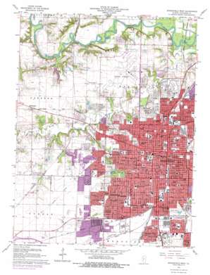
Springfield West Topo Map Illinois
To zoom in, hover over the map of Springfield West
USGS Topo Quad 39089g6 - 1:24,000 scale
| Topo Map Name: | Springfield West |
| USGS Topo Quad ID: | 39089g6 |
| Print Size: | ca. 21 1/4" wide x 27" high |
| Southeast Coordinates: | 39.75° N latitude / 89.625° W longitude |
| Map Center Coordinates: | 39.8125° N latitude / 89.6875° W longitude |
| U.S. State: | IL |
| Filename: | o39089g6.jpg |
| Download Map JPG Image: | Springfield West topo map 1:24,000 scale |
| Map Type: | Topographic |
| Topo Series: | 7.5´ |
| Map Scale: | 1:24,000 |
| Source of Map Images: | United States Geological Survey (USGS) |
| Alternate Map Versions: |
Springfield West IL 1950 Download PDF Buy paper map Springfield West IL 1965, updated 1966 Download PDF Buy paper map Springfield West IL 1965, updated 1973 Download PDF Buy paper map Springfield West IL 1965, updated 1978 Download PDF Buy paper map Springfield West IL 1998, updated 2000 Download PDF Buy paper map Springfield West IL 2012 Download PDF Buy paper map Springfield West IL 2015 Download PDF Buy paper map |
1:24,000 Topo Quads surrounding Springfield West
> Back to 39089e1 at 1:100,000 scale
> Back to 39088a1 at 1:250,000 scale
> Back to U.S. Topo Maps home
Springfield West topo map: Gazetteer
Springfield West: Airports
Capital Airport elevation 180m 590′Griffith RLA Airport elevation 164m 538′
Lindbergh Air Mail Field (historical) elevation 181m 593′
Memorial Medical Center Heliport elevation 180m 590′
Saint Johns Hospital Heliport elevation 184m 603′
State Fairgrounds Heliport elevation 177m 580′
Springfield West: Bridges
Chinquapin Bridge (historical) elevation 152m 498′Springfield West: Crossings
Interchange 91 elevation 189m 620′Rolls Ford elevation 152m 498′
Springfield West: Parks
Bunn Park elevation 181m 593′Carpenter Park Nature Preserve elevation 155m 508′
Central Springfield Historic District elevation 183m 600′
Douglas Park elevation 177m 580′
Enos Park elevation 184m 603′
Fairview Park elevation 182m 597′
Gehrmann Park elevation 182m 597′
Gurgens Park elevation 160m 524′
Hobbs Park elevation 182m 597′
Iles Park elevation 184m 603′
Lanphier Park elevation 184m 603′
Lincoln Home National Historic Site elevation 181m 593′
Lincoln Park elevation 180m 590′
Lincolns Tomb State Historic Site elevation 177m 580′
Memorial Pool Park elevation 183m 600′
Old State Capitol Plaza elevation 182m 597′
Pasfield Park elevation 175m 574′
Reservoir Park (historical) elevation 185m 606′
Vredenburg Park elevation 187m 613′
Washington Park elevation 180m 590′
Springfield West: Populated Places
Archer elevation 184m 603′Bando elevation 178m 583′
Bradfordton elevation 180m 590′
Cody elevation 186m 610′
Coleman elevation 183m 600′
East Springfield elevation 183m 600′
Hawthorne Place elevation 184m 603′
Iles elevation 184m 603′
Jerome elevation 183m 600′
Jess elevation 186m 610′
Leland Grove elevation 183m 600′
Mildred elevation 182m 597′
Ridgely elevation 181m 593′
Southern View elevation 186m 610′
Springfield elevation 183m 600′
West Grand Place elevation 184m 603′
Springfield West: Post Offices
Springfield Post Office elevation 181m 593′Springfield West: Streams
Jacksonville Branch elevation 161m 528′Spring Creek elevation 158m 518′
Willow Branch elevation 152m 498′
Springfield West digital topo map on disk
Buy this Springfield West topo map showing relief, roads, GPS coordinates and other geographical features, as a high-resolution digital map file on DVD:
Northern Illinois, Northern Indiana & Southwestern Michigan
Buy digital topo maps: Northern Illinois, Northern Indiana & Southwestern Michigan


