Athens Topo Map Illinois
To zoom in, hover over the map of Athens
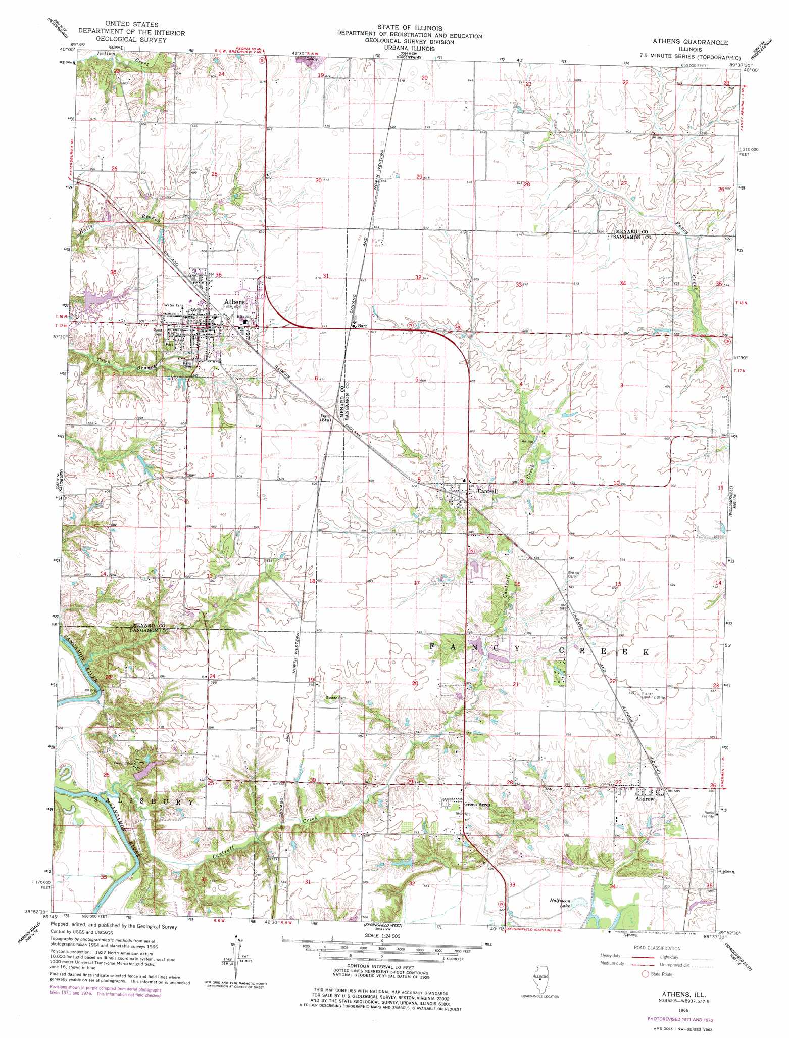
USGS Topo Quad 39089h6 - 1:24,000 scale
| Topo Map Name: | Athens |
| USGS Topo Quad ID: | 39089h6 |
| Print Size: | ca. 21 1/4" wide x 27" high |
| Southeast Coordinates: | 39.875° N latitude / 89.625° W longitude |
| Map Center Coordinates: | 39.9375° N latitude / 89.6875° W longitude |
| U.S. State: | IL |
| Filename: | o39089h6.jpg |
| Download Map JPG Image: | Athens topo map 1:24,000 scale |
| Map Type: | Topographic |
| Topo Series: | 7.5´ |
| Map Scale: | 1:24,000 |
| Source of Map Images: | United States Geological Survey (USGS) |
| Alternate Map Versions: |
Athens IL 1966, updated 1967 Download PDF Buy paper map Athens IL 1966, updated 1973 Download PDF Buy paper map Athens IL 1966, updated 1978 Download PDF Buy paper map Athens IL 2012 Download PDF Buy paper map Athens IL 2015 Download PDF Buy paper map |
1:24,000 Topo Quads surrounding Athens
Biggs |
Easton |
Mason City |
New Holland |
Lincoln West |
Oakford |
Petersburg |
Greenview |
Middleton |
Broadwell |
Tallula |
Salisbury |
Athens |
Williamsville |
Cornland |
Pleasant Plains |
Farmingdale |
Springfield West |
Springfield East |
Mechanicsburg |
New Berlin |
Loami |
Chatham |
New City |
Edinburg |
> Back to 39089e1 at 1:100,000 scale
> Back to 39088a1 at 1:250,000 scale
> Back to U.S. Topo Maps home
Athens topo map: Gazetteer
Athens: Airports
Fisher Landing Strip elevation 182m 597′Athens: Dams
Cilca Lake Dam elevation 161m 528′Country Lake Dam elevation 181m 593′
Athens: Lakes
Cow Pond (historical) elevation 159m 521′Halfmoon Lake elevation 157m 515′
Horseshoe Lake (historical) elevation 156m 511′
Wiggins Slough elevation 157m 515′
Athens: Parks
Sangamon County Conservation Area elevation 156m 511′Athens: Populated Places
Andrew elevation 177m 580′Athens elevation 183m 600′
Barr elevation 187m 613′
Cantrall elevation 181m 593′
Green Acres elevation 180m 590′
North Wind elevation 180m 590′
Athens: Reservoirs
Cilca Lake elevation 161m 528′Country Lake elevation 181m 593′
Athens: Streams
Cantrall Creek elevation 152m 498′Athens digital topo map on disk
Buy this Athens topo map showing relief, roads, GPS coordinates and other geographical features, as a high-resolution digital map file on DVD:
Northern Illinois, Northern Indiana & Southwestern Michigan
Buy digital topo maps: Northern Illinois, Northern Indiana & Southwestern Michigan