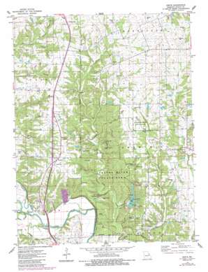
Okete Topo Map Missouri
To zoom in, hover over the map of Okete
USGS Topo Quad 39090a8 - 1:24,000 scale
| Topo Map Name: | Okete |
| USGS Topo Quad ID: | 39090a8 |
| Print Size: | ca. 21 1/4" wide x 27" high |
| Southeast Coordinates: | 39° N latitude / 90.875° W longitude |
| Map Center Coordinates: | 39.0625° N latitude / 90.9375° W longitude |
| U.S. State: | MO |
| Filename: | o39090a8.jpg |
| Download Map JPG Image: | Okete topo map 1:24,000 scale |
| Map Type: | Topographic |
| Topo Series: | 7.5´ |
| Map Scale: | 1:24,000 |
| Source of Map Images: | United States Geological Survey (USGS) |
| Alternate Map Versions: |
Okete MO 1975, updated 1978 Download PDF Buy paper map Okete MO 1975, updated 1984 Download PDF Buy paper map Okete MO 2011 Download PDF Buy paper map Okete MO 2014 Download PDF Buy paper map |
1:24,000 Topo Quads surrounding Okete
> Back to 39090a1 at 1:100,000 scale
> Back to 39090a1 at 1:250,000 scale
> Back to U.S. Topo Maps home
Okete topo map: Gazetteer
Okete: Areas
Sherwood Forest elevation 201m 659′Okete: Cliffs
Frenchmans Bluff elevation 202m 662′Okete: Dams
Christofferson Lake Dam elevation 218m 715′Emert Lake Dam elevation 220m 721′
Girl Scout Lake Dam elevation 191m 626′
Girl Scouts Dam elevation 205m 672′
Lake Lincoln Dam elevation 173m 567′
Shady Eighty Ranch Lake Dam elevation 204m 669′
Suter Lake Dam elevation 213m 698′
Okete: Parks
Cuivre River State Park elevation 167m 547′David Kessler Memorial State Wildlife Area elevation 205m 672′
Okete: Populated Places
Brussells elevation 192m 629′Cuivre Heights elevation 153m 501′
Okete elevation 232m 761′
Okete: Reservoirs
Emert Lake elevation 220m 721′Girl Scout Lake elevation 191m 626′
Lake Lincoln elevation 173m 567′
Shady Eighty Ranch Lake elevation 204m 669′
Suter Lake elevation 213m 698′
Welker Lake elevation 218m 715′
Okete: Streams
Bailey Branch elevation 183m 600′Draper Branch elevation 184m 603′
Dry Branch elevation 146m 479′
Indian Nest Hollow elevation 170m 557′
North Fork Cuivre River elevation 140m 459′
Porter Slough elevation 140m 459′
Spring Creek elevation 140m 459′
West Fork Cuivre River elevation 140m 459′
Okete digital topo map on disk
Buy this Okete topo map showing relief, roads, GPS coordinates and other geographical features, as a high-resolution digital map file on DVD:


