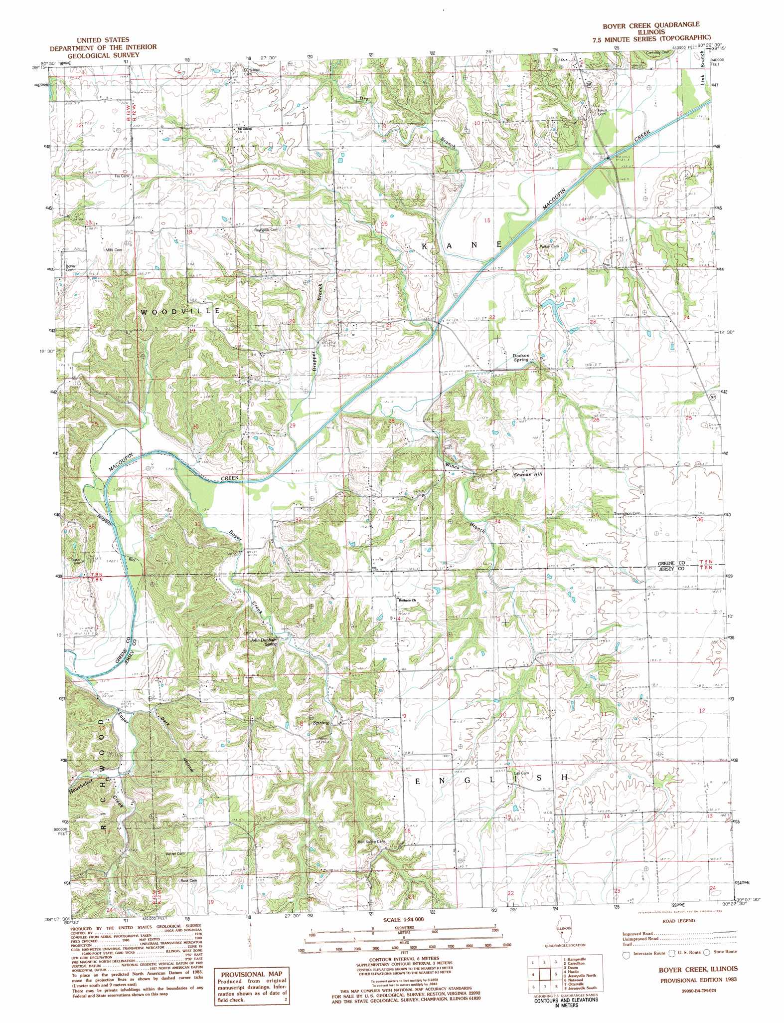
Boyer Creek Topo Map Illinois
To zoom in, hover over the map of Boyer Creek
USGS Topo Quad 39090b4 - 1:24,000 scale
| Topo Map Name: | Boyer Creek |
| USGS Topo Quad ID: | 39090b4 |
| Print Size: | ca. 21 1/4" wide x 27" high |
| Southeast Coordinates: | 39.125° N latitude / 90.375° W longitude |
| Map Center Coordinates: | 39.1875° N latitude / 90.4375° W longitude |
| U.S. State: | IL |
| Filename: | o39090b4.jpg |
| Download Map JPG Image: | Boyer Creek topo map 1:24,000 scale |
| Map Type: | Topographic |
| Topo Series: | 7.5´ |
| Map Scale: | 1:24,000 |
| Source of Map Images: | United States Geological Survey (USGS) |
| Alternate Map Versions: |
Boyer Creek IL 1983, updated 1984 Download PDF Buy paper map Boyer Creek IL 2012 Download PDF Buy paper map Boyer Creek IL 2015 Download PDF Buy paper map |
1:24,000 Topo Quads surrounding Boyer Creek
Pearl West |
Pearl East |
Roodhouse West |
Roodhouse East |
Athensville |
Pleasant Dale Valley |
Kampsville |
Carrollton |
Daum |
Greenfield |
Hamburg |
Hardin |
Boyer Creek |
Jerseyville North |
Medora |
Foley |
Nutwood |
Otterville |
Jerseyville South |
Brighton |
Winfield |
Brussels |
Grafton |
Elsah |
Alton |
> Back to 39090a1 at 1:100,000 scale
> Back to 39090a1 at 1:250,000 scale
> Back to U.S. Topo Maps home
Boyer Creek topo map: Gazetteer
Boyer Creek: Dams
West Lake Country Club Lake Dam elevation 202m 662′Boyer Creek: Populated Places
Conwayville (historical) elevation 138m 452′Mid City (historical) elevation 143m 469′
Boyer Creek: Reservoirs
West Lake Country Club Lake elevation 202m 662′Boyer Creek: Springs
Dodson Spring elevation 146m 479′John Dunham Spring elevation 151m 495′
Boyer Creek: Streams
Boyer Creek elevation 133m 436′Drapper Branch elevation 132m 433′
Dry Branch elevation 132m 433′
Haushalter Creek elevation 144m 472′
Wines Branch elevation 137m 449′
Boyer Creek: Summits
Shanks Hill elevation 181m 593′Boyer Creek: Valleys
Dark Hollow elevation 131m 429′Dobson Hollow elevation 137m 449′
Haushalter Hollow elevation 144m 472′
Boyer Creek digital topo map on disk
Buy this Boyer Creek topo map showing relief, roads, GPS coordinates and other geographical features, as a high-resolution digital map file on DVD: