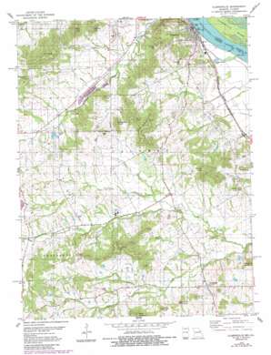
Clarksville Topo Map Missouri
To zoom in, hover over the map of Clarksville
USGS Topo Quad 39090c8 - 1:24,000 scale
| Topo Map Name: | Clarksville |
| USGS Topo Quad ID: | 39090c8 |
| Print Size: | ca. 21 1/4" wide x 27" high |
| Southeast Coordinates: | 39.25° N latitude / 90.875° W longitude |
| Map Center Coordinates: | 39.3125° N latitude / 90.9375° W longitude |
| U.S. States: | MO, IL |
| Filename: | o39090c8.jpg |
| Download Map JPG Image: | Clarksville topo map 1:24,000 scale |
| Map Type: | Topographic |
| Topo Series: | 7.5´ |
| Map Scale: | 1:24,000 |
| Source of Map Images: | United States Geological Survey (USGS) |
| Alternate Map Versions: |
Clarksville MO 1978, updated 1978 Download PDF Buy paper map Clarksville MO 1978, updated 1984 Download PDF Buy paper map Clarksville MO 1993, updated 1996 Download PDF Buy paper map Clarksville MO 2011 Download PDF Buy paper map Clarksville MO 2014 Download PDF Buy paper map |
1:24,000 Topo Quads surrounding Clarksville
> Back to 39090a1 at 1:100,000 scale
> Back to 39090a1 at 1:250,000 scale
> Back to U.S. Topo Maps home
Clarksville topo map: Gazetteer
Clarksville: Dams
Joseph Keeven Dam elevation 142m 465′Lockard Lake Dam elevation 205m 672′
Love Lake Dam elevation 184m 603′
Pipefitters Dam elevation 167m 547′
Ripple Lake Dam elevation 170m 557′
Thiel Lake East Dam elevation 160m 524′
Thiel Lake West Dam elevation 162m 531′
William B Weakley Dam elevation 171m 561′
Clarksville: Islands
Clarksville Island elevation 136m 446′Island 464 elevation 137m 449′
Clarksville: Populated Places
Clarksville elevation 142m 465′Paynesville elevation 163m 534′
Clarksville: Post Offices
Aberdeen Post Office (historical) elevation 191m 626′Clarksville: Ranges
Cooper Knobs elevation 220m 721′Clarksville: Reservoirs
Love Lake elevation 184m 603′Pipefitters Lake elevation 167m 547′
Thiel Lake East elevation 160m 524′
Thiel Lake West elevation 162m 531′
Weakley Lake elevation 171m 561′
Clarksville: Ridges
Parse Mackey Ridge elevation 257m 843′The Pinnacle elevation 232m 761′
Clarksville: Streams
Buck Branch elevation 144m 472′Little Ramsey Creek elevation 142m 465′
Mud Creek elevation 150m 492′
Clarksville: Summits
Ben Watts Knob elevation 275m 902′Bethlehem Knob elevation 256m 839′
Bryant Knob elevation 235m 770′
Dale Knob elevation 263m 862′
Forgey Knob elevation 243m 797′
Harris Knob elevation 249m 816′
Long Knob elevation 267m 875′
Marion Mackey Knob elevation 250m 820′
Mcllroy Knob elevation 236m 774′
Owens Knob elevation 250m 820′
Page Knob elevation 251m 823′
Painter Knob elevation 257m 843′
Richardson Knob elevation 246m 807′
Robert Hill elevation 250m 820′
Salem Knob elevation 229m 751′
Tower Knob elevation 259m 849′
Wilcoxen Knob elevation 250m 820′
Clarksville digital topo map on disk
Buy this Clarksville topo map showing relief, roads, GPS coordinates and other geographical features, as a high-resolution digital map file on DVD:


