Nortonville Topo Map Illinois
To zoom in, hover over the map of Nortonville
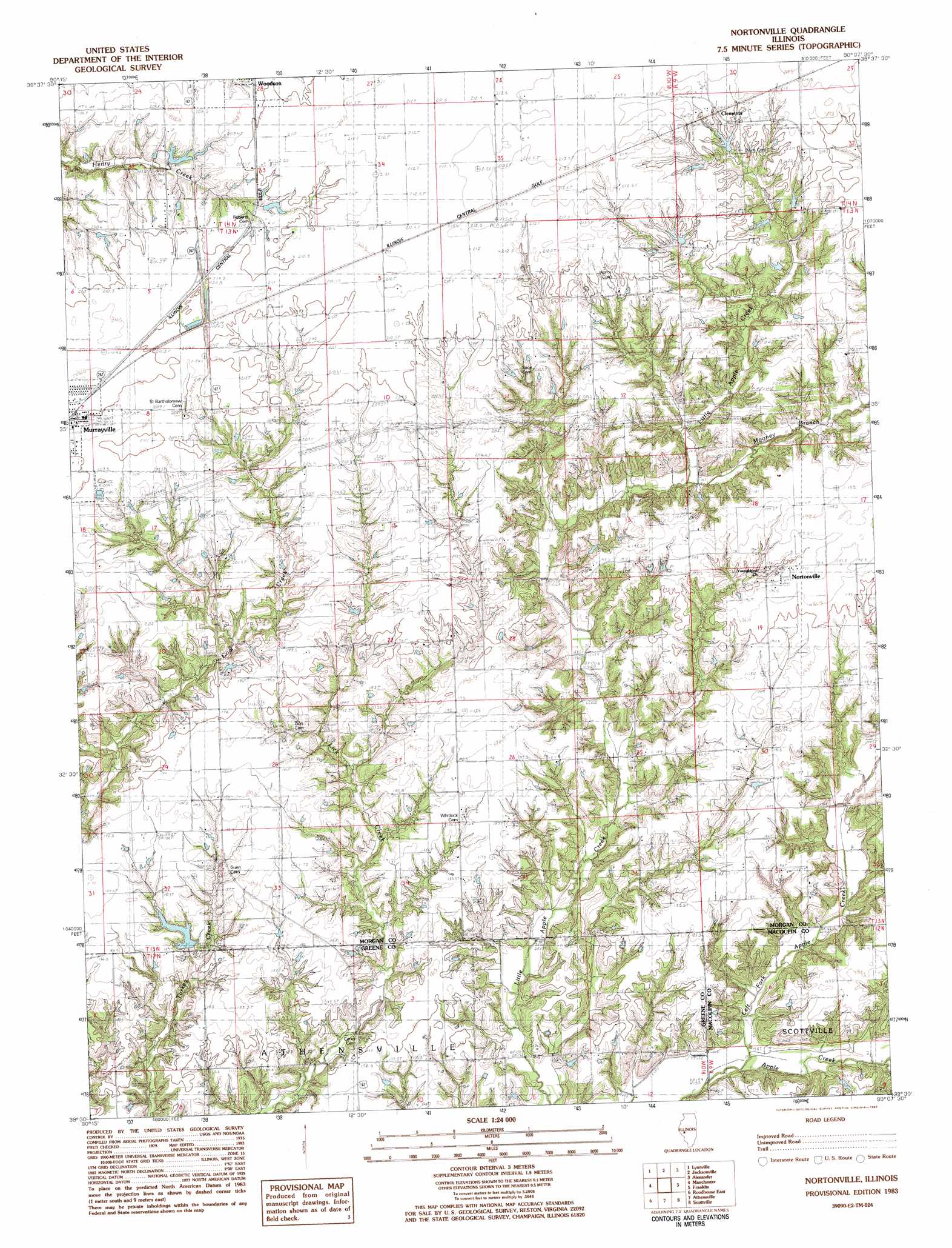
USGS Topo Quad 39090e2 - 1:24,000 scale
| Topo Map Name: | Nortonville |
| USGS Topo Quad ID: | 39090e2 |
| Print Size: | ca. 21 1/4" wide x 27" high |
| Southeast Coordinates: | 39.5° N latitude / 90.125° W longitude |
| Map Center Coordinates: | 39.5625° N latitude / 90.1875° W longitude |
| U.S. State: | IL |
| Filename: | o39090e2.jpg |
| Download Map JPG Image: | Nortonville topo map 1:24,000 scale |
| Map Type: | Topographic |
| Topo Series: | 7.5´ |
| Map Scale: | 1:24,000 |
| Source of Map Images: | United States Geological Survey (USGS) |
| Alternate Map Versions: |
Nortonville IL 1983, updated 1983 Download PDF Buy paper map Nortonville IL 2012 Download PDF Buy paper map Nortonville IL 2015 Download PDF Buy paper map |
1:24,000 Topo Quads surrounding Nortonville
Chapin |
Concord |
Literberry |
Prentice |
Pleasant Plains |
Winchester |
Lynnville |
Jacksonville |
Alexander |
New Berlin |
Alsey |
Manchester |
Nortonville |
Franklin |
Waverly |
Roodhouse West |
Roodhouse East |
Athensville |
Scottville |
Palmyra |
Carrollton |
Daum |
Greenfield |
Hettick |
Carlinville West |
> Back to 39090e1 at 1:100,000 scale
> Back to 39090a1 at 1:250,000 scale
> Back to U.S. Topo Maps home
Nortonville topo map: Gazetteer
Nortonville: Dams
Murrayville Woodson Lake Dam elevation 193m 633′Ware Brothers Pond Dam elevation 183m 600′
Nortonville: Populated Places
Clements elevation 213m 698′Nortonville elevation 196m 643′
Nortonville: Reservoirs
Murrayville Woodson Lake elevation 193m 633′Ware Brothers Pond elevation 183m 600′
Nortonville: Streams
Left Fork Apple Creek elevation 156m 511′Mooney Branch elevation 186m 610′
Rock Branch elevation 159m 521′
Nortonville digital topo map on disk
Buy this Nortonville topo map showing relief, roads, GPS coordinates and other geographical features, as a high-resolution digital map file on DVD: