Manchester Topo Map Illinois
To zoom in, hover over the map of Manchester
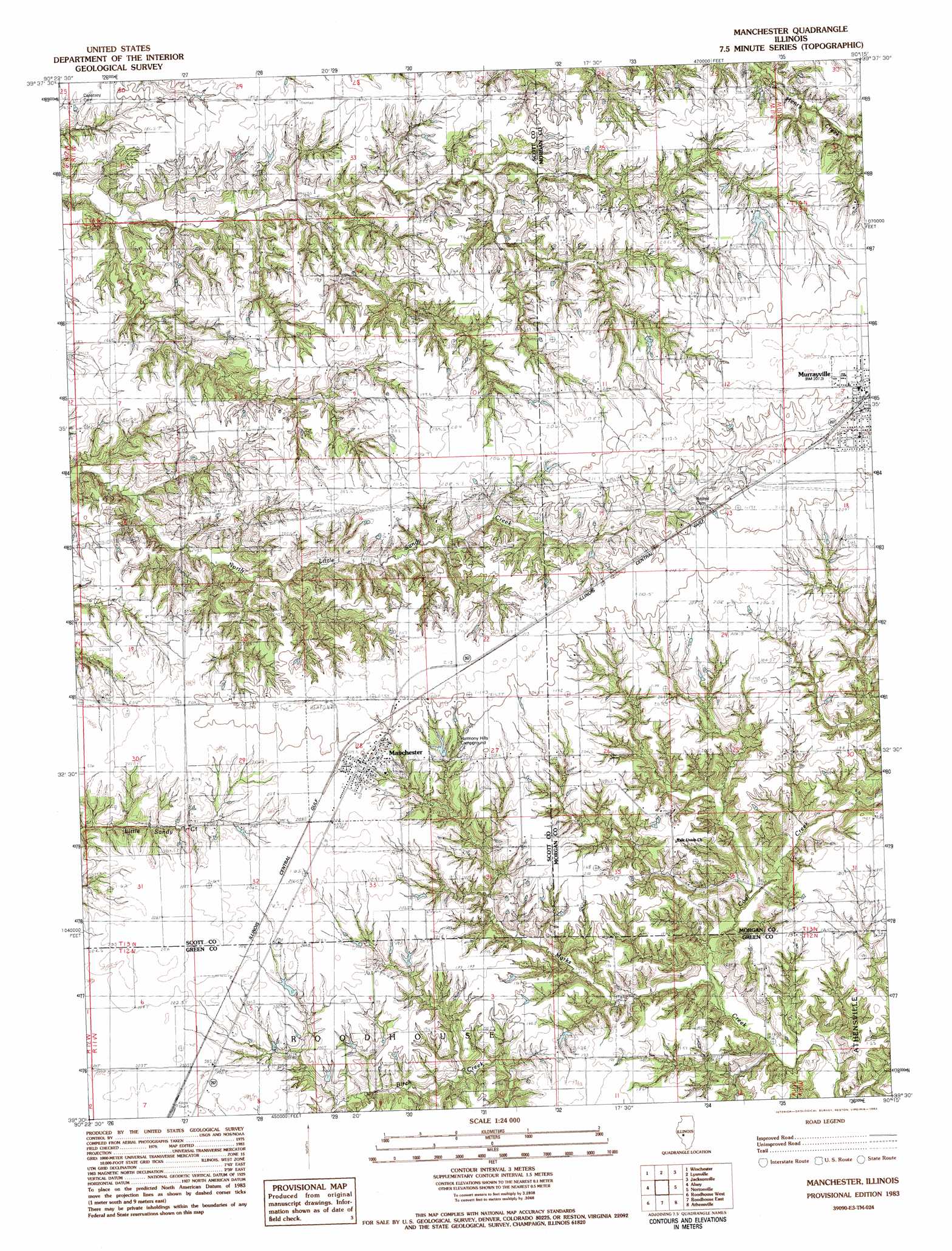
USGS Topo Quad 39090e3 - 1:24,000 scale
| Topo Map Name: | Manchester |
| USGS Topo Quad ID: | 39090e3 |
| Print Size: | ca. 21 1/4" wide x 27" high |
| Southeast Coordinates: | 39.5° N latitude / 90.25° W longitude |
| Map Center Coordinates: | 39.5625° N latitude / 90.3125° W longitude |
| U.S. State: | IL |
| Filename: | o39090e3.jpg |
| Download Map JPG Image: | Manchester topo map 1:24,000 scale |
| Map Type: | Topographic |
| Topo Series: | 7.5´ |
| Map Scale: | 1:24,000 |
| Source of Map Images: | United States Geological Survey (USGS) |
| Alternate Map Versions: |
Manchester IL 1983, updated 1983 Download PDF Buy paper map Manchester IL 2012 Download PDF Buy paper map Manchester IL 2015 Download PDF Buy paper map |
1:24,000 Topo Quads surrounding Manchester
Meredosia |
Chapin |
Concord |
Literberry |
Prentice |
Florence |
Winchester |
Lynnville |
Jacksonville |
Alexander |
Bedford |
Alsey |
Manchester |
Nortonville |
Franklin |
Pearl East |
Roodhouse West |
Roodhouse East |
Athensville |
Scottville |
Kampsville |
Carrollton |
Daum |
Greenfield |
Hettick |
> Back to 39090e1 at 1:100,000 scale
> Back to 39090a1 at 1:250,000 scale
> Back to U.S. Topo Maps home
Manchester topo map: Gazetteer
Manchester: Populated Places
Manchester elevation 209m 685′Murrayville elevation 211m 692′
Manchester: Post Offices
Manchester Post Office elevation 207m 679′Manchester: Streams
Big Branch elevation 162m 531′Coal Creek elevation 164m 538′
Manchester digital topo map on disk
Buy this Manchester topo map showing relief, roads, GPS coordinates and other geographical features, as a high-resolution digital map file on DVD: