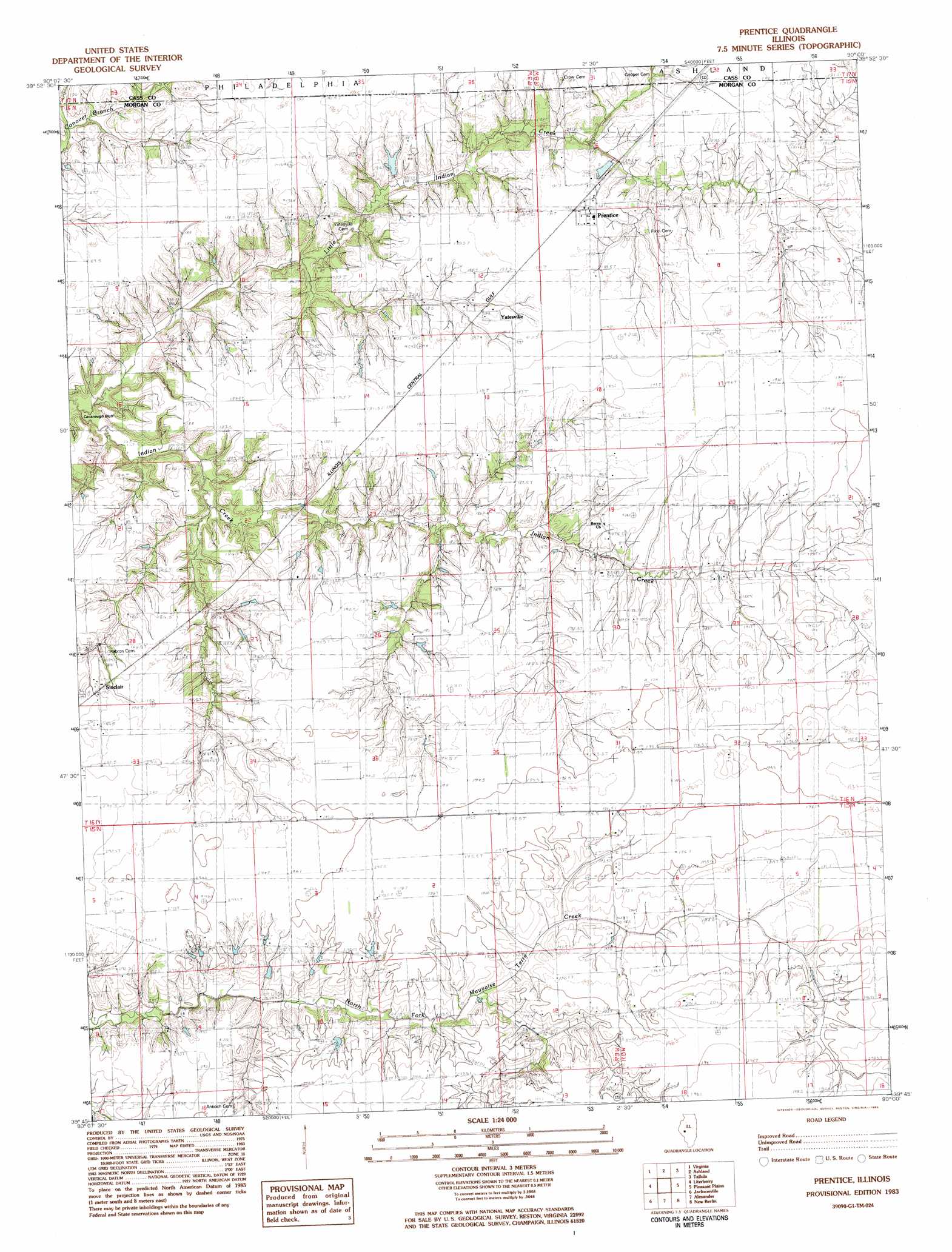
Prentice Topo Map Illinois
To zoom in, hover over the map of Prentice
USGS Topo Quad 39090g1 - 1:24,000 scale
| Topo Map Name: | Prentice |
| USGS Topo Quad ID: | 39090g1 |
| Print Size: | ca. 21 1/4" wide x 27" high |
| Southeast Coordinates: | 39.75° N latitude / 90° W longitude |
| Map Center Coordinates: | 39.8125° N latitude / 90.0625° W longitude |
| U.S. State: | IL |
| Filename: | o39090g1.jpg |
| Download Map JPG Image: | Prentice topo map 1:24,000 scale |
| Map Type: | Topographic |
| Topo Series: | 7.5´ |
| Map Scale: | 1:24,000 |
| Source of Map Images: | United States Geological Survey (USGS) |
| Alternate Map Versions: |
Prentice IL 1983, updated 1983 Download PDF Buy paper map Prentice IL 2012 Download PDF Buy paper map Prentice IL 2015 Download PDF Buy paper map |
1:24,000 Topo Quads surrounding Prentice
Clear Lake |
Chandlerville |
Newmansville |
Oakford |
Petersburg |
Arenzville East |
Virginia |
Ashland |
Tallula |
Salisbury |
Concord |
Literberry |
Prentice |
Pleasant Plains |
Farmingdale |
Lynnville |
Jacksonville |
Alexander |
New Berlin |
Loami |
Manchester |
Nortonville |
Franklin |
Waverly |
Virden North |
> Back to 39090e1 at 1:100,000 scale
> Back to 39090a1 at 1:250,000 scale
> Back to U.S. Topo Maps home
Prentice topo map: Gazetteer
Prentice: Dams
Wyatt Pond Dam elevation 183m 600′Prentice: Populated Places
Jordanville (historical) elevation 188m 616′Prentice elevation 192m 629′
Sinclair elevation 189m 620′
Yatesville elevation 189m 620′
Prentice: Post Offices
Prentice Post Office elevation 191m 626′Prentice: Reservoirs
Wyatt Pond elevation 183m 600′Prentice digital topo map on disk
Buy this Prentice topo map showing relief, roads, GPS coordinates and other geographical features, as a high-resolution digital map file on DVD: