Ashland Topo Map Illinois
To zoom in, hover over the map of Ashland
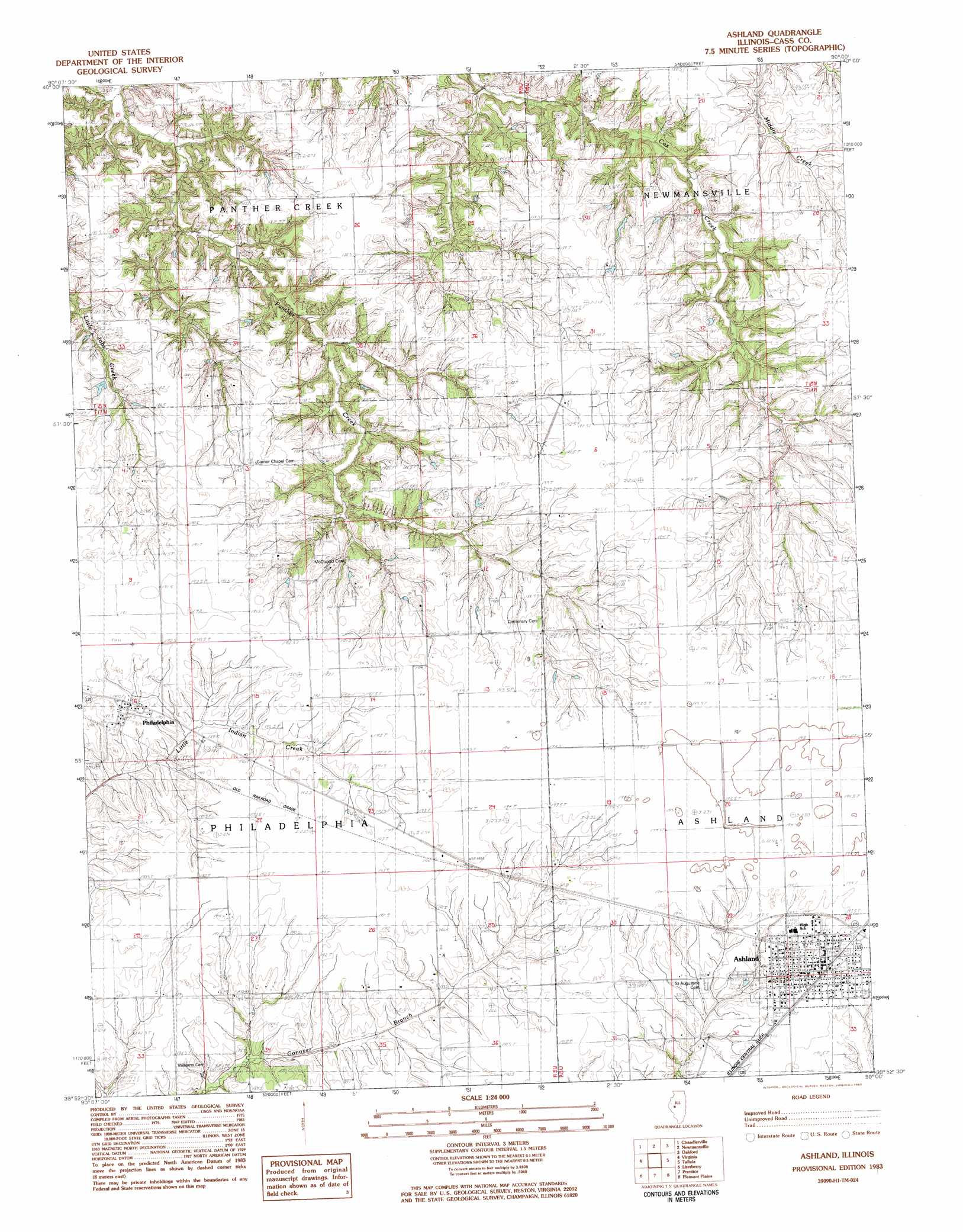
USGS Topo Quad 39090h1 - 1:24,000 scale
| Topo Map Name: | Ashland |
| USGS Topo Quad ID: | 39090h1 |
| Print Size: | ca. 21 1/4" wide x 27" high |
| Southeast Coordinates: | 39.875° N latitude / 90° W longitude |
| Map Center Coordinates: | 39.9375° N latitude / 90.0625° W longitude |
| U.S. State: | IL |
| Filename: | o39090h1.jpg |
| Download Map JPG Image: | Ashland topo map 1:24,000 scale |
| Map Type: | Topographic |
| Topo Series: | 7.5´ |
| Map Scale: | 1:24,000 |
| Source of Map Images: | United States Geological Survey (USGS) |
| Alternate Map Versions: |
Ashland IL 1983, updated 1983 Download PDF Buy paper map Ashland IL 1983, updated 1983 Download PDF Buy paper map Ashland IL 2012 Download PDF Buy paper map Ashland IL 2015 Download PDF Buy paper map |
1:24,000 Topo Quads surrounding Ashland
Astoria |
Bath |
Kilbourne |
Biggs |
Easton |
Clear Lake |
Chandlerville |
Newmansville |
Oakford |
Petersburg |
Arenzville East |
Virginia |
Ashland |
Tallula |
Salisbury |
Concord |
Literberry |
Prentice |
Pleasant Plains |
Farmingdale |
Lynnville |
Jacksonville |
Alexander |
New Berlin |
Loami |
> Back to 39090e1 at 1:100,000 scale
> Back to 39090a1 at 1:250,000 scale
> Back to U.S. Topo Maps home
Ashland topo map: Gazetteer
Ashland: Populated Places
Ashland elevation 193m 633′Gurney (historical) elevation 192m 629′
Philadelphia elevation 189m 620′
Sylvan (historical) elevation 185m 606′
Ashland: Post Offices
Berryton Post Office (historical) elevation 188m 616′Garner Post Office (historical) elevation 185m 606′
Ashland digital topo map on disk
Buy this Ashland topo map showing relief, roads, GPS coordinates and other geographical features, as a high-resolution digital map file on DVD: