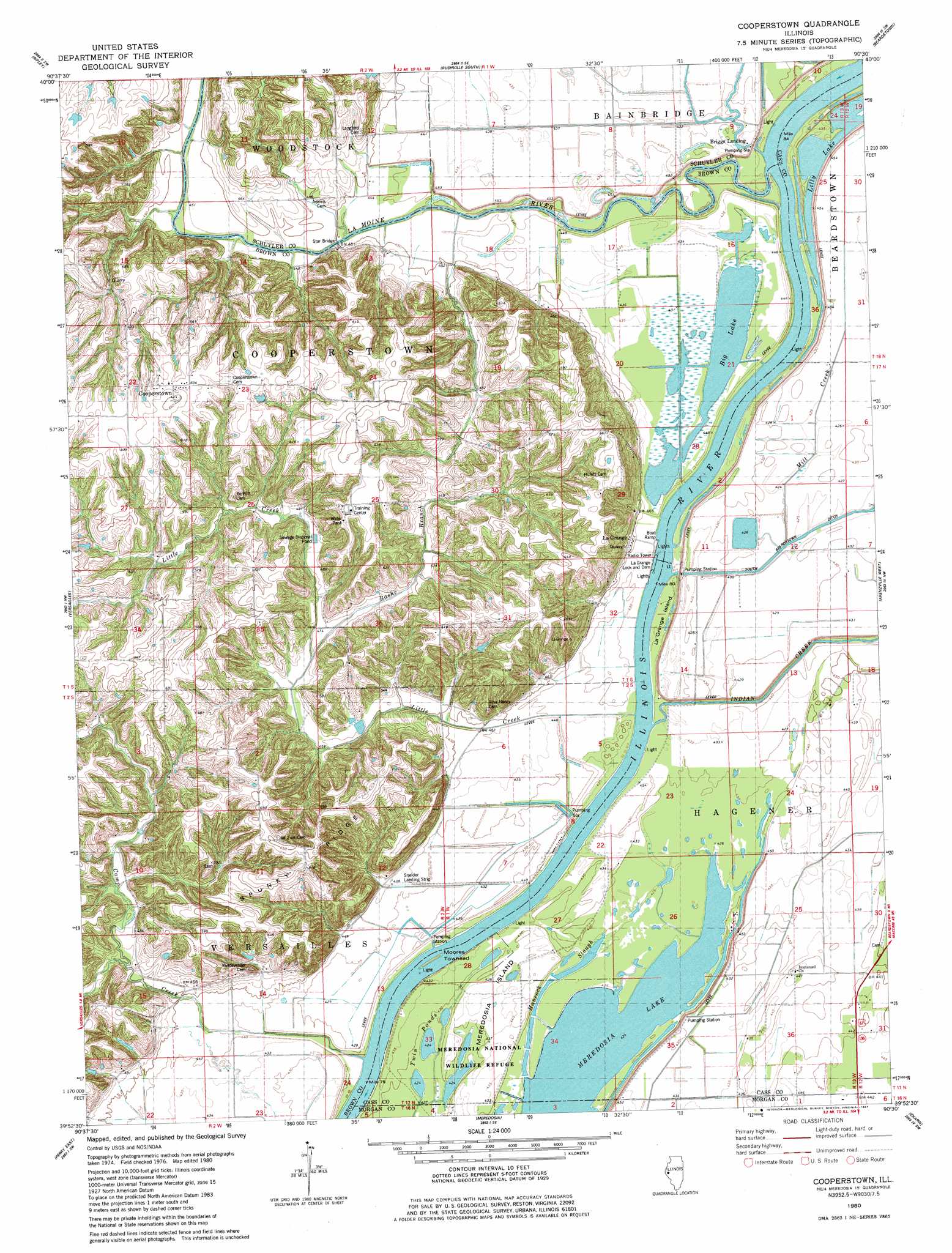
Cooperstown Topo Map Illinois
To zoom in, hover over the map of Cooperstown
USGS Topo Quad 39090h5 - 1:24,000 scale
| Topo Map Name: | Cooperstown |
| USGS Topo Quad ID: | 39090h5 |
| Print Size: | ca. 21 1/4" wide x 27" high |
| Southeast Coordinates: | 39.875° N latitude / 90.5° W longitude |
| Map Center Coordinates: | 39.9375° N latitude / 90.5625° W longitude |
| U.S. State: | IL |
| Filename: | o39090h5.jpg |
| Download Map JPG Image: | Cooperstown topo map 1:24,000 scale |
| Map Type: | Topographic |
| Topo Series: | 7.5´ |
| Map Scale: | 1:24,000 |
| Source of Map Images: | United States Geological Survey (USGS) |
| Alternate Map Versions: |
Cooperstown IL 1980, updated 1981 Download PDF Buy paper map Cooperstown IL 2012 Download PDF Buy paper map Cooperstown IL 2015 Download PDF Buy paper map |
1:24,000 Topo Quads surrounding Cooperstown
Camden |
Erwin |
Rushville North |
Ray |
Astoria |
Lake Mount Sterling |
Ripley |
Rushville South |
Beardstown |
Clear Lake |
Mount Sterling |
Versailles |
Cooperstown |
Arenzville West |
Arenzville East |
Perry West |
Perry East |
Meredosia |
Chapin |
Concord |
New Salem |
Griggsville |
Florence |
Winchester |
Lynnville |
> Back to 39090e1 at 1:100,000 scale
> Back to 39090a1 at 1:250,000 scale
> Back to U.S. Topo Maps home
Cooperstown topo map: Gazetteer
Cooperstown: Airports
Kloker Airport elevation 134m 439′Sneider Landing Strip elevation 131m 429′
Cooperstown: Bars
Moores Towhead elevation 131m 429′Cooperstown: Bridges
Star Bridge elevation 135m 442′Cooperstown: Dams
La Grange Lock and Dam elevation 131m 429′La Grange Lock and Dam elevation 134m 439′
La Grange Locks (historical) elevation 134m 439′
Cooperstown: Guts
Hancock Slough elevation 129m 423′Cooperstown: Islands
La Grange Island elevation 131m 429′Meredosia Island elevation 132m 433′
Cooperstown: Lakes
Big Lake elevation 131m 429′Elbow Lake (historical) elevation 133m 436′
Long Lake (historical) elevation 130m 426′
Perkins Lake (historical) elevation 131m 429′
Twin Ponds elevation 129m 423′
Cooperstown: Parks
Meredosia National Wildlife Refuge elevation 132m 433′Cooperstown: Populated Places
Briggs Landing elevation 131m 429′Cooperstown elevation 193m 633′
La Grange elevation 142m 465′
Cooperstown: Reservoirs
La Grange Pool elevation 134m 439′Cooperstown: Ridges
Spunky Ridge elevation 194m 636′Cooperstown: Streams
Baehr Branch elevation 142m 465′Camp Creek elevation 131m 429′
Indian Creek elevation 131m 429′
La Moine River elevation 134m 439′
Little Creek elevation 131m 429′
Cooperstown digital topo map on disk
Buy this Cooperstown topo map showing relief, roads, GPS coordinates and other geographical features, as a high-resolution digital map file on DVD: