Silex Topo Map Missouri
To zoom in, hover over the map of Silex
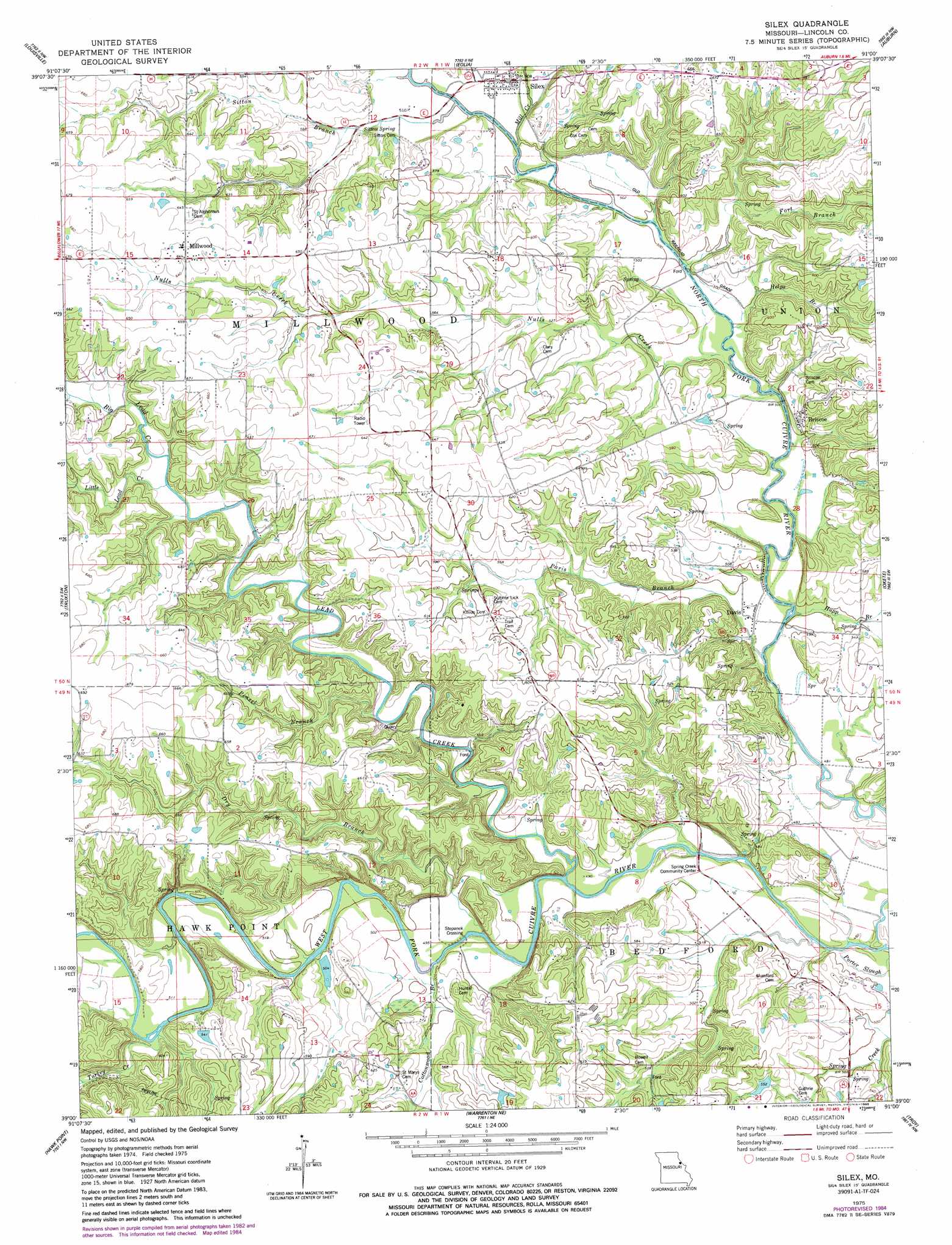
USGS Topo Quad 39091a1 - 1:24,000 scale
| Topo Map Name: | Silex |
| USGS Topo Quad ID: | 39091a1 |
| Print Size: | ca. 21 1/4" wide x 27" high |
| Southeast Coordinates: | 39° N latitude / 91° W longitude |
| Map Center Coordinates: | 39.0625° N latitude / 91.0625° W longitude |
| U.S. State: | MO |
| Filename: | o39091a1.jpg |
| Download Map JPG Image: | Silex topo map 1:24,000 scale |
| Map Type: | Topographic |
| Topo Series: | 7.5´ |
| Map Scale: | 1:24,000 |
| Source of Map Images: | United States Geological Survey (USGS) |
| Alternate Map Versions: |
Silex MO 1975, updated 1977 Download PDF Buy paper map Silex MO 1975, updated 1985 Download PDF Buy paper map Silex MO 2012 Download PDF Buy paper map Silex MO 2015 Download PDF Buy paper map |
1:24,000 Topo Quads surrounding Silex
Curryville |
Bowling Green |
Cyrene |
Clarksville |
Annada |
New Hartford |
Louisville |
Eolia |
Auburn |
Elsberry |
Bellflower North |
Truxton |
Silex |
Okete |
Luckett Ridge |
Bellflower South |
Hawk Point |
Warrenton Ne |
Troy |
Maryknoll |
Jonesburg |
Warrenton |
Wright City |
Foristell |
Wentzville |
> Back to 39091a1 at 1:100,000 scale
> Back to 39090a1 at 1:250,000 scale
> Back to U.S. Topo Maps home
Silex topo map: Gazetteer
Silex: Airports
Baldwin Airport elevation 189m 620′Silex: Bridges
Steffen Bridge elevation 145m 475′Silex: Dams
Burkemper Lake Dam elevation 166m 544′Henebry Lake Dam elevation 166m 544′
Terbrock Lake Dam elevation 154m 505′
Silex: Populated Places
Briscoe elevation 163m 534′Cave elevation 184m 603′
Davis elevation 145m 475′
Famous elevation 144m 472′
Mackville elevation 188m 616′
Mashek (historical) elevation 182m 597′
Millwood elevation 196m 643′
Silex elevation 152m 498′
Stepanek Crossing elevation 145m 475′
Silex: Post Offices
Famous Post Office (historical) elevation 144m 472′Mackville Post Office (historical) elevation 188m 616′
Silex: Reservoirs
Burkemper Lake elevation 166m 544′Henebry Lake elevation 166m 544′
Terbrock Lake elevation 154m 505′
Silex: Springs
Sitton Spring elevation 157m 515′Silex: Streams
Big Lead Creek elevation 168m 551′Cottonwood Branch elevation 148m 485′
Dry Branch elevation 145m 475′
Fort Branch elevation 151m 495′
Helps Branch elevation 149m 488′
Hupp Branch elevation 146m 479′
Lead Creek elevation 145m 475′
Little Lead Creek elevation 168m 551′
Mill Creek elevation 152m 498′
Nulls Creek elevation 146m 479′
Paris Branch elevation 146m 479′
Peasel Branch elevation 155m 508′
Sitton Branch elevation 152m 498′
Turkey Creek elevation 156m 511′
Silex digital topo map on disk
Buy this Silex topo map showing relief, roads, GPS coordinates and other geographical features, as a high-resolution digital map file on DVD: